

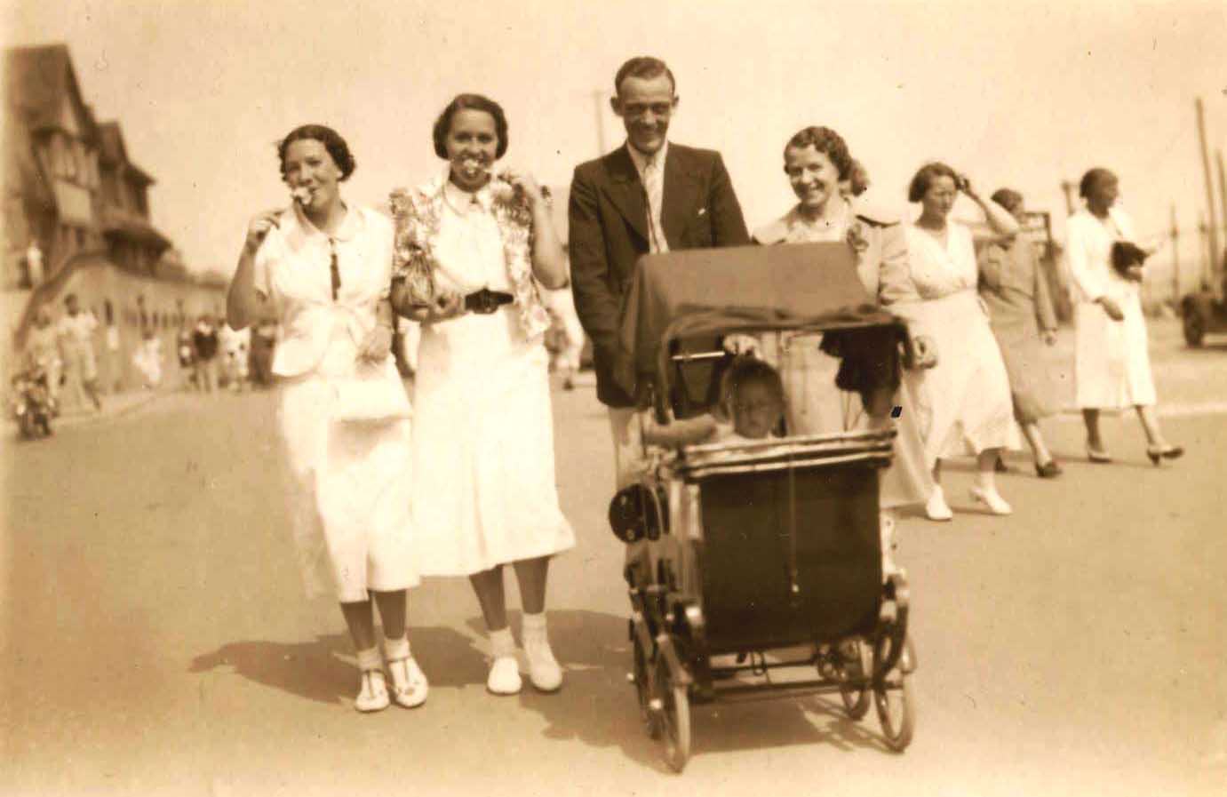
Isn't this a fabulous photo? It was given to me on my last trip over, and from right to left it is my mother's sister, Nellie - or Ellen which was her actual name, her husband Len, pushing my cousin Tony. Next to Len is her sister Kay - or Hilda as she hated to be called, and far left was a friend of hers, whose name I don't know. They were all walking along the Stade coming from the East Cliff sands, and obviously having a great time! I know Tony was born in July 1937, so would guess the date of this photo at appx. Aug 1938. Ooh, can't you just taste those toffee apples?
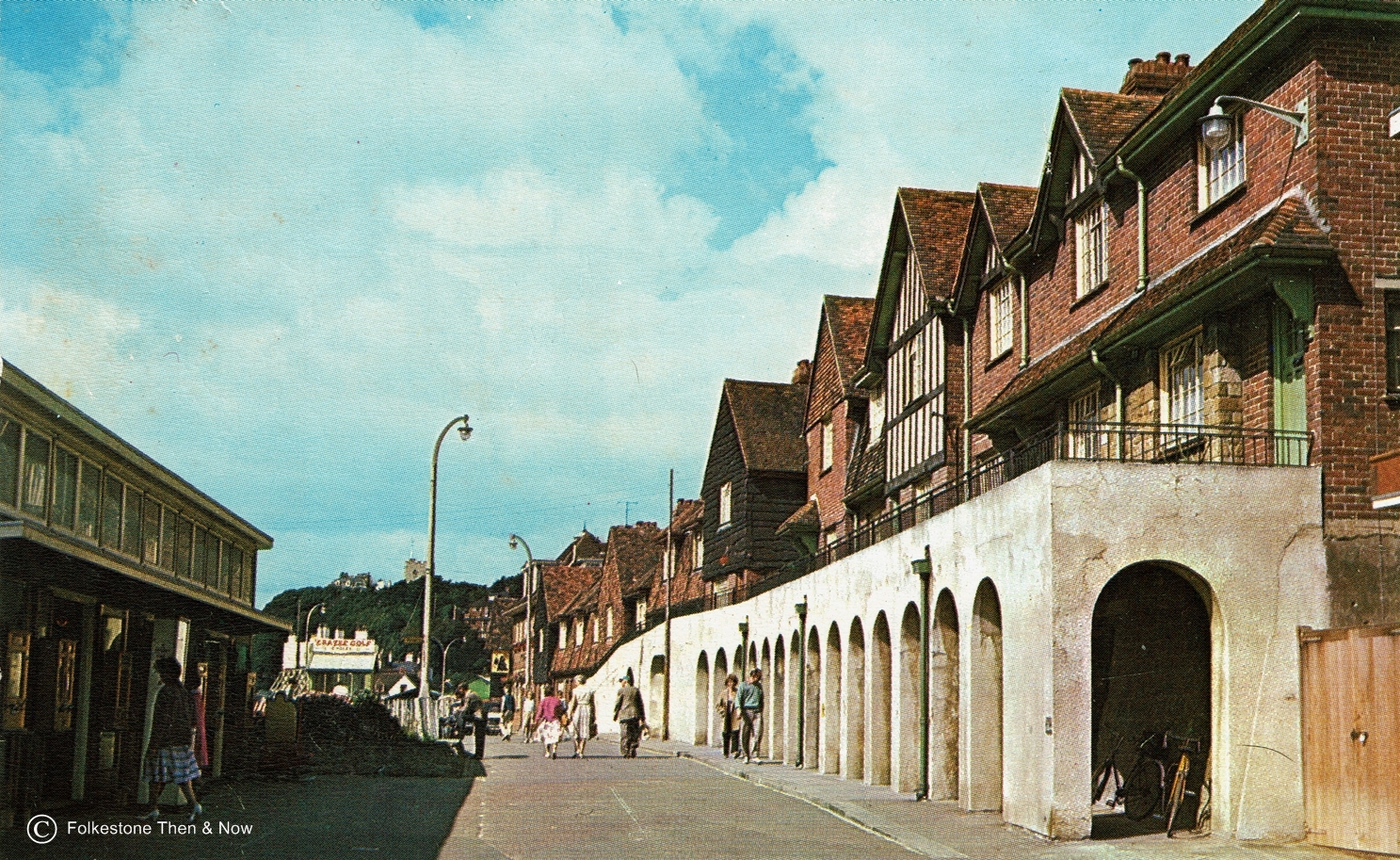
This card was posted in 1968, and shows the Sunny Sands restaurant on the left.
If you have memories of Folkestone, be sure to share them with us by jotting them down in the Folkestone Memories guestbook
A fellow called Mick posted the following in the Folkestone Memories book (below):
" A question for Alan Taylor. Alan, do you know what the remains of the building are, at the foot of Copt Point? It appears to be a chimney and some sort of concrete block (hut?) and some rails/track(?) which can be seen at low tide. I am talking from the viewpoint of the Sunny Sands end of the harbour looking East towards Dover. Many thanks "
Alan not only answered his question, but sent me a photo to put up. Here is what Alan said:
" The square concrete building at Copt-Point is a disused sewer chamber. The two tall chimney like things were built to erect a crane on when the chamber was being built, in the late 1920s. The railway line which can be seen at low tide was left behind by contractors in the late 1940s who extending the sewer pipe further out to sea."
So this is a picture of that crane. Thanks very much Alan, I too always wondered what that structure was.


Page updated March 2025
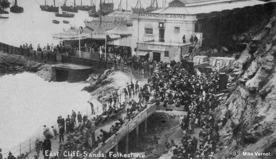
In Victorian and Edwardian times, the beaches at the East end of Folkestone were not used as much for swimming, and looking at the photo above left, you can see why. This end of Folkestone was very industrialised and the business of the day was fishing, passenger ferries and cargo. As you can see, the rocks hadn't been cleared away from the beach, and there was no prom to walk along, in fact it looked as if there was some kind of barrier preventing pedestrians coming through to the bay. However, some used to use it, because I have seen photos of people on this beach before development. But the majority of bathers used the West Beach even though the shingle was hard on the feet.
The harbour had several docks, some were used for loading and unloading, and some were used for making repairs when a ship was laid up. The Stade was a hive of activity, and the fishing industry was booming. You can see a hole around where our Mermaid sits these days, this was the sewer outfall that discharged onto the beach. It continued to do that until 1924 when Lord Radnor gave the East Cliff area to the town in order to extend the amenities. The rocks were cleared away to make the sandy beach and leisure area, and a new sewer was built out to Copt Point . You can't see that area clearly in the modern photo on the right, which was taken by Chris Barnard, who is kindly allowing me to use it here, but these days, you can see two large bricked up entrances which I will show you further down the page. These were storm drain outlets which would discharge drain water onto the sandy beach when we had very heavy rain, I am not sure what happens today. Thanks for the lovely photo Chris.
There is quite a vast difference in the two photos isn't there? The ferries are no longer running, resulting in the branch line of the railway becoming obsolete. Most of the buildings on the pier have been demolished and the docks dismantled. The pier is now called the Harbour Arm, and is used at the moment for pleasure with pop-up stalls, eateries and entertainment throughout the summer. The lovely Royal Pavilion Hotel has mostly been demolished, and the white Grand Burstin Hotel is in place of it. Just a small portion of the old hotel remains at the back. The only reminders we have left of the busy harbour we used to have is a small portion of the Customs House, and the Harbour Master's House. The old railway station has been refurbished, but it will never see trains running through it again. The railway line on the harbour viaduct has been turned into a walkway, and the large fishing fleet is now reduced to a handful of boats, and the fish auction sheds are long gone.
The tourist industry that many people in Folkestone relied on, which used to be huge, died off due to a combination of things. The lack of ferry service, plus cheaper air travel to places with a more reliable climate meant a big drop in the family holidays and coach party day trips that Folkestone had enjoyed for so long. Also, as the northern and London factories and mills cleaned up their act and stopped poisoning people with pollution, there was less need for the workers to come down to clean out their lungs with some fresh sea air.
So now Folkestone is on the move again, and is trying to attract people to the town with art. This takes the form of a Triennial every three years, and you can see strange and wonderful objects popping up all over the place for art buffs to admire. They are also concentrating on new housing, aimed towards Londoners, who will be able to buy a luxury apartment with a sea view, and commute by fast train up to London to work. This is why most of the harbour buildings have been cleared away, as the plan is to build lots of residential blocks there, and all along the seafront to the Lower Leas Coastal Park.
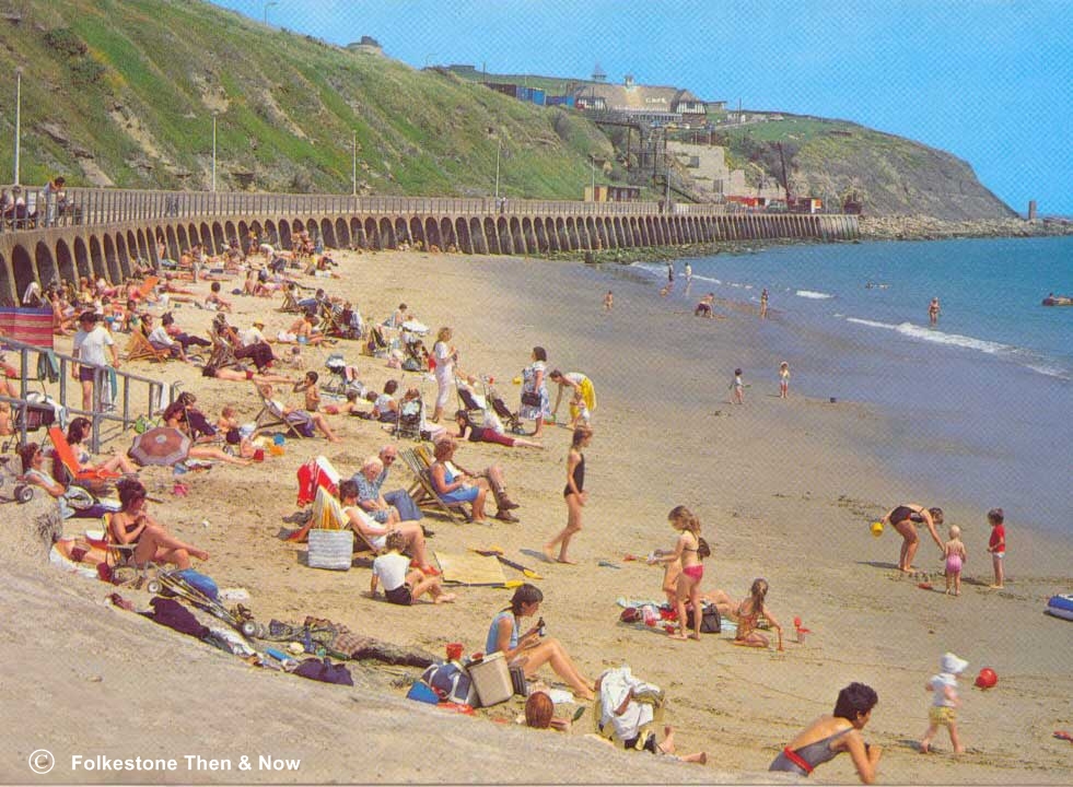
The East Cliff Sands were made user friendly in the 1920's by removing a lot of the rocks and building a promenade right along the back of the beach. The first prom had square arches. The arches that were there when I was a child in the 50's and 60's, and I think are still there today were rounded at the top and had steps at the back of some that led up onto the prom.
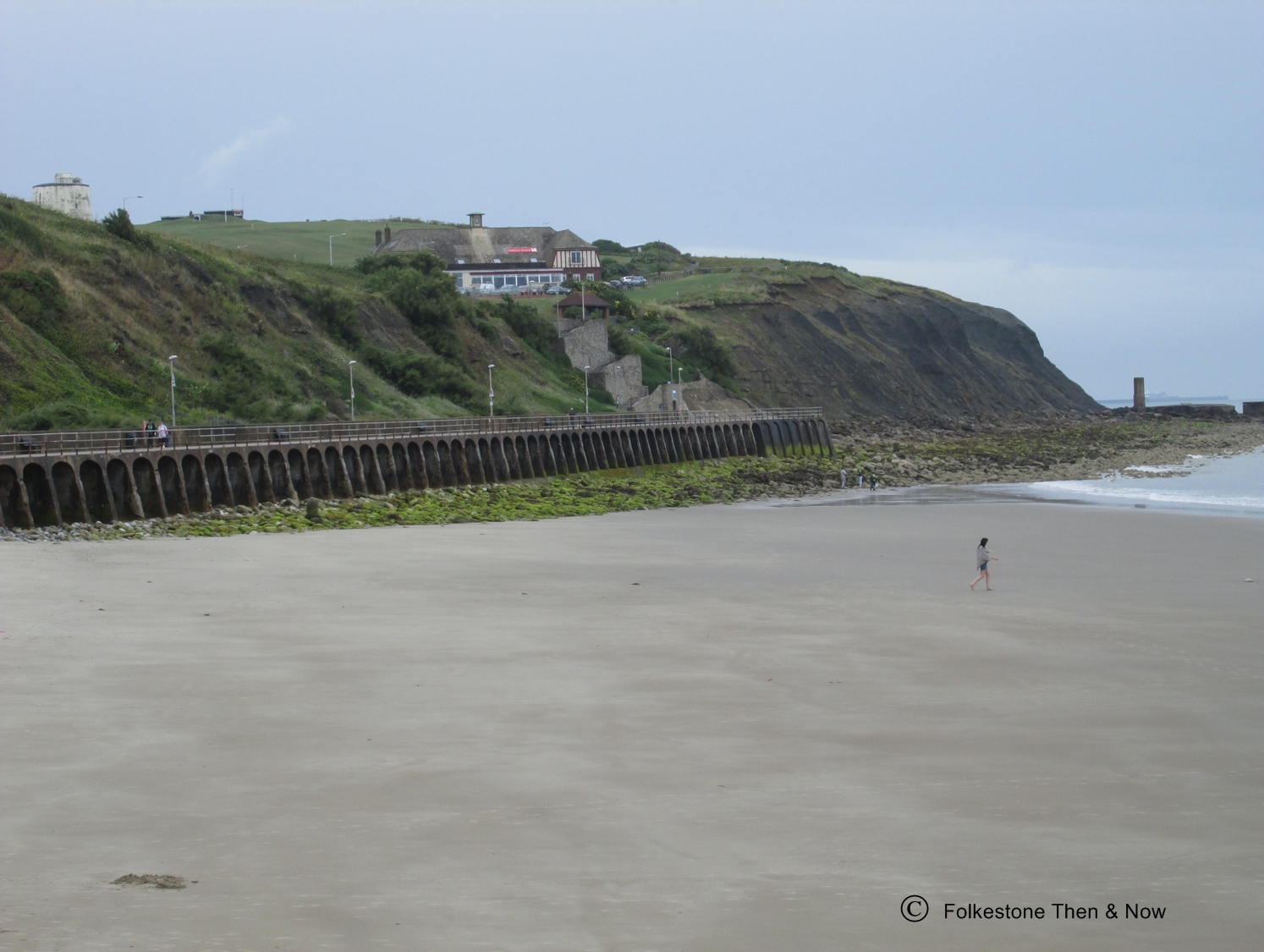
The Sands at the East Cliff has been known by a few different names over the years, some of which I think were only names on postcards, like Sandy Bay and Golden Sands. I believe the official title is the East Cliff Sands, but when I was a child, everyone just referred to it as The Sands. These days some people call it the Sunny Sands, and I suspect that name came about because there used to be a restaurant on The Stade with that name.
There is a second beach just on the harbour side of the East Head that we always referred to as the Little Sands. We sometimes opted for that beach as kids because the 'Big Sands' would get extremely crowded, but there was a reason why the little one was less used, the fishing fleet was large in those days, and fish guts and debris would be dumped into the harbour, as a consequence it would be very polluted and smelly. I don't think it is like that today.
A third beach is of course The Warren, but that one has its own page, so we won't talk about it here.


I was curious about the above card, because it is postmarked 1951, and I had never heard of the Prom being replaced around that time. I checked with Alan Taylor, and he suggested it might have been repaired then, as it had been damaged during the war. The official title of the Prom is Coronation Parade, it gained that name when it replaced the original one in 1935.
A modern version of the photo on the left with permission of Juliette Joyce Felton, who is an Administrator of the Facebook group Folkestone Residents Group Thank you Juliette, even the Burstin looks good with a rosy glow!
I can date this one easily without a postmark, because this prom was replaced in 1935 and the East Cliff Pavilion was built in 1934, so it has to be 1934 when the Pavilion was brand new. You can't see it well in this picture, but a temporary path had been cut along the cliff at the end of the prom, leading to some steps going up to the East Cliff. You can also spot some donkeys on the beach upon which you could have a ride for a price.


The card on the left shows that temporary path and steps a little more clearly, but I have also enlarged it for you below. As you can see, there were quite a few buildings on the East Cliff prior to the Pavilion being built, including a tea house and shelters.
The photo above of the donkey rides was sent to me by Carole Sage. I think it is a picture of her relatives (the children, not the donkeys!) Thanks Carole, it's fabulous!

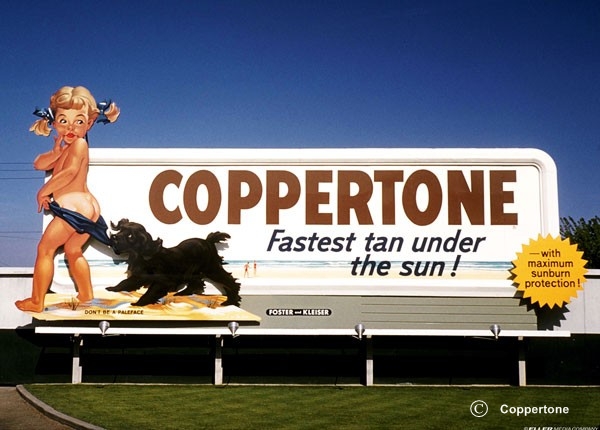
This image has to be large, because more than any other view, this one was my childhood. If I close my eyes I can hear the horn of the ferries, the smell of the salt water mixed with Coppertone, and who remembers the big waves that would come rolling to the shore each time a ferry arrived or left?

This card was posted in 1951, but I fear the shop must have been selling off very old stock, because this prom was replaced in 1935. I am not sure which year they added a pathway down to the rocks two thirds of the way along.
This card was also mailed in 1951, and I was curious because it is entitled 'New Prom'. I asked Alan Taylor if the Prom had been replaced a second time, and he assured me it hadn't, however it had been badly damaged during the war, so probably after the repairs, it looked as good as new!
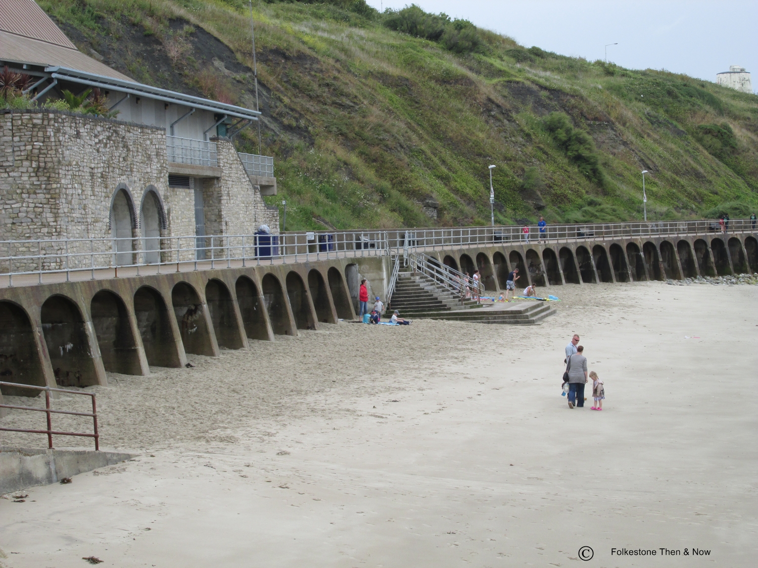
A couple I took of the East Cliff Sands in 2014. It was a little too early in the year to be crowded, not that it gets as crowded these days as it did when I was a child. I believe the building on the prom has something to do with sewage treatment, last time I was there, you could buy a cup of tea in the little cafe on top of it. As you can see, steps have also been added to the centre of the prom for easy access to and from the beach. But I believe some of the arches still have steps up the back as well.

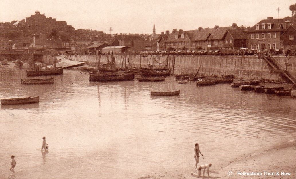
Here is a lovely Then & Now view, I don't have a date for the one on the left, but it was before the East Cliff Sands were developed, and you can see the masts of the sailing ships in the harbour. What is now known as the East Head was called the Breakwater back then, and it is what I always called it too, and if it was classified as old in that picture, you can just imagine how old it really is now. I don't think I have seen a photo of the working harbour before it was built, indeed, I suspect it was built before the age of photographs. The beautiful sunset photo on the right was taken by Terry Noakes, who has kindly allowed me to add it here. It's beautiful isn't it? Thanks Terry!

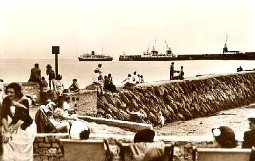
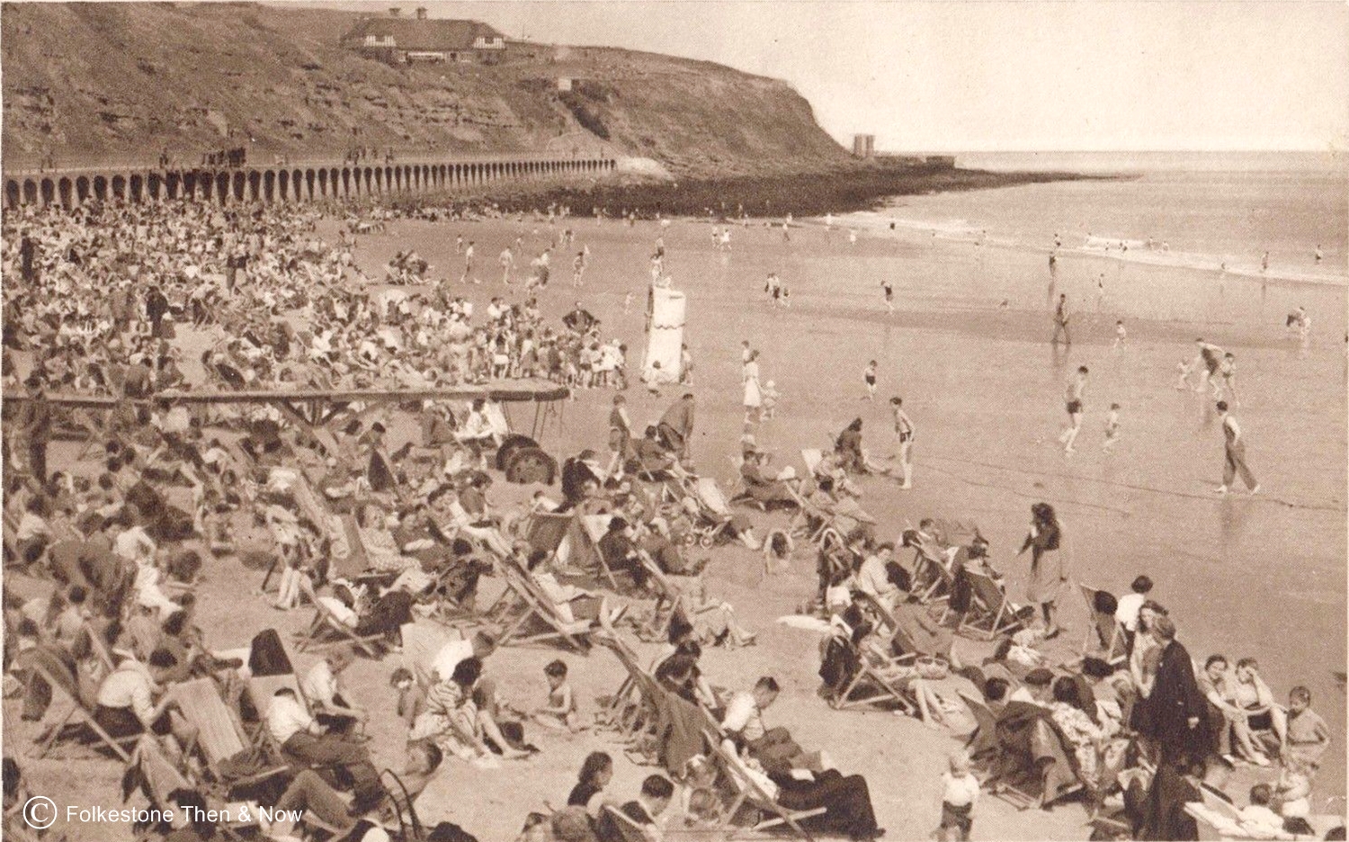
Oh yes, this is how it was in the summer during the 50's, looks as if the tide is going out which will make a bit more room for the people.
This one, post dated 1960 shows the landing stage where the rowing boat would pick up and drop off people when giving them a sail around the harbour. The white object in the middle of the beach was a Punch & Judy show, where little children were exposed to murder and mayhem as Mr. Punch killed his wife and baby and then would get eaten by a crocodile. We loved it - we were raised to be tough in those days! Ha ha!

I know I have this one at the top of the page, but there is so much to see in it, I thought you would like to see it enlarged. Dated 1913, I think we can count on one hand things that are still there today, let's see, there is the breakwater, or East Head, which you are no longer allowed to walk along, the Harbour Master's house is still there, although the developers have talked of wanting to demolish it, and there is a small section of the Customs House - that's it! Oh yes, we do still have a swing bridge, but not the same one as in the photo, and I am not sure if it still swings. We also still have a viaduct across the harbour, but as you can see, it looked very different back then.

Not dated, but although you can't see the prom, I suspect the old one was there, because looking at the skirt hemlines, and the amount of people on this beach, I would guess it has to be later than 1920's However, as the East Cliff Pavilion is not in the picture, it is earlier than 1934. Golden Sands?? I think that name was made up by the photographer!
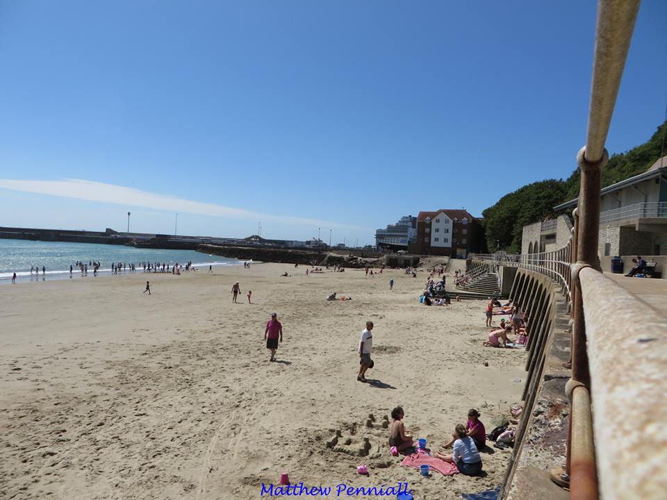
Now here is one that could be described as Golden Sands, it was taken in 2015 by Matthew Penniall, who has kindly agreed to let me show it here. Doesn't it make you want to get that sand between your toes? Beautiful photograph, thank you so much Matthew!
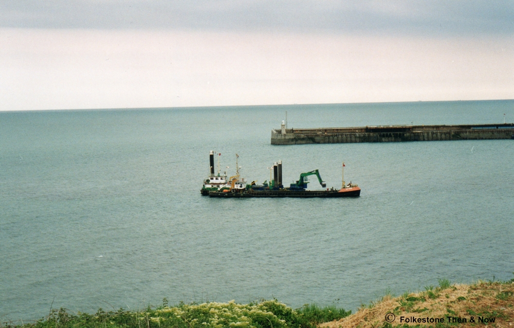
Another fairly modern one showing a dredger hard at work, clearing the silt from the outer harbour.

I expect many of you have wondered what these two bricked up entrances were for - me too, so I asked Alan Taylor, who told me they were storm drain outlets which would discharge drain water onto the sandy beach when we had very heavy rain. Does it still run underneath today? The rust suggests that it might.


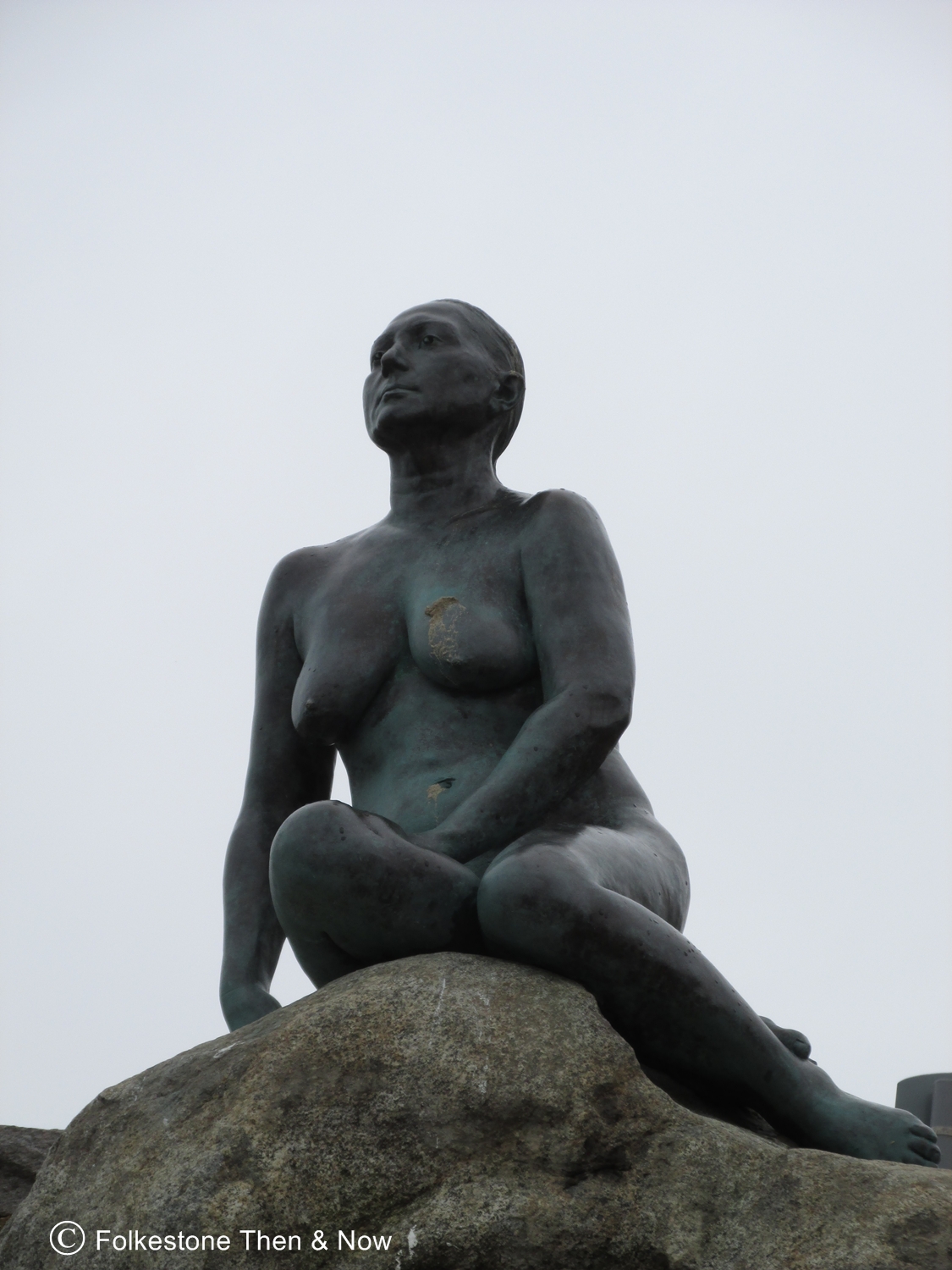

A few modern photos. I do like the statue that was added to the rocks on the East Cliff Sands, however it does irk me a bit that they insist on calling it a mermaid. If they wanted to copy the Danish one, they should have gone all the way and given her a tail. As it is, it's a very nice statue of a woman, modelled by Georgina Baker and sculpted by Cornelia Parker.
While we are on the subject of statues, Tony Quarrington has kindly sent me the following photographs of two sculptures by Antony Gormley, an artist most famous for his 'Angel of the North' piece. These two men are from his 'Another Time' series, and others can be found in various places around our coastline, the nearest being Margate in Kent. They were loaned to Folkestone for the Triennial festival in 2017, and the man under Coronation Parade has now been returned. However, the figure under the Harbour Arm still stands in 2019, and can be seen at low tide. Will it stay? I hope so!

Let's start with what I think is the best photo I have ever seen of the man under the Harbour Arm, there he is, contemplating whether he should dive in naked and swim across to the East Cliff Sands, or possibly the Warren, while a fisherman chugs by him concentrating on his day's catch. He is a long way from home though, his boat registration tells us he is from Hartlepool. That is a great shot Tony!


Three fabulous views of the man who used to be at the end of the arches under the Prom, or Coronation Parade. He stood there looking over at his brother under the Harbour Arm. It's a shame he couldn't stay, but would probably have been destroyed as he was very accessible to the public.
My sincere thanks to Tony Quarrington for allowing me to add his images to this page. Tony does fabulous walking tours of Folkestone throughout the summer months, so if you are planning a visit, I urge you to book yourself onto one. You will go places and find out things about Folkestone you didn't know before - I promise!


Walking along the prom in 2014 I met up with these two guys above, and got chatting to them. Their names are Bradley Penfold on the left and Russell Reilly on the right, who are just two of the wonderful crew members of the Folkestone Rescue team. They volunteer their time to keep Folkestone safe all along the coast from Dover to Sandgate.
Working in partnership with Dover Coastguard, the RNLI, and NCI Folkestone, they cover the coast between Sandgate and Dover, focusing on Sunny Sands beach and Folkestone Harbour.
You can find them at Sunny Sands beach on Saturdays and Sundays, between the hours of 10am and 4pm from April until September. Their current base of operations is the yellow and blue shipping container at the end of the Stade. Their Lookout – at the corner of the grey stone building on Coronation Parade – is temporarily closed. The crew frequently patrol the beach, and you can recognise them by their distinctive red and yellow uniforms.
Their main patrol area is Sunny Sands beach, Little Sands beach, and Coronation Parade, although they also keep an eye on Folkestone Harbour. Their rescue boats are able to respond to any incidents on the coast between Sandgate and Dover.
Normal operating times between April and September are 10am until 4pm on Saturdays and Sundays. They also operate during certain special events. When their lifeguards are on duty, the red & yellow lifeguard flags will be flying from the beach slipway and the lookout at Sunny Sands. You can see their current flag status on the right hand side of their website here: Folkestone Rescue

The above card was sent to me by John Anton, who told me it dates from 1984 and in the foreground shows his second ex-wife sitting with her parents. He didn't say if he took the photo.
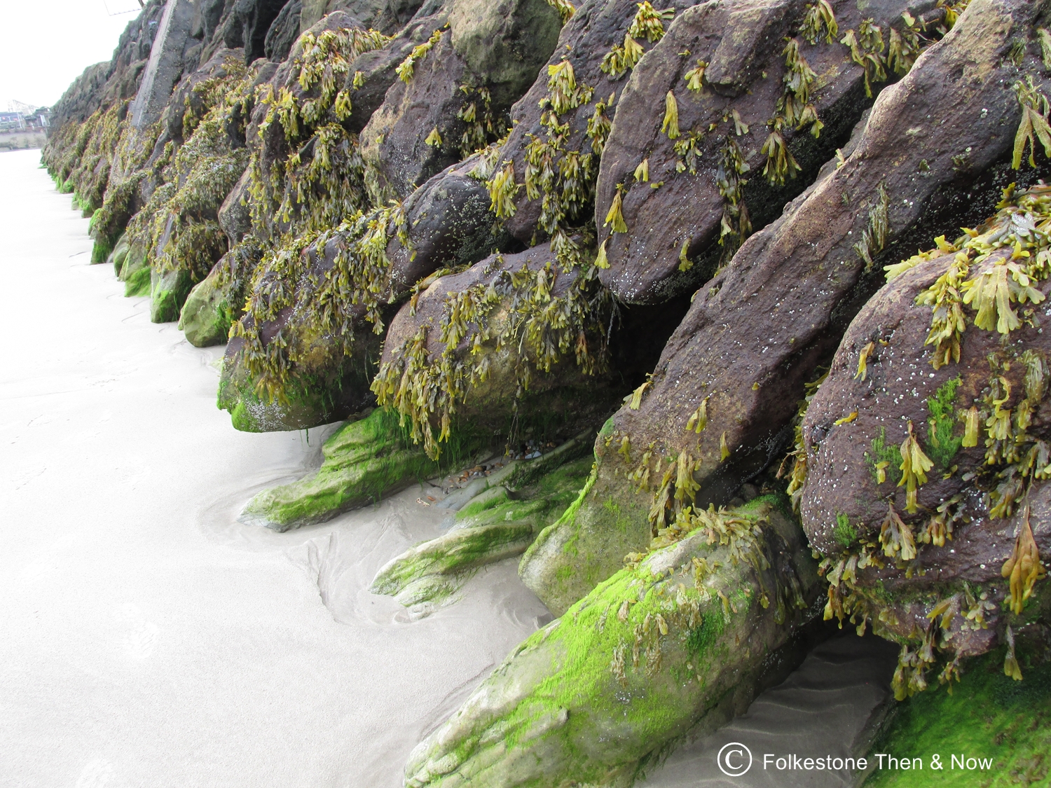
These are the rocks shown in the picture on the left, taken from below in 2014. Something tells me the seaweed growing on them is not the type people eat, but I stand to be corrected on that. I will say it doesn't appeal to me to have it for breakfast though!
I had this scan saved with the title 'East Cliff Sands Now', and it was when I saved it, but as it doesn't have the steps leading down from the middle of the prom, we know it's not very recent. It looks like the height of summer, but nowhere near the amount of people on the beach we used to see back in the 50's and 60's.
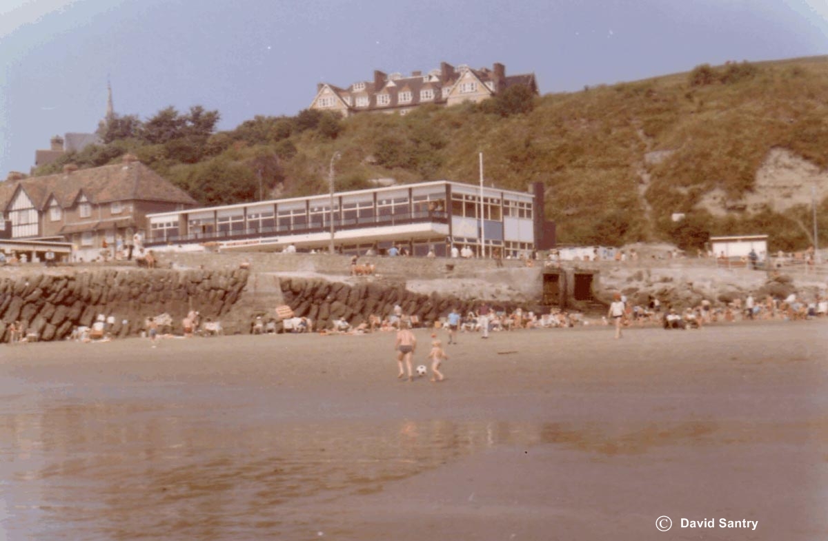
This one dates back to 1971 and was sent to me by David Santry, who now lives in Canada, but used to live on The Bayle. If I am not mistaken, the first building up on the Stade is the Sunny Sands Restaurant, after which the East Cliff Sands became better known. Thank you David!
As you can see, when the above photo was taken, you could wander along the East Head, or Breakwater as we used to call it, you could fish from it, and the brave would jump off it into the water. The photo on the right shows the way it is now, a barrier prevents any pedestrian traffic. They say it is for our own safety. Was it a big problem with people falling off I wonder? To the right of the East Head is the Little Sands. As kids we would sometimes opt for this beach as it was usually less crowded than the big sands. However, there was a reason for this, back then the fishing boats tended to throw fish guts, oil and other unmentionables overboard, and it would wash up on the little sands, the smell was rather ripe too! These days, I think everyone is a lot more pollution conscious, so it looks to be a lot cleaner. I do know that plastic is an enormous problem in the oceans world wide though, so I hope visitors to our beaches put all their litter in the bins to prevent it ending up in the sea. If the bins are full, please take it home!

Children playing on the Little Sands, was that us? I don't think so, I am not that old! I don't have a date for it, but the Fishermen's Bethel looks to be still there, and that was destroyed by a Messerschmitt on Armistice Day, November 11th 1940.
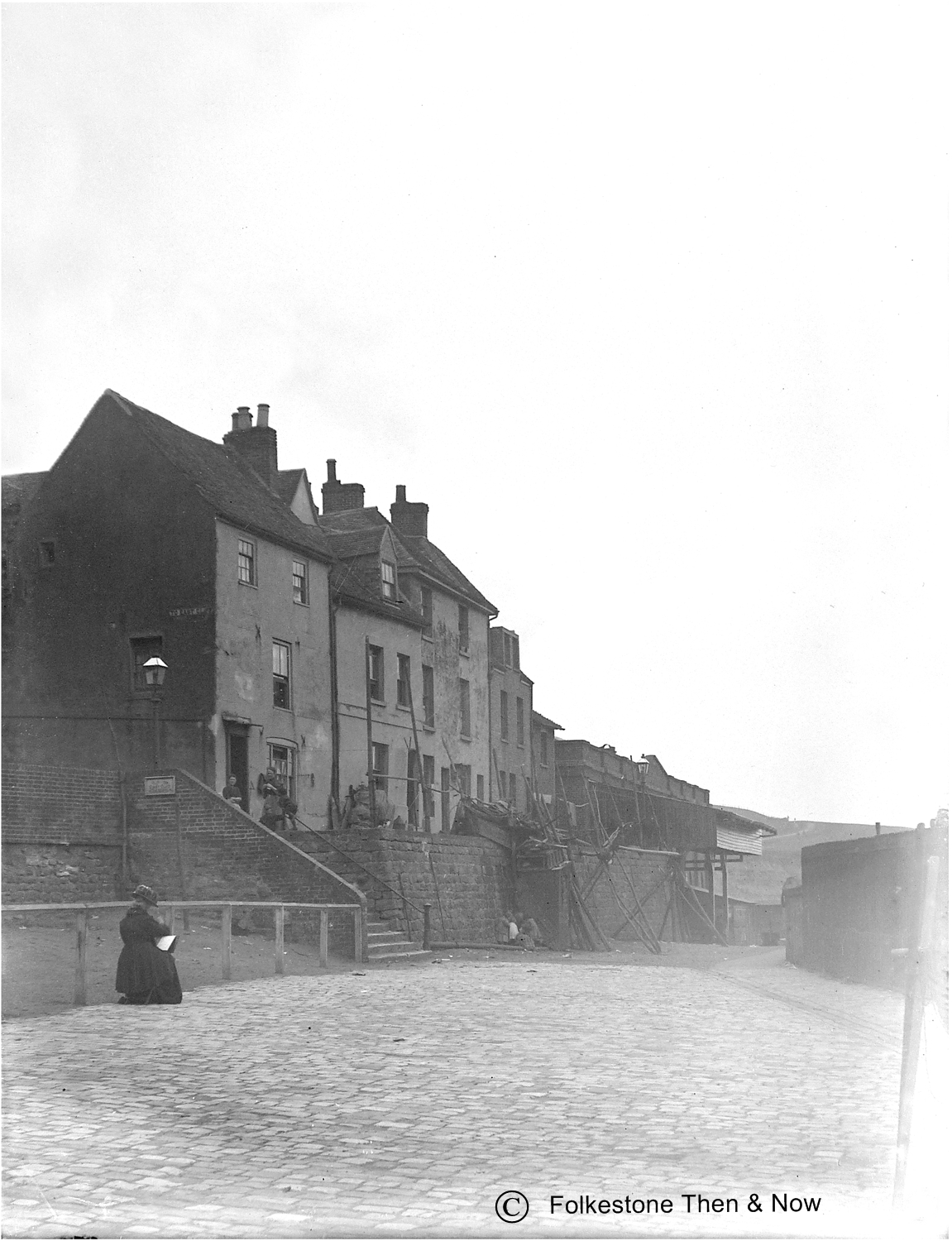
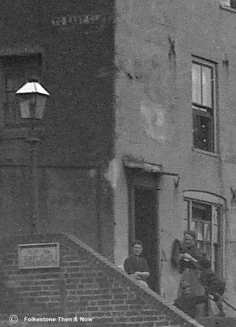
As we leave the East Beaches, let's take a little walk along the Stade. This is probably the oldest one I have of it, taken from a glass plate. I have no idea of the age, but I do believe we are almost up to the East Head. Is the seated lady an artist possibly? I guess we will never know. The sign on the side of the first house says 'To East Cliff', so I guess those steps led all the way up. The two women standing in the doorway are looking very curious about what is going on, what with an artist and a photographer invading their space.
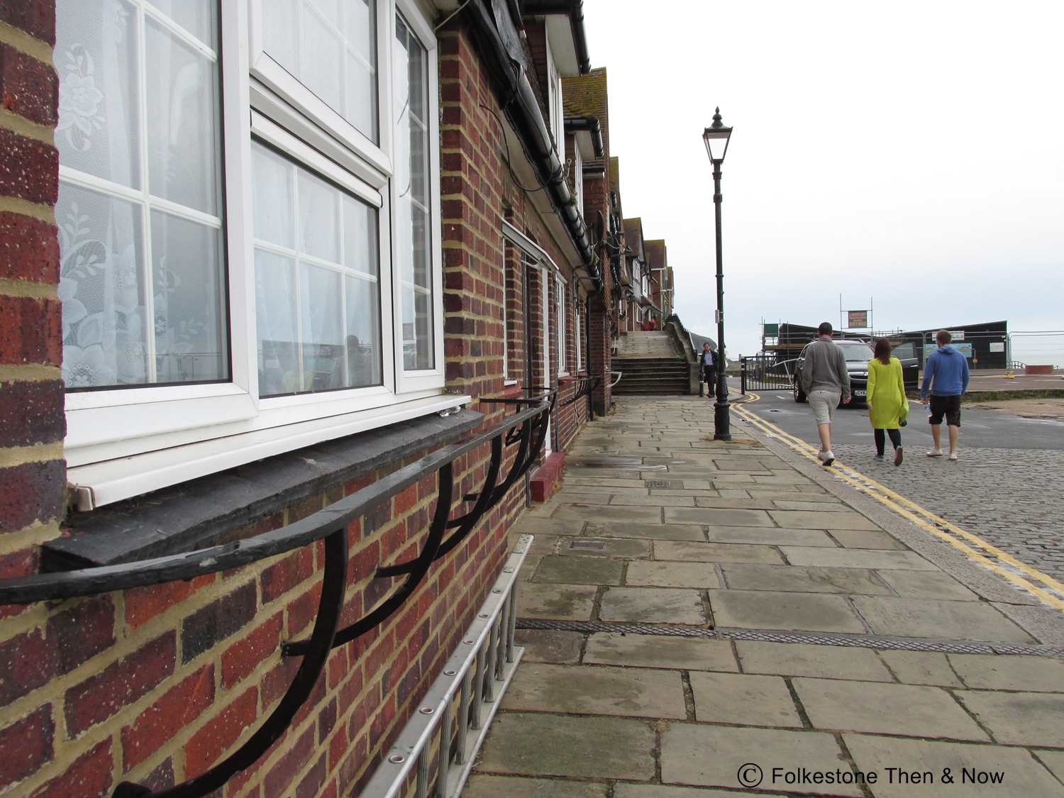
Not sure of the date of the photo on the left, but I took it on one of my visits. I do know the one on the right dates from 2014 though. Note there is now a barrier preventing vehicles from driving right to the end.
When I first added this card, scanned and sent to me by Mike Vernol, I was curious as to what everyone was looking at. They were not regular holidaymakers, because most were wearing coats and hats, and you don't normally see them standing on the cliffs behind the prom. We knew it was prior to 1935 because the arches were square. After lots of input from lots of people, I finally found the exact answer in Wikipedia. Headed Meteotsunami 1929 it reads: On 20 July 1929 a wave reported as being between 3.5 and 6 metres high struck the south coast including busy tourist beaches at Worthing, Brighton, Hastings and Folkestone. Two people drowned and the wave was attributed to a squall line travelling along the English Channel. So there you have it, it was a tidal wave on July 20, 1929.

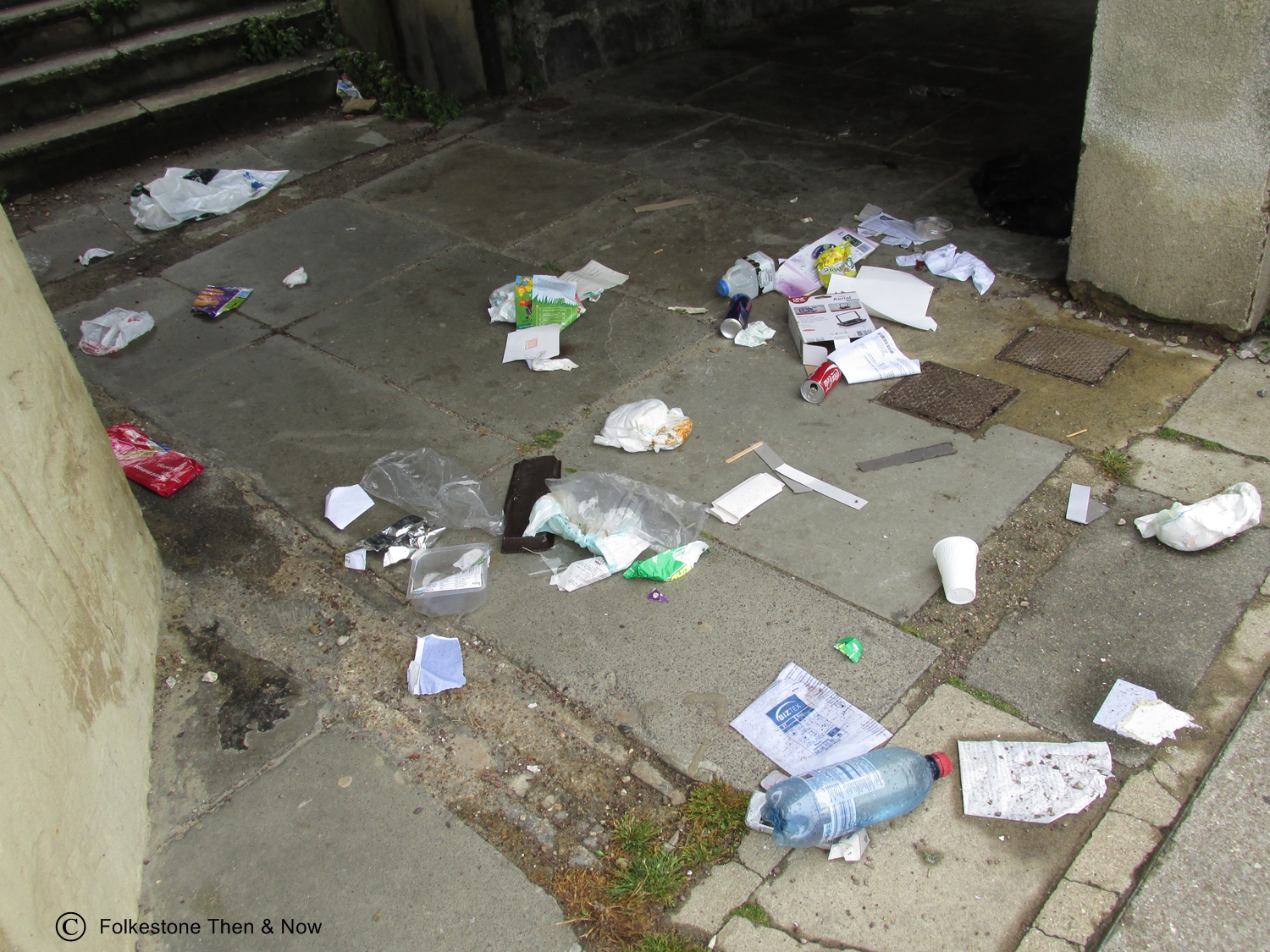
Yes, everywhere means something to someone. Unfortunately this is what I found near the Stade arches in 2014. This will be someone's childhood memory of a day out down the Sands. How sad is that! Mind you, I guess a dead fox is not a great one either!


I was curious about the steps in the old photo to the left, but all I could find was the lovely painting above, showing what I believe to be the same steps. The artist was Francis Lindon, and it was painted before 1914. Copyright belongs to the Folkestone Museum, and if they object, please drop me a line, and I will remove it immediately.
This was the Little Sands in 2014. Artist Michael Sailstorfer buried 30 gold pieces as an art project for the Triennial that year, and not all were found, even though many metal detectors were used.
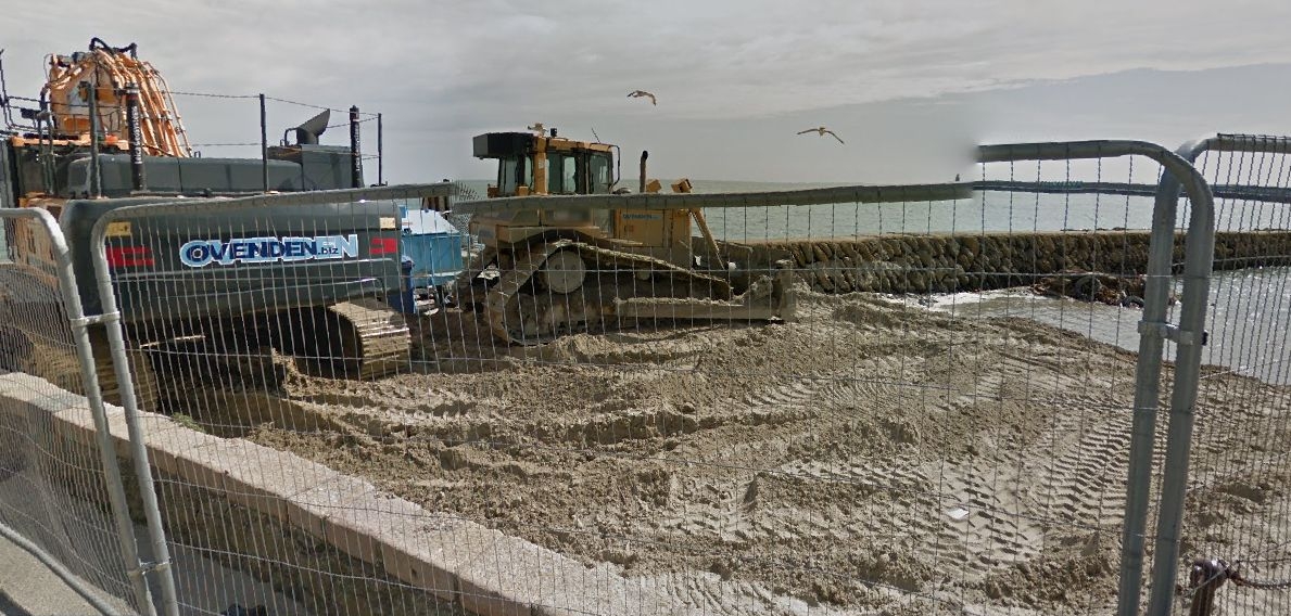
On the right in 2017, it shows heavy duty work going on at the Little Sands, were they still looking for gold perhaps? Anyway, I am sure it is open to the public again now.


Yes, you used to be able to watch a Punch & Judy show on the East Cliff Sands, and further back in time, it was also possible to catch a show up on the Leas. This colourful photo was taken from this page, where you can learn the secrets of the Swazzle.
You can get to the Folkestone Triennial website by clicking the above photo.


© Folkestone Museum


Alan Taylor sent these two photos that he took of the East Cliff Sands in March 2008. This reminds us that the sea sometimes gets very angry, and at times like this you should respect the fact that it will win, and stay well away from it. I have seen videos on You Tube of parents walking along the Prom with their children walking ahead of them, when the sea has been coming right up over them. That is total madness, they could all be swept right off and be gone forever, especially the lighter weight children. Please don't do it.