
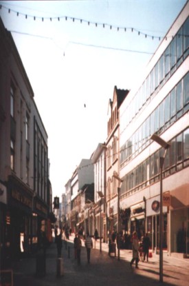
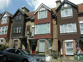
If you have ever walked around the streets of Folkestone, you will know that it can get pretty tiring. There are some very steep hills, and although these days, the main shopping area is Sandgate Road, you would be cheating yourself if you stuck to that one area. Many interesting shops can be found throughout Folkestone and district, like Tontine Street above, Cheriton Road, Dover Road, Blackbull Road and Canterbury Road. Not forgetting the Old High Street and the fascinating strip of antique shops in Sandgate High Street and lots more.
As mentioned above. In the old days, the main shopping area of Folkestone was Tontine Street. Consequently the old High Street was extremely busy too, and catered as much to the locals as to the tourist. This street however was very badly hit during both world wars, which you can read more about on the Folkestone At War page, but they picked themselves up, dusted themselves off and started all over again. Other streets were not so resilient, and disappeared under the bombs forever.
Anyway, enough prattle from me, let's take a walk around Folkestone's streets, skipping back and forth through the years. This is the best way to do it - much easier on the legs!
|
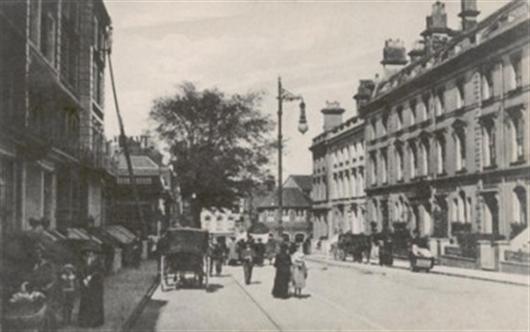
1897
|
2001
|
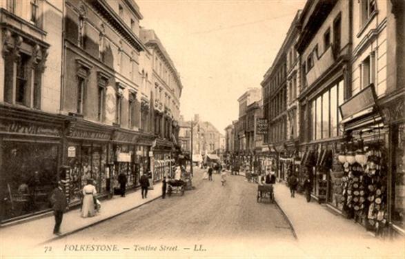
This fascinating photo of Tontine Street in 1890 was sent to me by David Bryceson who used to own Video VaudeVille in Tontine St. It looks as if something was being celebrated doesn't it? I can read the sign of Kent Colonial Meat Stores.
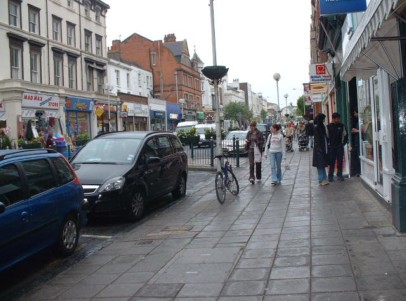
I took this one of Tontine Street on one of my visits. The horses have been replaced by cars, causing the dreaded yellow lines, and Tontine Street is no longer the main shopping area that it used to be.
|
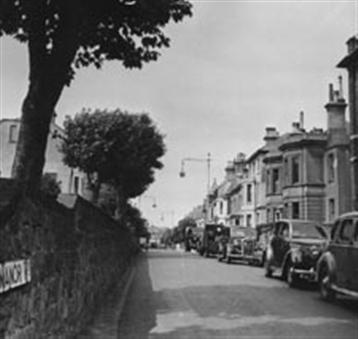
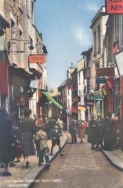
We will start with Manor Road, I don't have a date for this one, but no doubt you car buffs will be able to date it from the vehicles parked by the kerb.
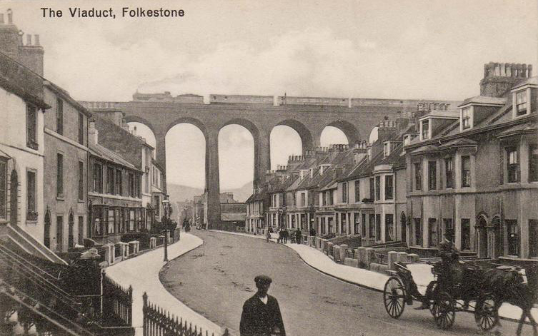
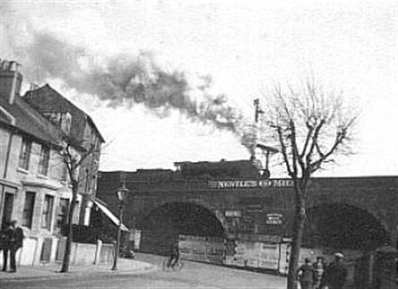
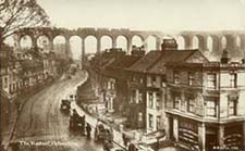
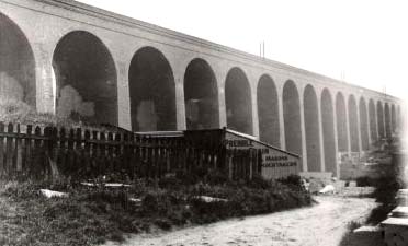
Ah yes, Foord Road and the Viaduct. I have a few photos of that from the olden days, so let's show those next
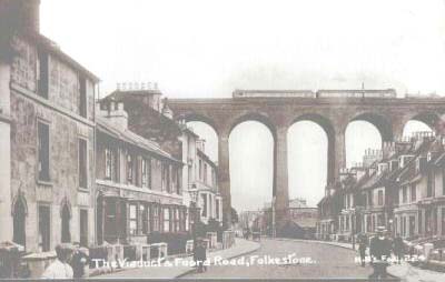
Isn't that a lovely carriage above? It must have been pretty smelly in those days though with all that horse poop in the streets.
Actually, the year here is 1912, and we are just in time to see the Royal Train passing over the viaduct. I wonder if King George V waved as he went through? He was too high up to smell the poop though!
In this photo you can see the gas works through the arches.
|
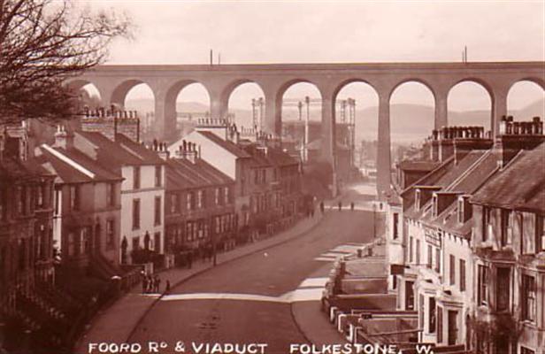
I can't quite make out what is written on that wall through the arch, it could be 'carpets' but I am not sure.
So - do you remember how many arches there are? It is 19!
.
|
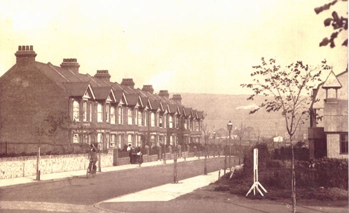
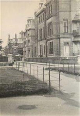
This one was such a thrill to find. It is Surrenden Road in Cheriton.
Can you just make out a woman standing gossiping at the gate of the second house down? Well, that is number three, where I was living in the late 50's and early 60's!
It's funny, when you live in a house, it doesn't occur to you that previous inhabitants had been swishing about in long dresses!
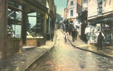
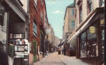
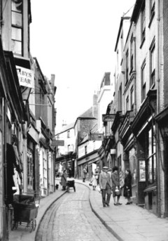
The old High Street in 1913. It looks as if it might have been raining, giving the cobbles a bit of a sheen.
The businesses have changed hands quite a few times since then, but apart from that, it looks exactly the same now.
Don't you love the little girl with the pinafore over her dress? Very much the style in those days.
|
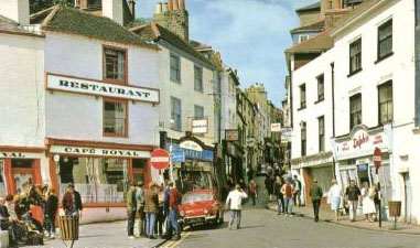
The photo in the middle dates from 1911, and in contrast, it is flanked by two taken in the 60's. Comparing the two later ones, the same gift shop is on the left, and bingo could be played opposite, in the photo on the right, you can see both the Cafe Royal and the Dolphin Restaurant.
|
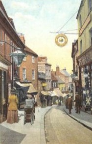
Stepping back in time, I don't have a date for the photo on the left, but can read several of the signs, like The Earl Grey Inn, Ostlers, Ironmongers, Dining Rooms for "Dinners and Teas" Bayfields Bazaar - "Cheapest in Town" P & J. Dicks - Hydraulic Presser Soles (Yellow sign over Shoe Shop) Hair Cutting & Shaving Salon.
|
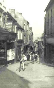
Three more of the Old High Street. Far left is 1958, in the middle is 1961 and immediate left is 1966.
|
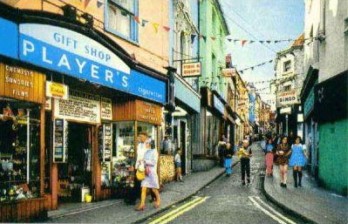
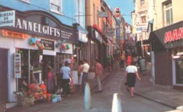
We had a change of businesses in 1970. It is now Channel Gifts where the Gift Shop used to be, and the business on the right is different too.
Note there is also a Bureau de Change next door to Channel Gifts.
|
Nipping back to 1955, as you can see, we had a baby's wear shop about half way up. Note the old pram parked outside - methinks that was slightly older than 1955!
|
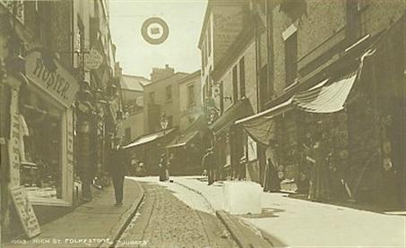
I don't have a date for this one - but obviously it was before refrigerators had been invented! Note the huge block of ice sitting on the pavement. On the left we have a hosier.
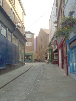
Here is a photo of the top end of the High Street taken quite recently by Cindy Milne, who kindly sent it to me.
As you can see, the old cobbles are still there, and so is Rowland's Rock Shop top right.
As I have said before, I am convinced that if Rowland's ever closes, Folkestone will fall - mark my words!
|
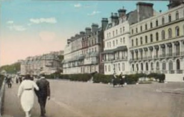
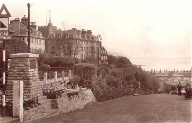
Marine Parade in 1924. You notice the gentleman is walking on the outside to protect the lady from the horses!
|
This is another one that I have on the wall of my office. It depicts the Lower Sandgate Road, The Slope - which later became The Road of Remembrance, and Swiss Cottage, which is of course no longer there.
I don't know the history behind it, but it had a very distinctive roof and chimneys.
|
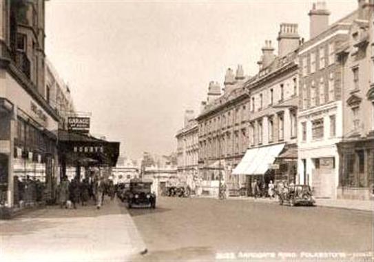
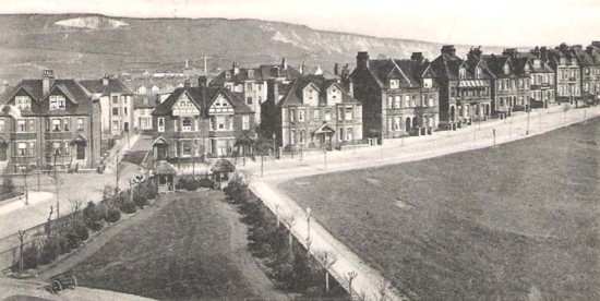
Sandgate Road, in the days before they had to close it to traffic at the lower end. There are not many shops are there? It looks very residential. But I think those houses came down, and W. H. Smith is situated around there on the right, and Debenham's would be on the left.
This is a photo I picked up on one of my trips over, and it too graces the wall of my office. It is of Dover Road, leading to Grace Hill around the corner of the Wesleyan Church in the foreground,, but am not sure of the year. I can just make out that there is an antique shop on the right, with the words 'The Curiosity Shop' written at the top of the building. Can you imagine the age of the goods they had in there then?
|
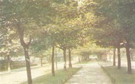
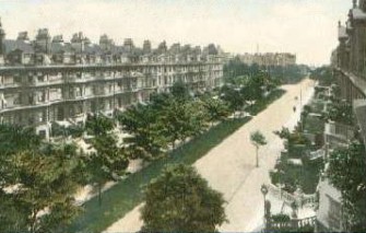
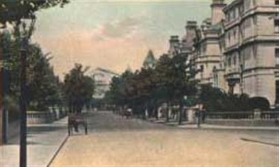
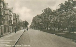
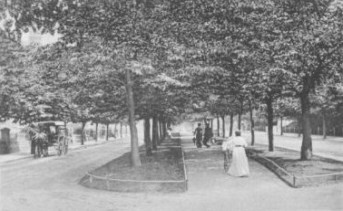
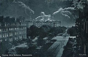
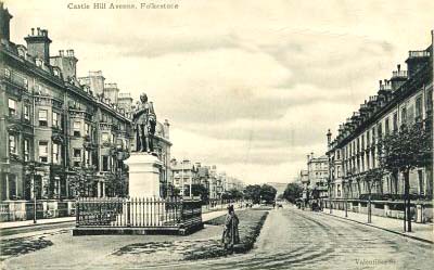
This is just the first of many photographs you will see of Castle Hill Avenue. I don't really know why it was so popular on post cards in the old days, but it was probably because you didn't often see dual carriageway streets with a place to walk down the centre.
It was and is a very pretty street with all those beautiful trees.
|
Here we have Bouverie Place in 1965 - while I was still there! On the right you can see Bobby & Co. which of course is now Debenhams. Ahead is the Bouverie Square bus station, of which there is a picture below.
|
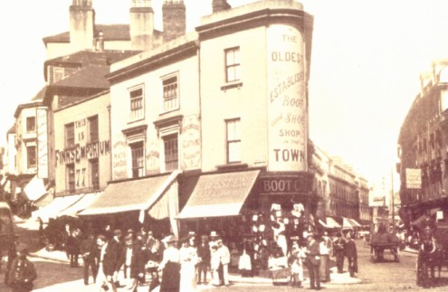
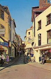
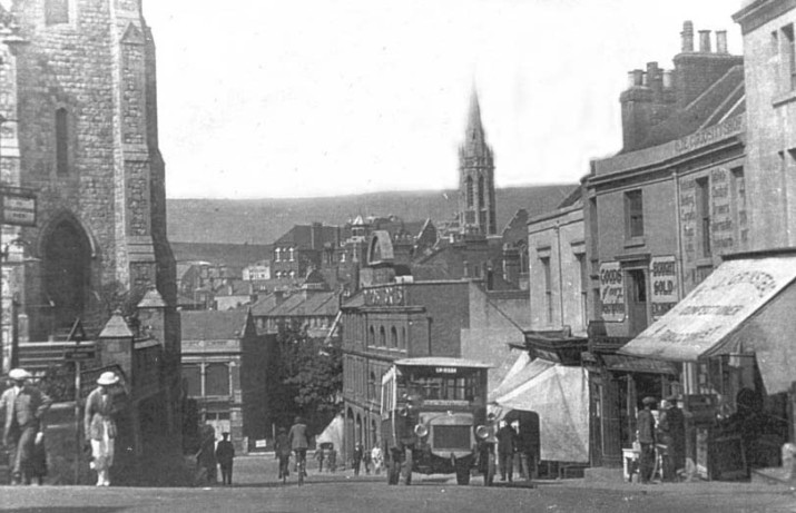
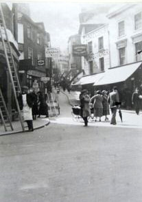
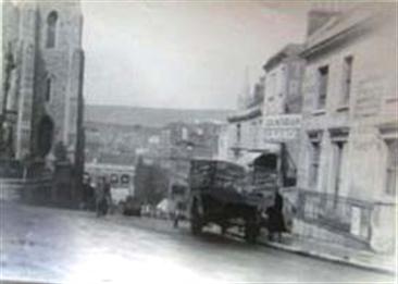
A photo of a very busy street corner. This is the old High Street going up to the left, and Tontine Street on the right.
What is now an amusement arcade on the corner was then the oldest established boot and shoe shop in the town.
You can also make out Finns Emporium at 77 High Street. The streets were quite adequate in those days for the kind of traffic you see here, bicycles and horses. What a different story it is these days!
|
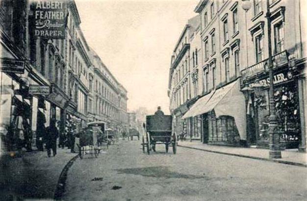
Tontine Street again, and the most visible sign is Albert Feather, Popular Draper. Talk about blowing your own horn!
Those horses must have found it hard going when they turned the corner to go up Dover Road to Grace Hill
|
This is one of Sandgate Road in 1914. Don't you just love the light standard?
|
I think this one of Sandgate Road might be slightly later than the one above. However, they still had the same street lights!
|
What a find this one was! Tontine Street in 1908. The street is busy, with what looks like vendors pitched on either side of the street. On the left is a shop called Upton's, which eventually moved next to Bobby's in Sandgate Road. And next to that is Tontine Bazaar.
Upton's was quite a going concern at the time, and produced their own postcards, and Folkestone souvenirs, which had the Upton's name stamped on the bottom.
If you are familiar with Tontine Street today, you are probably wondering what those buildings were at the bottom of the Street. They were a row of shops in Harbour Street, which were destroyed by a parachute mine 18th November, 1940.
Thanks to Alan Taylor for the latter tid bit of information
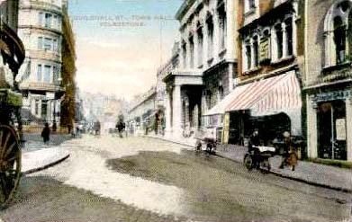
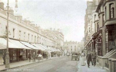
Here we have a nice picture of Guildhall Street, with Sandgate Road going off to the left. The Town Hall is on the right, which later became Waterstone's book shop. Now it houses the Silver Screen Cinema, but I am not sure what else it is being used for.
The building on the corner with the lovely carriage outside was The Queens Hotel is now Bon Marche, ladies wear.
Two 1906 photos of Castle Hill Avenue, taken from The Wampach Hotel - where I had my first wedding reception.
Were they all hotels in those days? Or were some of those huge houses private homes?
Note the large containers of red flowers flanking the building on the right, and you can just make out an open topped vehicle filled with people at the bottom of the picture on the left.
|
The Road of Remembrance, formerly called The Church Slope, but changed to honour the many soldiers who marched this way when leaving during the wars. It runs from the Leas down to the harbour, and they were not kidding when they put that steep hill sign up!
|
Both of these photos were sent to me by a lovely couple who go by the names of Pat & Trevor. Both are pictures of Sandgate Road, at almost exactly the same spot. I would date the one on the left at around 1920 - 30, and the one on the right was taken in 2001. Quite a difference eh? :-) Thanks a million you two
|
Now this is Shaftesbury Avenue, and the cone shaped building you see at the bottom was W. Martin's Ashley Mill.
I was wondering if that was where Ashley Avenue came from but Alan Taylor tells me that the name Ashley Avenue came from the Ashley Grange estate, which was sold for development in 1902. There were 100 building plots.
That being said, I would guess the Ashley Mill was on the Ashley Grange Estate, otherwise it would all be rather too much of a coincidence with Ashley Avenue being right there.
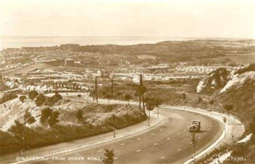
A picture of Folkestone taken from Dover Road in 1954.
People in Canada will laugh at this, but when it snows here, this road is the first to be affected because it is very steep and the snow is very wet. I have stood at the top and watched everything sliding back down to the bottom. If you have never seen a double decker bus skate in circles down this hill, you haven't lived!
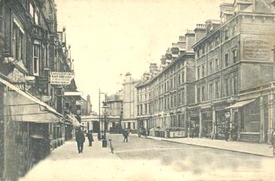
Sandgate Road looking down from Cheriton Place to West Terrace.
|
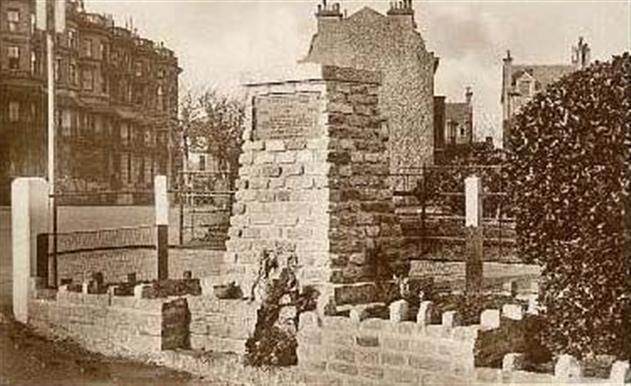
I don't know how old photo is, but this memorial was erected after the first World War in memory of those who fell. Hundreds of rosemary bushes were planted down the hill also for remembrance. Anyone know if they are still there?
It is located at the top of the Road of Remembrance.
OK, hands up who recognises this street?
The shop you see on the right must have been there for many years, this was taken in 1919. and the shop is Boots the Chemist, I remember it being there, and 1919 was a very long time before I was born! The street is Rendezvous Street. Turn right at the white building at the bottom, and you come to the Old High Street and The Bayle. Follow the road around to the left, and you will come to Grace Hill.
In the mid 1800's, Rendezvous Street was known as Butchers Row, as there were several Butchers shops on both sides of the street. At that same time, there was a slaughter house in Mill Bay behind Tontine Street.
Now, we are talking about the days before refrigeration, there was horse dung in the streets, slaughterhouses right in the middle of town and butchers would hang their meat both inside and outside their shops. Folkestone had to be an extremely smelly place in those days, especially in the summer, and it must have been a miracle if you lived to a ripe old age, because let's not forget, there was no penicillin to cure all the bacteria they must have ingested! Good old days? I don't think so!
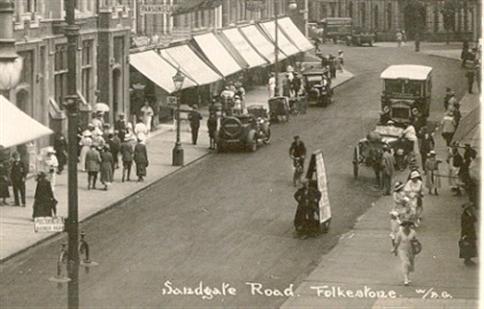
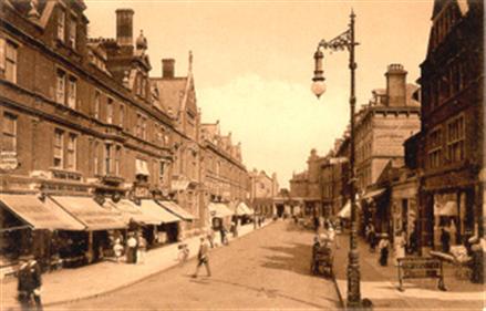
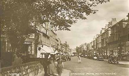
A busy day in Sandgate Road, possibly in the 30s.
I rather think the upper part of Sandgate Road was the busier shopping area in those days, because you do see more photos of it than the area now known as the precinct further down
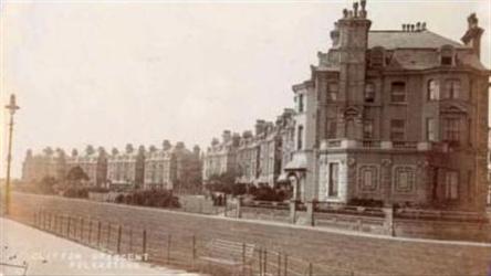
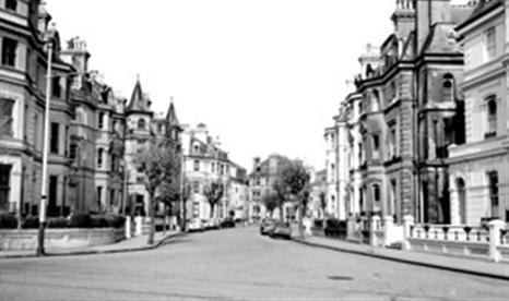
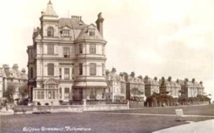
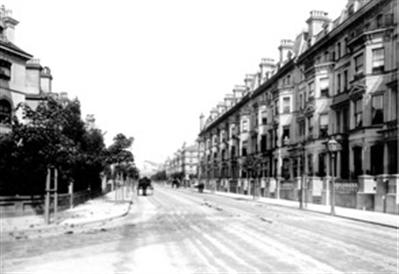
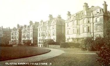
Here we have a 1907 photograph of Clifton Crescent.
|
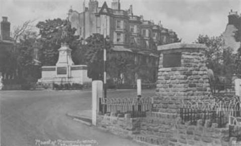
Here again is the cairn at the top of the Road of Remembrance, but this time you can see the War Memorial in the background.
|
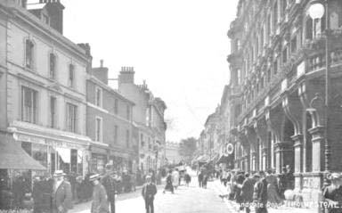
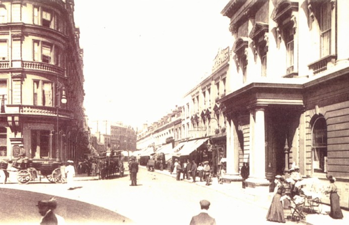
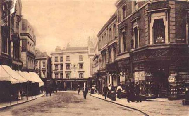
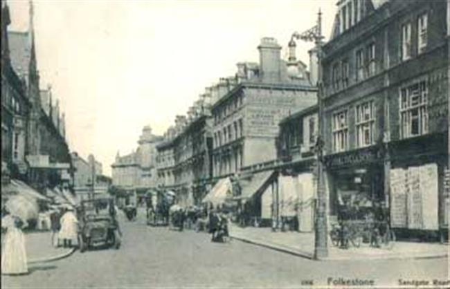
A busy day, taken from the bottom end of Sandgate Road. You didn't have Marks & Sparks on the left in those days! On the right is seen the Queen's Hotel.
|
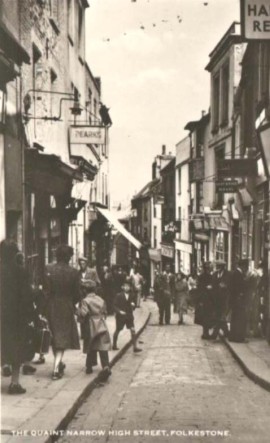
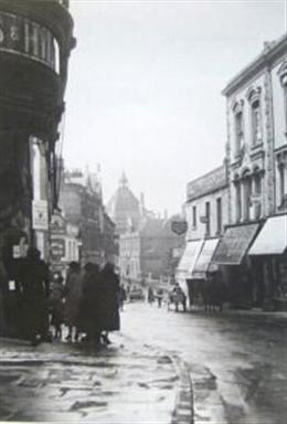
Back to the Old High Street again. This street was described as quaint and narrow even back then - which I would guess was in the 50's? Anyway, one business I can read the sign of is Pearks. It seems to me I vaguely remember this shop.
|
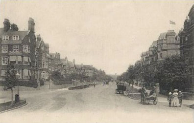
I was pleased to find this one. It is a photograph of Earls Avenue. It isn't dated, but we can't have everything can we?
|
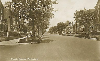
Here we have Earls Avenue again, with a carriage parked across the street, and an old postbox on the corner
|
Not very clear, but I am sure you will recognise the town hall on the right. So this means we are looking at Guildhall Street in 1914.
|
OK, who recognises this area? It is of course the skew arches at the corner of Dover Road and Canterbury Road. This photograph was taken from a site mostly about trains by Alan Newble, and this one was taken by his father, Ernest F. Newble in 1929.
He has quite a collection of his dad's Folkestone pics, so if you would like to see more, you will find them here:
|
A lovely clear photograph of the top end of Sandgate Road. Not dated, but I would guess around the '30s.
If I have my bearings, the women on the left would be walking past the churchyard.
|
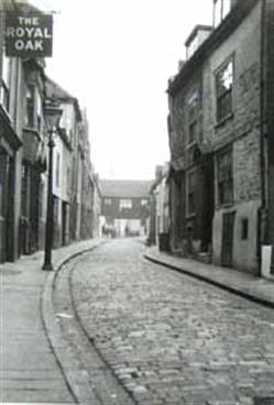
A 1923 photograph, this time of North Street, and you can make out the Royal Oak public house on the left.
North Street was originally called New Island and dates back to the 17th century, however, it was very badly damaged during the war, and it has mostly been rebuilt.
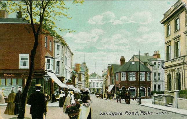
Another one interesting enough from 1909 to leave full size. Lloyds Bank is easy to read on the right, but I can't quite decipher the shop on the corner of Alexandra Gardens on the left. I think it says 'Ruth' something, but I am not sure. I think Shoe Zone is on that corner now. This photo too was taken from almost the same spot as the two sent by Pat & Trevor (above), but much earlier.
|
Another lovely old one sent to me by Ross, again it is of Sandgate Road when Folkestone was in the transition of going from horses to cars.
Isn't it interesting to see these moments in time captured this way. Thank you for sharing this one Ross!
Modern Sandgate Road, taken from a different angle to most shots of it. This was taken by ex-Folkestonian, David Boxer.
|
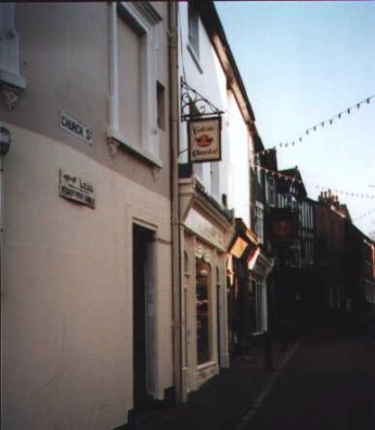
David took this one too, the location is Church Street the way it looks now.
|

Also sent by David, this is of St. Eanswythe Way, near Grace Hill.
|
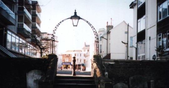
Now here is a neat bit of photography! David took it from the Parish Church, and framed through the archway you can see Sandgate Road in the distance.
|
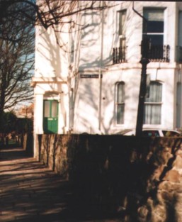
David took this one in Priory Gardens. I wonder if he knew who lived in that house? I don't, do you?
|

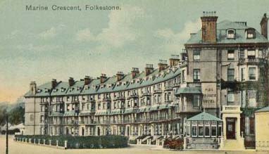
Back to the old days again, this one is a 1910 photo of Marine Crescent. These buildings have all been refurbished now, and have been sold as condos.
Is that an advertisement for Oxo on the right?
The Old High Street again, this time in 1923. This time, I can see a tobacconist and Confectioners - so Rowlands hasn't always had the monopoly on High St sweets! In fact, before Rowlands, I remember we bought our penny bags of rock crumbs from Andy Amos.
Just look at the length of that ladder!
|
1935, and on the left we have Bobby's in Sandgate Road, and Pearl Assurance.
|
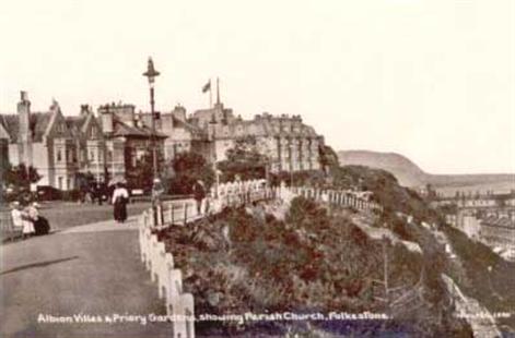
This is Albion Villas in Priory Gardens, where Charles Dickens once resided. You can read more about this on the 'People' page.
|
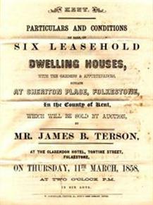
Here we have a notice of an auction to take place at the Clarendon Hotel, Tontine Street on Thursday, 11th March, 1858, and on the block are six leasehold dwelling houses in Cheriton Place.
I wonder how much they sold for?
This one is an old one of Augusta Gardens. At the bottom of the street you can see the Pleasure Gardens Theatre.
1961
|
1904
|
1923
|
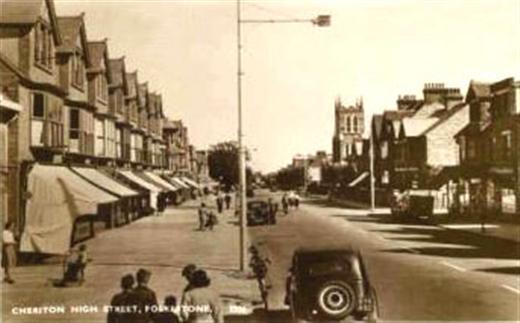
Cheriton High Street, don't you love the car with the spare wheel on the back?
|
When I was married for the first time, we lived in a flat in Cheriton Road while waiting for our house in Hythe to be built. It could have been one of these houses, I am not sure though. However, I wasn't there when this photo was taken - I am definitely not old enough to have ever worn long dresses!
|
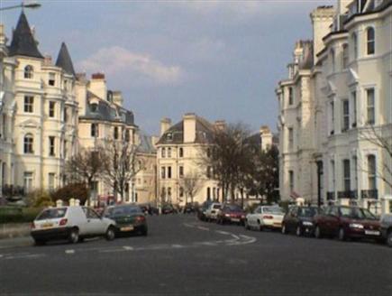
Beautiful architecture on this street. It is of course Clifton Crescent The one above was taken in the 60's but the more modern one on the right was taken by Dan Littauer on the Virtual Tourist website for Folkestone.
|
I don't have a date for this one of Clifton Crescent, but it is considerably older than the above two.
|
This one is of Clifton Road, and goes right back to the 1890's
|
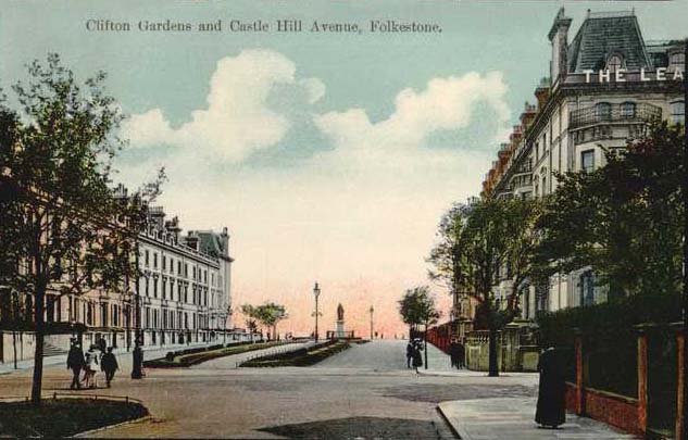
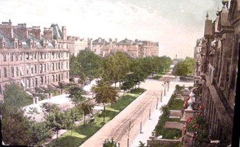
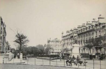
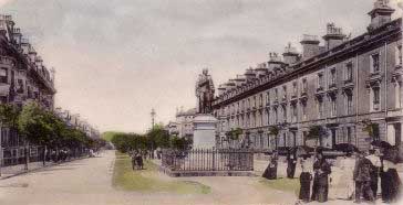
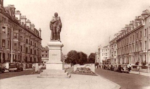
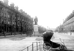
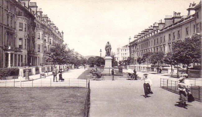
This 1912 postcard shows Clifton Gardens and Castle Hill Avenue. On the right you can just see the Leas Hotel, and at the end of the street stands the William Harvey statue.
|
A couple more of Clifton Gardens. The one abovedates from the 60's, but would guess the one below to be older.
|
This street looks almost identical doesn't it? However, this was Dover Street, which became Harbour Way in 1956. This street also suffered severe damage in 1943.
|
This 1922 photo is entitled Edgecliffe, I have no idea where this is, has anyone else? I am not sure if it refers to the street or a building.
|
Here are a couple of photos of Grace Hill. The one on the left was taken in 1923. It's not very clear, but I can see Halfords Cycle shop,Vye & Son Grocery & Provisions, Fitch, Blouses, Frocks and Hats, and the one above, taken a year earlier, is a little fuzzy, but I can make out The Cambrian Garage Coaching & Goods Transport.
|
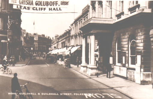
As you can see, this card was entitled Guildhall and Guildhall Street. Which I guess was what the Town Hall was originally called. I don't see much in the photo that is likely to have to heed the 'slow' sign in the road, do you?
And what or who on earth was 'Grisha Goluboff'? A reader in Australia by the name of Ruth Curtis did some research on this question, and came up with the fact that he was a child prodigy violinist born in America in 1919 of Russian heritage. He didn't die until 2002. To read more, check this site: http://histclo.com/act/music/pro/ind/g/pro-gol.html however, you will need to subscribe to the site to see the photos of him. Thanks Ruth, another nagging question answered!
|
1887
|
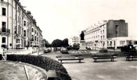
Three photos of Castle Hill Avenue, featuring the William Harvey statue. The large one above is from the 50's, the one in the centre shows a wonderful old bathchair from 1887. I don't have a date for the one on the right, but would guess it to be the early 1900's They used to have a pretty hefty railing around Harvey didn't they? Were they afraid someone would steal him? I would guess it was removed for the war effort and never replaced.
|
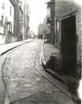
This 1923 photo is of Little Fenchurch Street which I think is now Harbour Way and ran to St. Michael's Street. Didn't it look quaint with its cobbles.
Another photo of Marine Crescent, and the Oxo ad has gone! The private hotel on the end was The Pier.
I don't know which year this was taken, but I do know that The Pier was there in 1958 when the Kelly's Directory I have was printed. It must have been there for a good few years though, because it looks to be the same name in the 1910 photo further up this page.
|
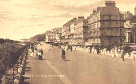
This 1924 card shows Marine Parade, which runs from the Harbour down to Marine Crescent. The fancy little wall on the right belonged to the Pavilion Hotel, and a considerable amount of it is still there, even though the hotel has gone.
|
This modern photo was taken in Martello Road, which runs from the Tram Road to Dover Road, and was sent to me by Steve & Sylvia Thompson, who had just bought one of these houses, and was justifiably proud of it!
Thanks for sending it you two!
|
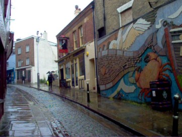
The card on the right was called 'Old Town', and this one is easy to recognise as the Fishmarket area. There are a lot more photos like this one on the 'Fishing Industry' page.
|
This page is very full, and I have many more photos of Folkestone streets, so they will be continued on page 2 HERE
|
same street as left, but different spot. On the left is the Co op.
|
2005
|
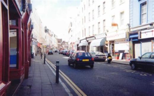
I took this one in 2005. See the changing face of the High Street, it is becoming an arts community as you can see by the wall art on the right, and you can just make out the piece of sculpture at the entrance to Mill Bay. I have a closer picture of that on this site.
|
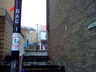
To the left is George Lane, taken in 2005. Does that sign say "Do not allow your dog to poop in here"?
Looking down Ingoldsby Road from the other side of Hill Road. The blue house you see on the corner has huge paw prints all over the outside aka Blues Clues, and I believe the back garden fence has Teletubbies in 2005. I hope they have children. (Had an e-mail from a lady who assured me they do)
Wow! Not many parents would decorate their house this way for their children.
|
If you have passed many blanks and want to see them, right click your mouse into the space, and click 'Show Picture'
|

Home
|
When this photo was taken, Prebble & Son, Undertakers, had their premises nearby.
1958
|
1961
|
1966
|
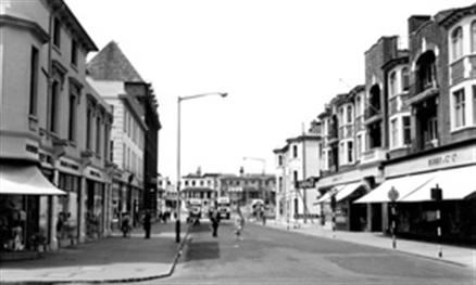
Taken in 2006, you can see the junction of Tontine Street and the Old High Street.
|
The same area in 2006 with the boot & shoe shop now 'Famous Amusements Emporium' and on the left, I believe is a restaurant called 'Kat Man Do' The 2006 photo was taken in May, so not the height of season, but what a difference in the number of people between these two photographs.
|
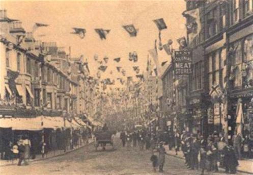
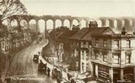
Alan tells me that in this photo they were celebrating Queen Victoria's Diamond Jubilee, so the year had to be 1897.
|
I received an e-mail from Lisa Green of Folkestone, who included the following interesting information about the viaduct and the houses in that area:
" The engineer and architect responsible for it was a man called "William Cubit" He worked on many projects for southern railways.
The houses in Bradstone Road underneeth the viaduct were errected for the builders to live in. They are known as monkey puzzle houses ( although over the years many have been changed to full houses) Two doors go into one house one door leads straight upstairs and thats one living space and the other doors leads into the groundfloor as the other living space.
As you can imagine, very small. Also the bricks that were used to build the viaduct were made in folkestone especially. What is known as Eastfields used to be home to the brick factory (used to be known as brickfields) The viaduct is now a grade 2 listed building.'
Fascinating Lisa - thanks!
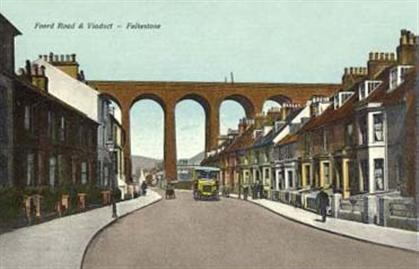
Another look at Foord Road and the viaduct. This time an old bus is trundling along. I wonder how much it cost to ride in those days?
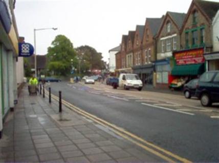
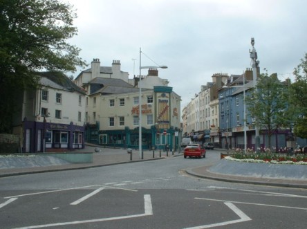
Sandgate Road in 2006, this is the West end looking towards Sandgate
|
Bouverie Road West in 2006
|
Alan Taylor of course knew!
Edgecliffe was a boarding house on the Leas, corner of Cheriton Place
|
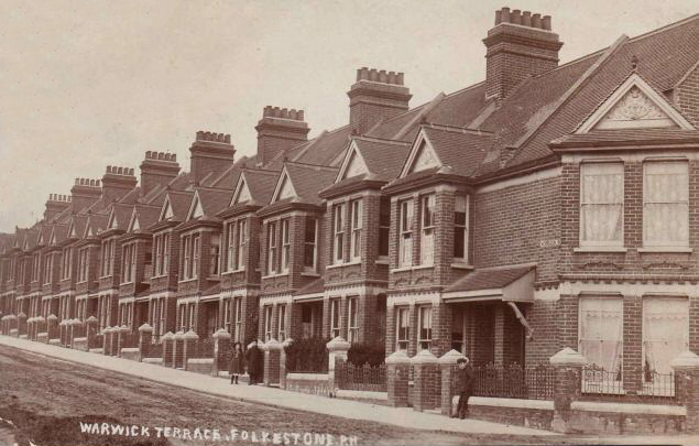
Warwick Terrace, which was located somewhere near the Junction Station, but I am not sure if it is still there, as I am unable to find it listed anywhere. I do know that in the early part of the last century, it had a bakery on the corner owned by Edward and Elizabeth Sellen. I also know that it was there in 1917, because someone from number 3 was killed in the Tontine Street air raid. But I can't find it listed in my 1958 Kelly's Directory, nor can I find it on a modern map. Was it a casualty of one of the wars? Or has it been renamed?
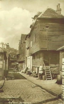
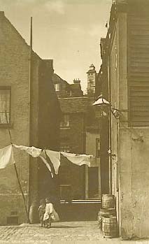
Now isn't this an amazing photo? It was sent to me by Ron Chadwick, who spent his early childhood here in Castle's Yard. Ron says:
"In the mid foreground is a tall house which was ours. I was told that it was over a hundred years old then. The footprint of the house was about 18 feet by 12 feet. There was a basement where we lived which contained everything including the kitchen sink. A gas stove, coal range, separate copper for washing, a coal cupboard under the stairs, and the toilet. Grandfather had a set of home made storage batteries for lighting and there was a gas engine under a small bench to charge them. In the picture you can just see the exhaust pipe up the wall. Above the basement was the sitting room about 11 feet square. Above that was a spare bedroom and our bedroom was at the top. from there I could see the ships in the Inner Harbour and spent hours on cold days watching the steam cranes unloading coal from large sailing barges."
To get an idea of where Castle's Yard was, you can see St. Peter's Church on the Durlocks in the background. Ron said it was located at the back of the Clarendon Hotel on Tontine Street and ran up to Dover Street. Why did he have to leave? Here is what he said:
"I lived with my Grand parents in Castles Yard until the Council compulsory purchased our house and we were bundled up to Dallas Brett in 1937/38. The payment only lasted about a year in rent."
Then the whole area was demolished, including I believe, Little Fenchurch Street.
|
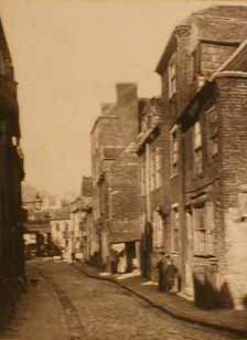
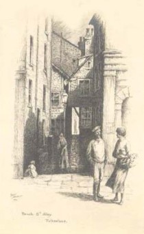
These very old pictures may or may not have been in the same general area. The drawing on the right says 'Beach St Alley', the other two were entitled 'Old Folkestone', although the one in the centre was dated 1896.
|
Here we have the Blackbull Public House in the 1930s, the house bottom left looks pretty old doesn't it, I am pretty sure it is now long gone - and so I believe is the pub!
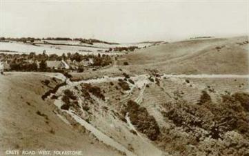
This card states that we are looking at Crete Road West in 1955, however Stan Cascino of Folkestone wrote to say that it is in fact the Canterbury Road before it drops dpwn to the junction with Crete road west and Alkham Valley Road. You can see the hill on the right that is in fact Crete road East. You are probably right Stan!
This is Wear Bay Road, not sure of the date though
|
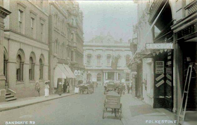
Back to the old, and it is Sandgate Road once again, and we see that Sainsbury's store was located on the right. I don't know what was in that building on the left, but it isn't there any more.
|
Same street, 1918
|
I don't have a date for the photo above, but note the carriages waiting for hire in front of the Harvey statue, an early taxi rank!
This one did have a date, it was 1904, and looks older doesn't it? The trees on the right are smaller, and the road doesn't look as well paved.
|
This page updated December 31, 2018
|
OK, mystery solved. Alan Taylor tells me that the houses on the left hand side of Morrison Road from Dover Road are called Warwick Terrace. I find it odd that this fact wouldn't be mentioned in any of the directories. I wonder if it was known as Warwick Terrace instead of Morrison Road at one time, because the listing I mentioned above of the Tontine Street victims said the woman had lived at 3 Warwick Terrace. Morrison Road wasn't mentioned.
Update: As you probably know, Rowlands has now closed, and I am happy to say, my prediction was wrong! However, its not the same without our favourite rock shop.
I recently received an e-mail from Robert Mycroft who lives in and did all the work on this house. This is how he explained to me that it all came about:
"Well I do have kids, but it was not done for the kids at first, it started with the wife asking me to paint the house, I asked the colour, she said blue, I replied what sort of blue, she said Blue's Clues blue, so I painted it and my youngest kept going on about Blue's Clues so I did it for a laugh.
The fence does have Teletubbies, and the Simpsons, did have Rug Rats, Pokémon and Disney people and animals. The neighbours pouch that my garden has Blue the dog now. I am planning Sponge Bob in 2009 for the side."
Thank you Robert, and thank you for being such a good sport, in letting me keep the photo on here.
In 1849 the Tontine Building Company raised 50,000 from 500 members to build a street in Folkestone. Members received an initial 5 per cent dividend while the last 20 surviving members each received a house.
This modern photo taken from Shaftesbury Avenue from about the same place as the one above makes me realise that the Ashley Mill was on the site of my old school, Harcourt School for Girls, or Pent Valley Technology College as it is now called. This school is just off Ashley Avenue, at the end of Postling Road. The shop is now a Chinese takeaway and the church has been demolished with houses now on the site.
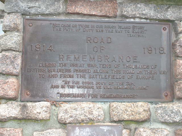
There is a lot of different shrubbery on both sides of the Road of Remembrance, so it's hard to say if the rosemary bushes are still there, I would have to get a lot closer to see (and smell)
2018 - Since I wrote the above, there has been a lot of work done to the shrubbery. It was spruced up for the 100th Anniversary of the beginning of WW1, and new Rosemary bushes were planted. Now, four years later, they have grown nicely, and the road looks lovely.
I do think this plaque should have read 'tens of thousands of British and Canadian soldiers', not just British, because the Canadians were stationed here in their thousands, and many of them lost their lives too.
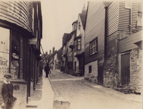
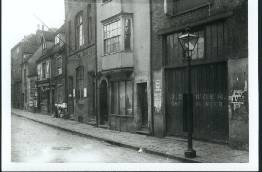
This was just called 'A Folkestone Street', which one? I am not sure, but you could buy tea and lamp oil in the corner shop, whose name was J. B. Something or other!
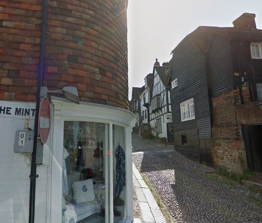
Hah!! No wonder I didn't recognise it. Just received an e-mail from John Gale, who tells me it isn't Folkestone at all, it is in fact Mermaid Street in Rye, Sussex. Taking a look on Google Streetview, it definitely is! Hasn't changed much over the years has it? How could the seller get it so wrong? Thank you John.
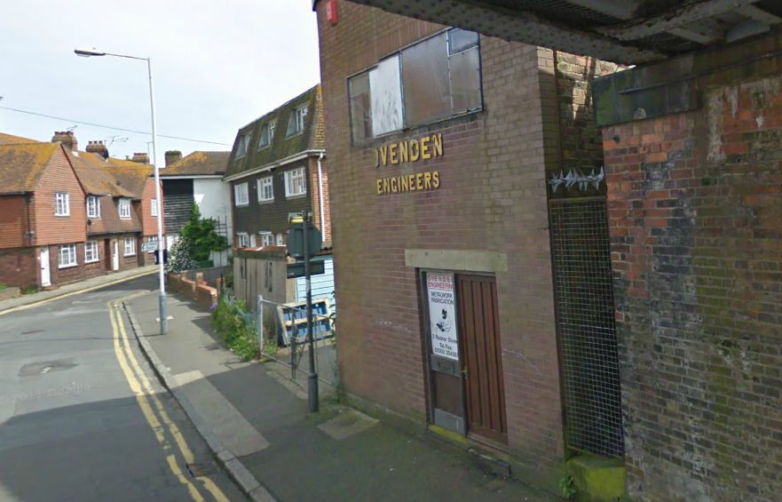
I obtained this photo from Alan Taylor to pass along to a lady by the name of Sue Cranmer, a relative of Granny Care. The shop you see in the distance was Granny Care's sweet shop located in Radnor Street at the foot of North Street. I received the following e-mail from Eileen Heron who remembered it well: "The photo is the bottom of North Street to the left is The Stade and to the right past OVENDENS is under the Arch to Tram Road. During the war and after the shop belonged to Bill Whittingstall and I used to buy an apple there, he sold sweets and most things--Ovendens was always very busy as it was a Blacksmiths but would be able to mend almost anything between the two I think was a Red Cross building--during the War the road North Street had a barrier across and we had to show a pass to be able to go into that area-looking back I wonder why a child needed a pass, my job was to take sandwiches etc to a sailor we had befriended who was a stoker in the Pavilion Hotel where navy personnel were billeted during the war."
Thanks Eileen, now here is how that area looks today. It's amazing that Ovenden's appears to be still in business.