

Folkestone is a wonderful place for the walking enthusiast, because all the most picturesque areas have plenty of walks and paths incorporated into them, which make taking your daily constitutional an absolute pleasure.
In the old days, people did a lot of walking because transportation wasn't easy to come by. Now, in the 2000's people are starting to realise they need to exercise more, and there is no better and cheaper way to do it than to walk.
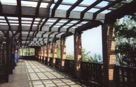
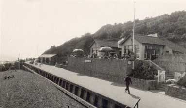
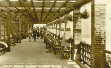
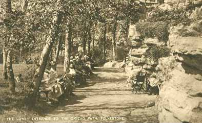
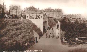
The place pictured above is just down the cliff a little from The Leas, and as you can see, it hasn't changed much over the years, except it isn't quite as welcoming nowadays as it was when it was first built. The photo on the left was entitled 'New Sheltered Walk', and as you can see, it was kitted out with chairs for the weary, and hanging baskets of flowers.
On the right, there is nothing except a few benches in the wall recesses where you can sit and watch the joggers go by. You also have a splendid view of the channel from there.
The man in the photo on the right is Rex, with whom I got chatting to here. He said he thought there was a connection with this place and grapes - that possibly they were grown here once. This was corroborated by another fellow who has been very helpful with information and photos for this site by the name of Trevor, who tells me he remembers old dead grape vines up the walls in here just after the war. I guess they had to come down when the riff raff were allowed up there to steal them!
Update: When I last visited Folkestone in 2006, I couldn't get to this shelter as the path was blocked off by a builder's van (I think it was Charlier's) It looked to me as if this shelter was being torn down. Can anyone please tell me if this is true, and what is there today?
|
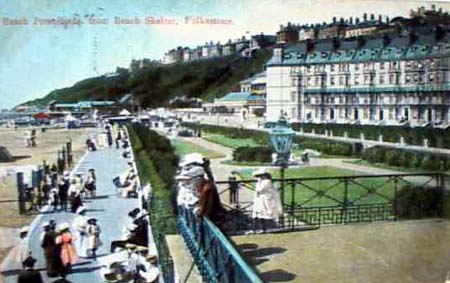
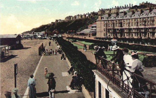
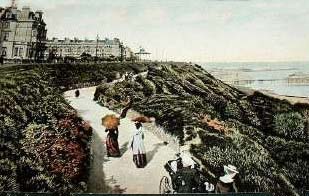
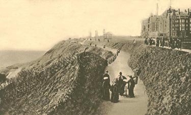
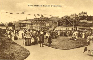
Oh doesn't this look nicer than it does today? If I am not mistaken, this would be the area where they used to hold the Sunday market. It was all soooo elegant back then wasn't it? Folkestone was at its height of popularity in Edwardian times, This area was known then as the West Promenade.
Over to the right, you can see Marine Crescent, and those buildings are still there. Right now, in 2007 they have been refurbished, and are up for sale as luxury condominiums. In the past, they have been hotels and guest houses, but for many years were allowed to run into disrepair.
|
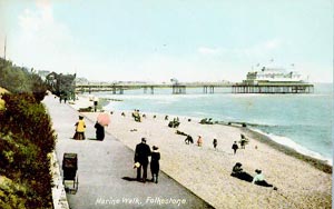
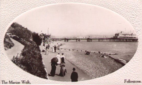
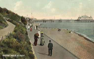
Marine Walk with Victoria pier in the background. Just look at those poor women walking along in the mid summer weather, wearing heavy skirts, jackets and hats.
You never saw a man in his shirtsleeves in those days either. We really have it easy today don't we? Except these days, we wouldn't dare leave the baby's pram unattended, because it wouldn't be there when we came off the beach!
|
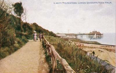
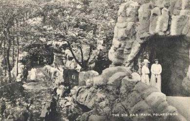
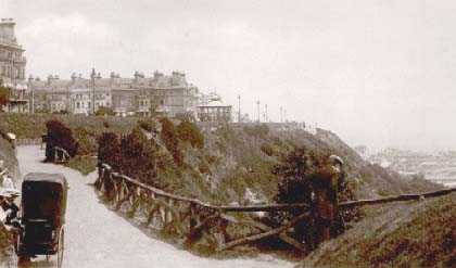
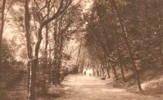
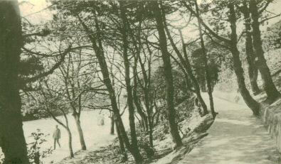
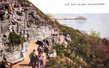
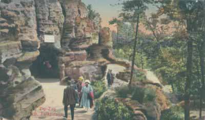
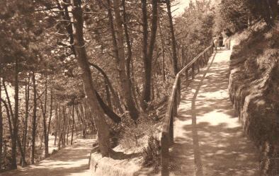
Yes, it is one of the most photographed walks in Folkestone, this is the only zig zag path that I remember, it runs from the Leas to the Lower Sandgate Road, but there is another one in the Warren.
When I was a child, I was fascinated by the braille signs they had on all the plants along the walk. What a lovely idea, I do hope they still have them.
|
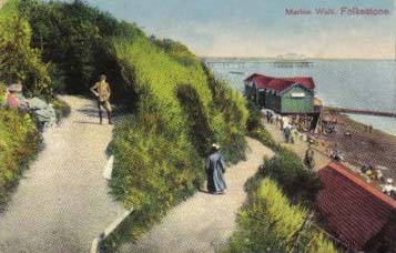
Above left, this area was referred to as the West Promenade. This one, which looks roughly the same era, was called the Lower Parade. Whatever it was called, it certainly looked lovely in those days didn't it?
|
Decided to scan this postcard intact - as it would lose too much if I tried to crop it into a rectangle.
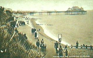
This is Marine Walk, with another view of The Victoria Pier. I bet the photographers were very sorry when it burned down, they seemed to take more pictures of it than anything else.
|
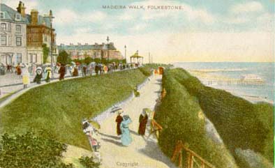
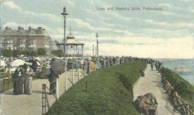
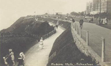
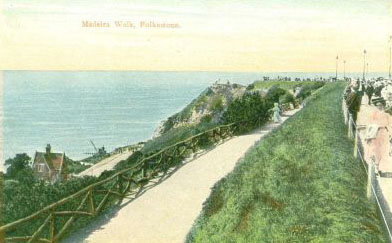
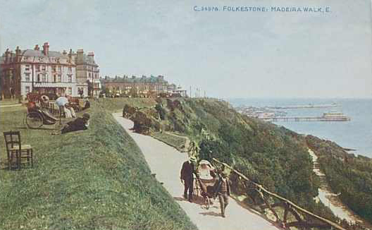
This is Madeira Walk, just down from the Leas. I could be wrong, but it think this walk runs into the covered walk shown at the top of the page.
This card was mailed in 1906.
|
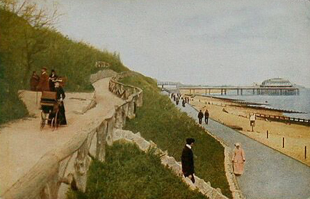
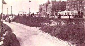
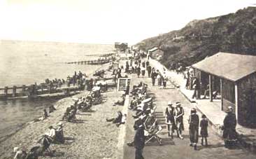
Marine and Lower Walks. Lovely going down, but pretty hard work coming back up!
|
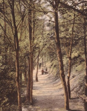
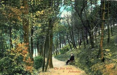
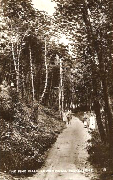
This is Pine Walk. I don't remember this at all, is it still there? I believe it was down the Lower Sandgate Road area, so it's probably long gone
|
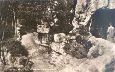
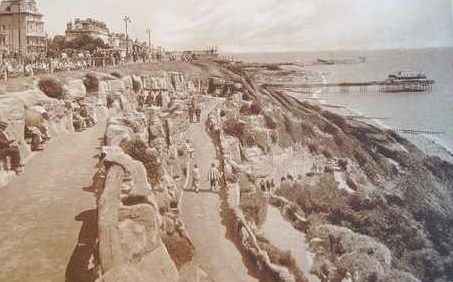
An extremely busy day on the Zigzag path. I don't think I ever saw that many people on it the whole time I was growing up!
I suppose you had to find something else to do before TV was invented!
|
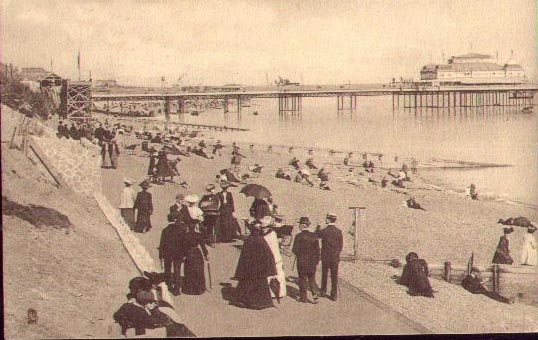
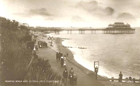
The Lower Promenade with the Victoria Pier in the background. I know I have harped on it before, but how on earth did those people stand the heat in those days?
Men in suits and women dressed in black from head to toe - and it was not considered tasteful to admit you were sweating!
|
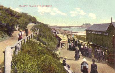
This card was entitled 'New Marine Walk', and at first I thought it might be referring to the path along which the lady is pushing her pram, especially as the one immediately above, which is showing the lower walk is entitled Lower Promenade. However, the photo further up the page with the abandoned pram only shows the lower path, and that too is entitled Marine Walk. So the upshot is - I'm confused!
|
Here we go again, same area, but the upper of the two walks featured. This 1914 card called it Lower Sandgate Road Walk.
|
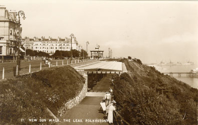
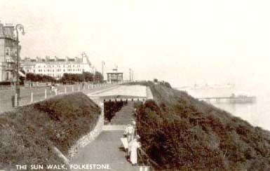
This one is entitled 'New Sun Walk, The Leas', but as it hasn't been postally used, we don't know exactly when it was new.
|
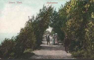
Here is one sent to me by David Santry, an ex-Folkestonian now also living in Canada.
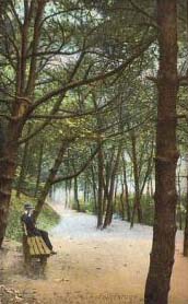
I It was entitled Lovers Walk, which looks suspiciously like Pine Walk to me. Maybe different generations called it different things. The generation that was around when this one was printed were living in 1909.
|
This one was dated 1915 and described as 'Madeira Walk, shewing the Metropole and Grand Hotel's.
Isn't that a lovely word - 'shewing'? How come we don't spell it like that any more?
|
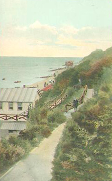
This used to be the Promenade Cafe, which was situated on the West Beach many moons ago.
Absolutely necessary - walking is thirsty work!
|
Now let's take a stroll with these ladies down the zig zag path. (Always much easier to go down than to come up!)
|
A 1908 photograph of Pine Walk - now this looks more like a lovers' walk doesn't it? :-)
|
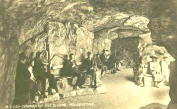
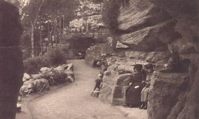
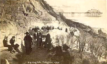
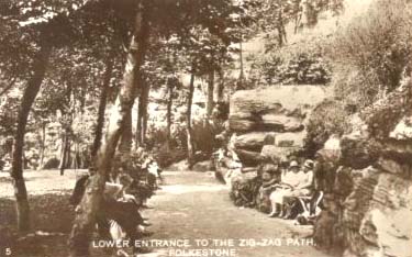
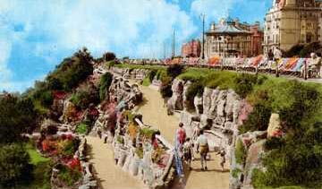
This was entitled 'A Cosy Corner of the Zig Zag' Looks more like a coven of witches to me, but there you go!
|
Oh yes, there is one in every crowd isn't there. You can see the sky is overcast, it's pouring with rain, the sea is coming up over the path in the foreground, and what is that man doing? Why he is getting ready to go fishing I believe!
What was it the song said about mad dogs & Englishmen - well they go out in the noon day rain too!
|
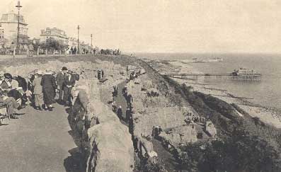
Now this is sad. This walk is no longer there because it fell into the sea - along with the beautiful rock garden.
Erosion is quite a problem up on the East Cliff, as it is on the cliffs all round the coast of England, and each year we lose a little bit more - sometimes along with a life or two.
|
A 1913 view of the Leas, showing Madeira Walk just below.
When I was a child, I remember my grandmother having parasols, but they were light in colour with silk tassels hanging from them, yet all the parasols I have seen in these old photos look more like our present day umbrellas.
|
Aha! Now this one is called Lovers Walk in 1912, and it looks quite close to the sea doesn't it? Yet I have never seen a view like that in any of the Pine Walk photos, so maybe they were two different paths after all. I will have to check with the Folkestone Local History Society.
|
This is the bottom end of the Zig Zag path which had the Lower Sandgate Road nearby.
|
Here is the same place a few years later
|
Would you believe that this 1905 photo was entitled 'Lower Road, Folkestone'
Lower Road? That was a road? The biggest vehicle you could possibly get on it would have been a bicycle, and who on earth would want to ride from the bottom up? That woman looks as if she is having enough of a struggle walking it!
|
OK, now this might answer the question. I feel this is probably the same path, further down, and this time it is entitled "Lower Sandgate Road Walk' So maybe it ran alongside the Lower Sandgate Road. This photo was taken in 1910.
|
Madeira Walk in 1907, only one lady is not walking, she is riding in style in a pretty fancy bath chair or carriage.
|
Madeira Walk again, but looking in the other direction this time. The timeline for this one is 1921.
|
Same walk again, pre 1915 this time, and again, a lady is being transported in a bath chair with two gentlemen in attendance, the lucky woman!
|
1917
|
1909
|
1908
|
1923
|
1920's
|
1916
|
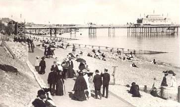
It certainly was a popular place to photograph wasn't it? This one was taken in 1922.
|
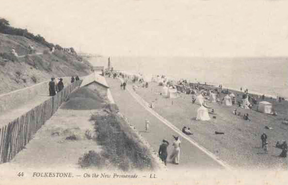
OK, so was this East or West of the pier? I am not sure if that is the pier or the harbour in the background. It says it was the New Promenade, and was used in 1911.
Note the tents on the beach used for changing purposes. You paid a daily or a weekly fee to have that privilege.
Look, the picture shows three walks, or was the upper one part of the lower one which came down in a zig zag fashion?
|
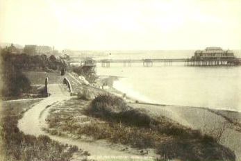
Look at the little footbridge! It seems to me that this bridge, or one very similar to it is still there. I will check it out when I go over next.
|
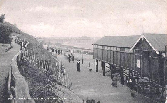
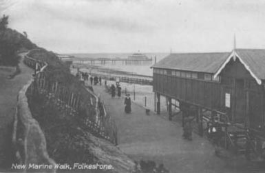
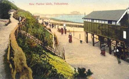
This one says 'New Marine Walk' and it was postally used in 1913, so you know it was built
sometime prior to that date. Look at that well behaved dog, no leash and not fouling the beach!
I think the building was a bathing station for changing purposes.
|
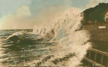
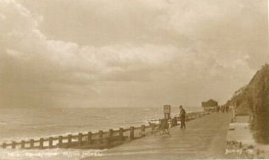
The year was 1957, but there is nothing unusual about the sea behaving like this! It could have been any year! Getting a soaking is the west Marine promenade and the Tea Rooms.
|
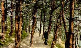
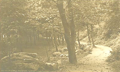
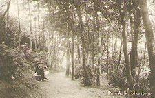
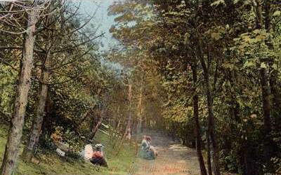
Now to a few more photos of Pine Walk, which started parallel with the Lower Sandgate Road, and may or may not have been later transformed into the Zig Zag path. If you know, please drop me a line..
|
1908
|
1910
|
1907
|
1916
|
No this one isn't Pine Walk is it? It is Sun Walk, just below the Leas.
|
60's
|
1930's
|
Whew! I am exhausted from all this walking up and down the cliffs, aren't you? Time to take a rest methinks!
|

Home
|
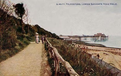
This clear photo of New Marine Walk was sent to me by Richard Westland. Thanks very much Richard!
|
Don't forget - if any photos remain blank after the page has loaded, right click your mouse into the space, and click 'Show Picture'
|
Page updated August 13, 2007
|
I suspect it might have been a forerunner of the Zig Zag path.
|
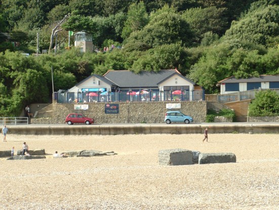
This was taken recently by Jean Adams. The Promenade Cafe is now the Mermaid Restaurant, and is still going strong! Thanks for the photo Jean.
|
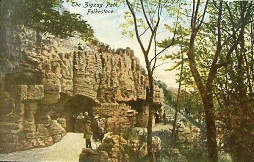
Now we get to the path that most people in Folkestone think of when you mention walking
|
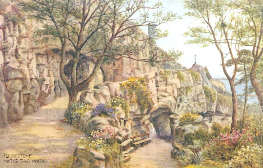
The Zig Zag Path
|
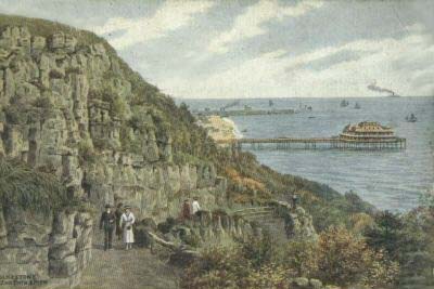
Did you know that the rocks that make up the Zig Zag path were totally man-made? They were constructed by James Pulham & Son in 1928. If you would like to know more about this company, you will find a link to a website all about it on my links page
|
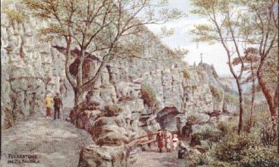
A lot of the older postcards were artist drawn, and you can see a couple of them above. The one on the right dates from 1928, so much have been done right after it opened.
|
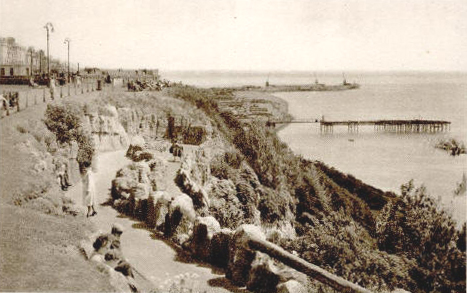
You have just seen several with the Victoria Pier in the background. Now on the right you can see they were still making postcards of the Zig Zag path, showing what was left after the pier burned down.
|
Madeira Walk again, and you can see the Metropole & Grand Hotels. Also the bandstand that used to be in front.
|
The above two are also Madeira Walk. The one showing the shelter on the left dates from 1937. On the right it goes right back to the early 1900's. Just think, that baby in the pram has probably died of old age by now!
|
In this one of Madeira Walk, you can see the Tollgate house on the Lower Sandgate Road below.
|
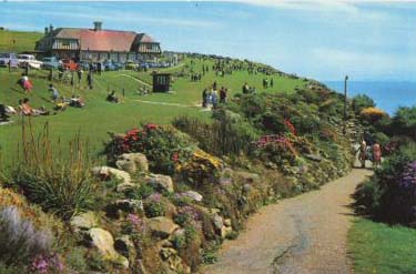
I did check it out in 2006, and it seems to me that it has been incorporated into the new Lower Leas Coastal Park (see the Parks & Gardens page).
|
I believe those people are walking on the Lower Sandgate Road
|
Isn't the colour in this one amazing for 1916?
|
If you have your own memories of Folkestone please be sure to share them with us by jotting them down in the guestbook below
|