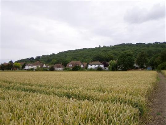
Hythe is a Cinque port just west of Folkestone, and I had to include some photos of it because I lived there for a while too. We were the first owners of 14 Romney Way, Pennypot Estate, it was our first owned home, and I was very surprised to see that the garage out back is still standing 50 plus years later. It was the first thing my ex-husband had ever built in his life!


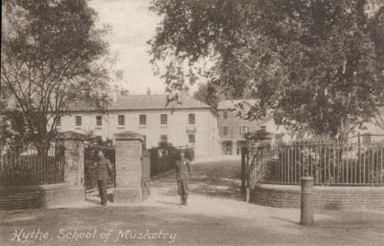
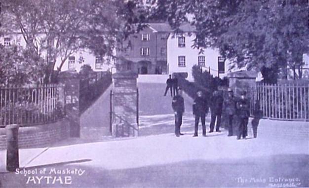
I mentioned the School of Musketry further up, and here it is on Military Road. A very ancient establishment. It later became the Small Arms School, but is no longer there.
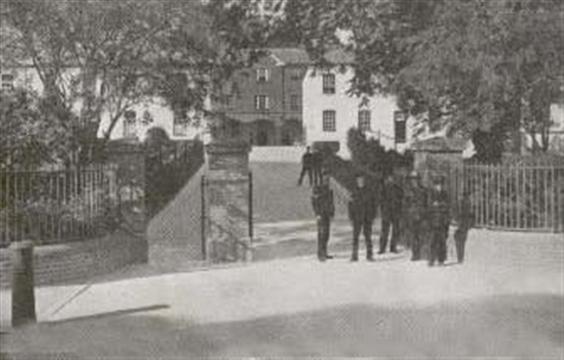
The School of Musketry again in 1912
|
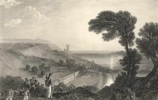
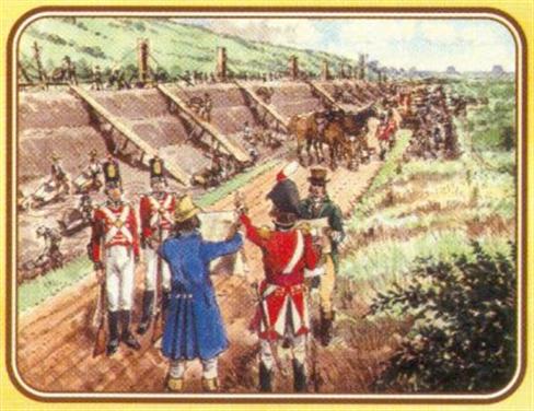
Here is an engraving of Hythe by the wonderful artist J.M.W. Turner. He has also featured some men from the School of Musketry.
(I have a Turner print of Folkestone from The Sea over my fireplace, I love his work! That one depicts one of Folkestone's oldest professions - smuggling, which is probably what these soldiers were watching out for too.)
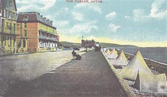
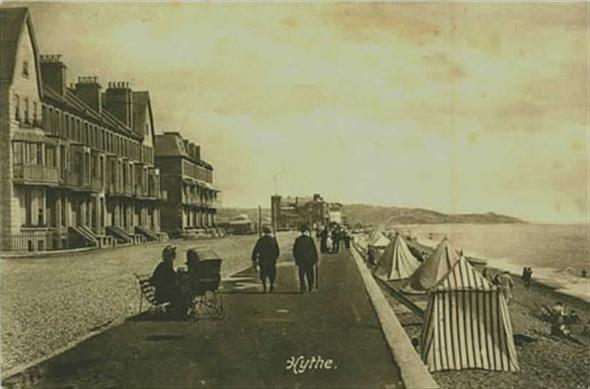
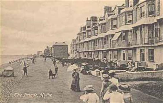
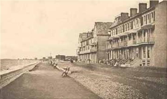
This is The Parade, Hythe with more tents pitched on the beach. I believe you could pay for these by the day or by the week. I don't think you could just go down there and pitch your own tent without some kind of charge.
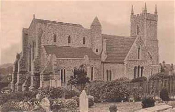
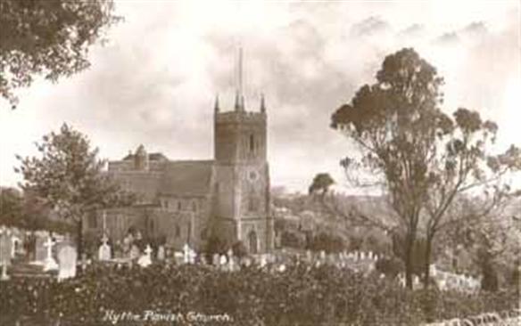
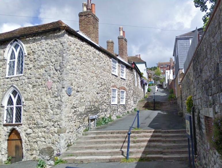
This is St. Leonard's Church again. Home of the skull filled crypt
I enlarged the photo, and even looked at it through a magnifying glass, but still couldn't read that tombstone!
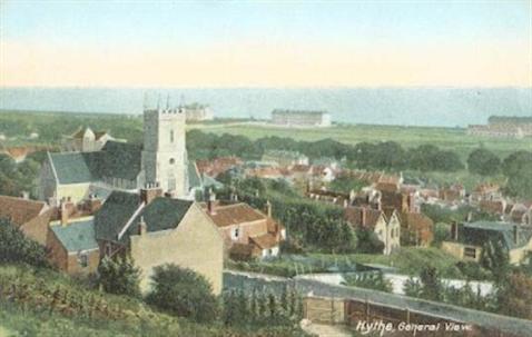
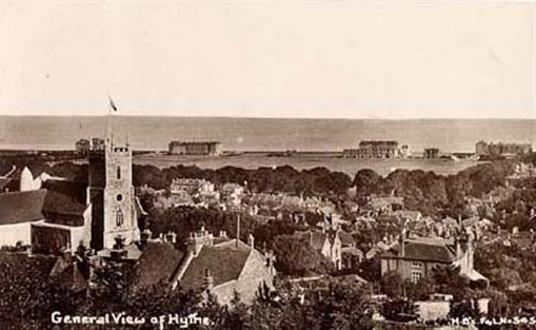
2 General views but no date for either. You can see the subtle differences in the two photos.
|
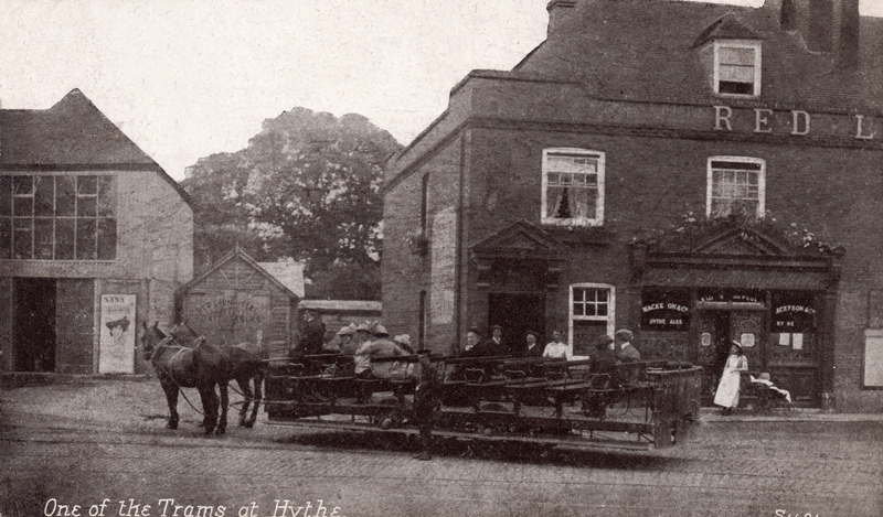
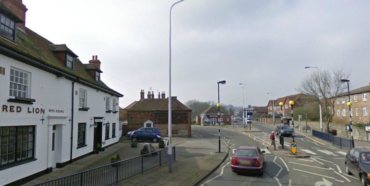
I don't know exactly how old the Red Lion is, but as you can see, it has been around for a good many years. This 1920 photo was entitled 'One of the Trams at Hythe'.
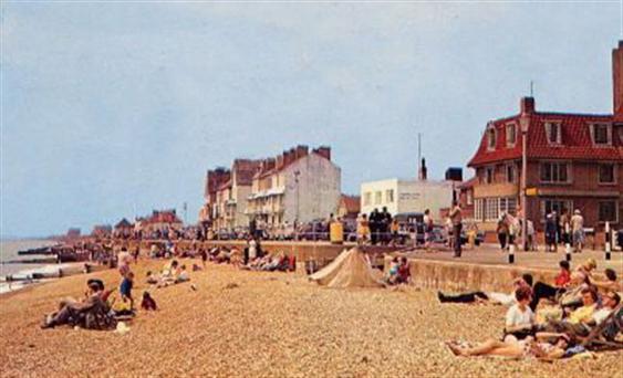
Same beach looking in the opposite direction - but this time we are in 1965.
|
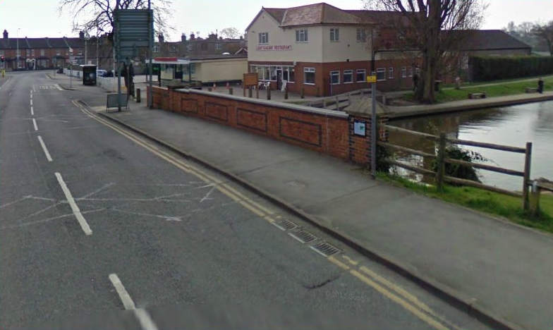
ROYAL MILITARY CANAL
The Royal Military Canal was built between 1804 and 1807.
It was constructed as a defence against Napoleon when it was feared that an invasion by the Imperial Army was imminent.
The Canal was designed as a series of measured staggers at 800 feet apart (within cannon range) to defend each section.
Hitler, too, had to take account of this formidable obstacle in planning his invasion of Britain.
The Canal runs from Seabrook in Kent to Pett Level in East Sussex.
This statement taken from Frontline Hythe http://www.hythe-kent.com/heritage/index.htm
This picture is copyright © 2000 Hythe Town Council
If you would like to read more about the building of the canal, check Royal Military Canal.

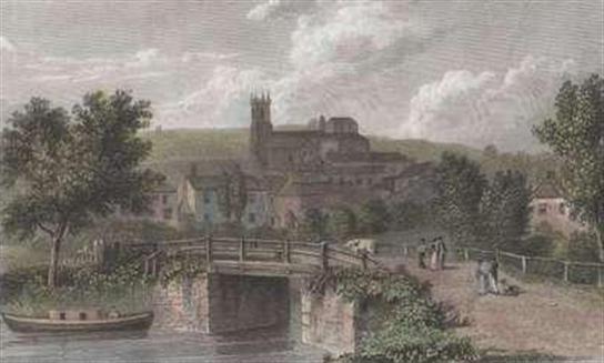
Here we have a very old engraving of Hythe. I have no idea of the date, or of the accuracy of the picture depicted.
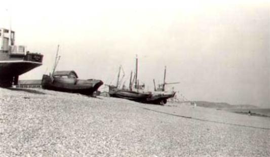
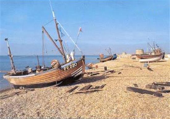
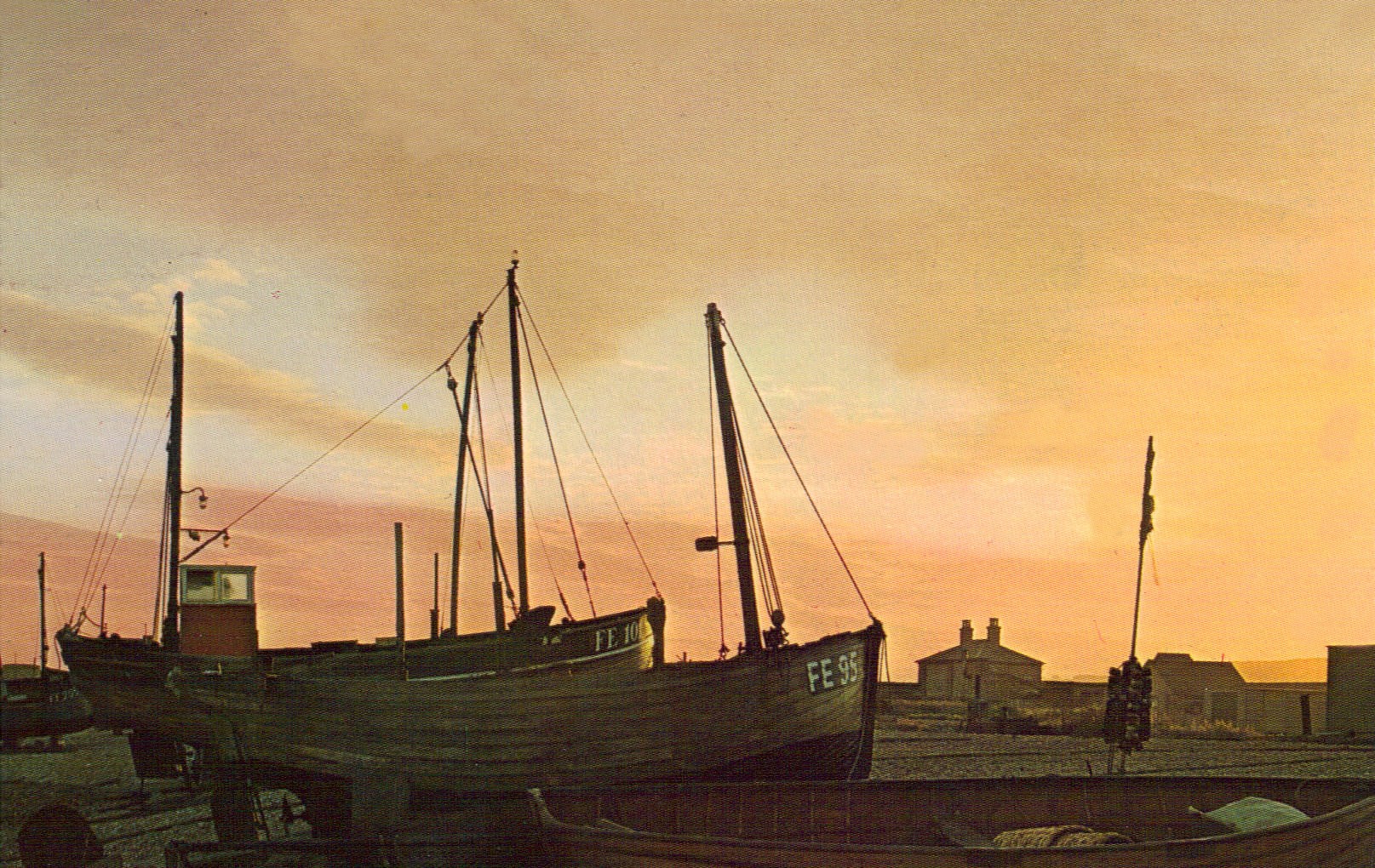
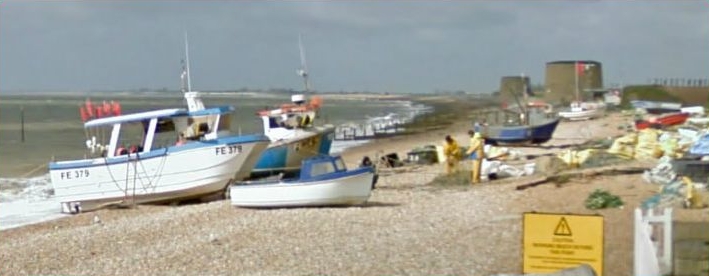
To show you that Folkestone hasn't always had a monopoly on the South-East coast fishing industry. Here are some boats waiting to go out from Hythe.
|
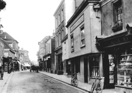
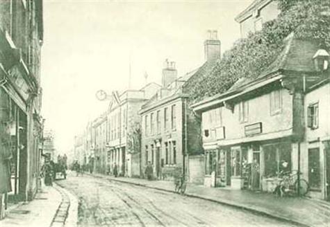
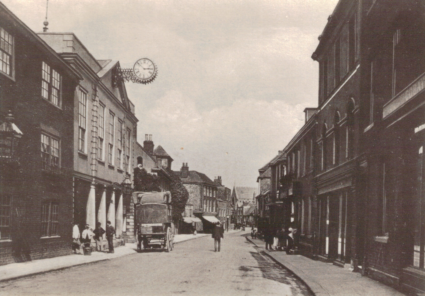
This 1890 picture is of the same street, but a different part, they sure didn't need any double yellow lines in those days did they?
Tony Reeve writes to say that in the 50's and he believes into the 60's, parking in the High Street was limited to one side of the road on even numbered days - and the other side on odd numbered days. Which was probably fine unless you were retired from work, when you tend to lose track of which year it is, never mind the date!
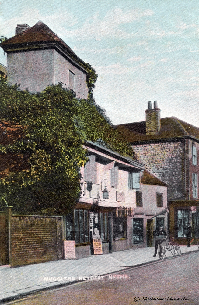
Another pretty old picture showing the Guildhall, and on the immediate right is the Smuggler's Retreat.
|
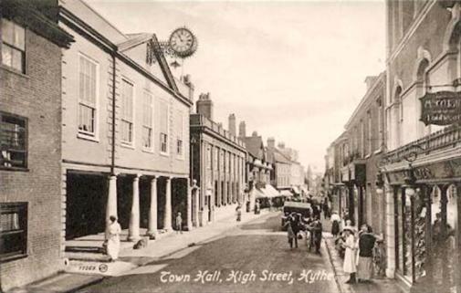
Here is another one of the High Street in the 1900's showing the Town Hall. Isn't it amazing that this building has now been there for over 200 years? Or has it been rebuilt at some point? It has looked exactly the same in every photo I have seen of it.
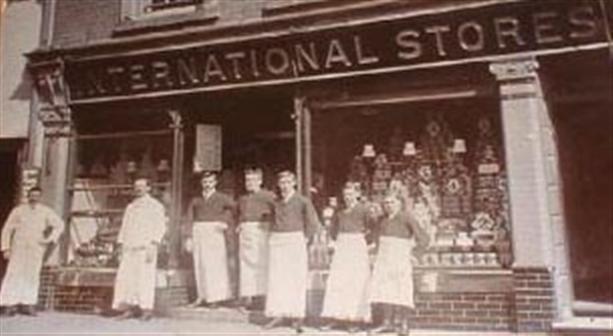
Before we leave the shopping area, here are the employees of the Hythe branch of the International Stores. I believe their trademark at the time was that all employees wore a long white apron which was frayed at the bottom. Not certain of their address, but I do know they were located at 43 High Street in the 50's and 60's. Would this be that address? You can find a potted history of this company on page 2.
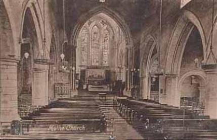
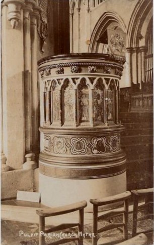
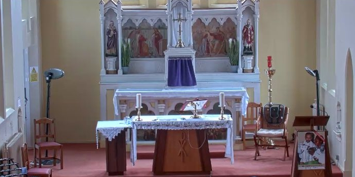
A few old photos from the interior of St. Leonard's Church, including the font and pulpit.
|
The military have always had a presence in Hythe. Even now, they use the ranges in West Hythe for military exercises.
In 1853 the School of Musketry was formed, shown here in 1910. It later became the Small Arms School, which finally closed down in 1968.
The street names in Hythe still reflect the military past. The street pictured here is Military Road, and around the corner is Barrack Hill, where the barracks were located.
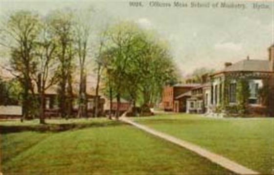
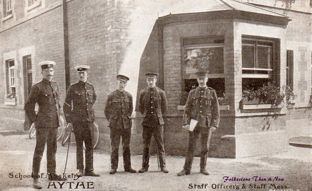
This was the officers' mess, photo taken sometime between 1910 and 1920.
|
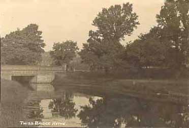
Here we have the Twiss Bridge. Do you know why Twiss is such a prominent name in Hythe? It probably arose from the fact there used to be a Fort Twiss, which was named for Brigadier-General Twiss, who was a key player in getting the Martello Towers built all along the south-east coast.
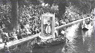
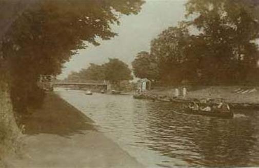
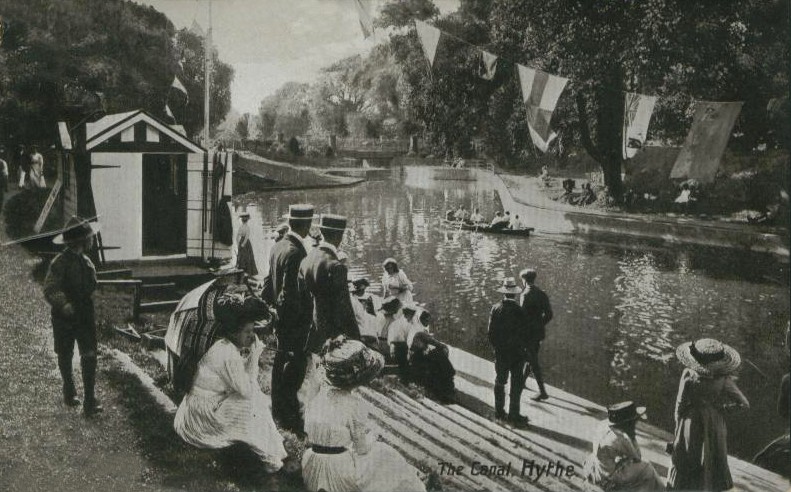
Ooh look at this one! A much older photograph of the Venetian Fete. I wonder who the woman in the box was supposed to be? Just look at the crowds and crowds of people lining the canal bank.
|
And to prove Alan's point, here is a photo showing the memorial and bandstand. This one was taken in 1929.
If you have your own memories of Hythe, please be sure to share them with us by leaving a message in the guestbook below

Home
|
It's time we had some photographs that fit into the 'Now' category.
George Hills lives in West Hythe, and frequently sends me photos of things he comes across while walking his dog.
|
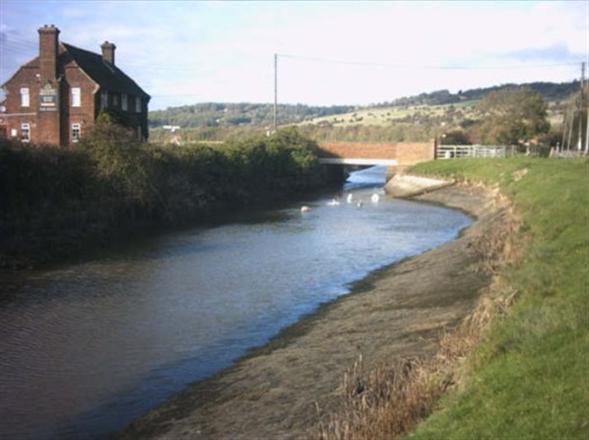
The canal and the Botolph's Bridge Inn. The swans gather there in the winter time (More about Botolph's Bridge later)
Listening dish on the 'Roughs'
|
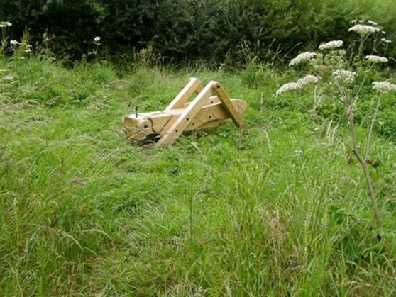
Wooden carving of a cricket that George came across while walking along the canal bank. He said there are a few different ones along there. The question is, how long will they stay there? I am sure someone will come along who will decide it would look good in their own garden!
West Hythe the way it looks now.
|
Sailing boats on the lake at Palmarsh
|
Thank you George, these photos are really lovely!
|
And here are those fishermen who sailed those boats in 1921
|
Alan confirmed that the Bridge and Road are indeed named after this gentleman. Now I have to ask, is Peter Twiss mentioned in connection with the Venetian Fete further down by Tony a relative of Brigadier-General Twiss?
This page updated May 7, 2022
|
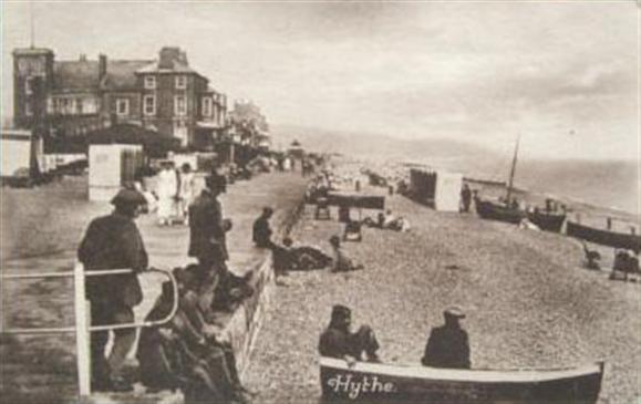
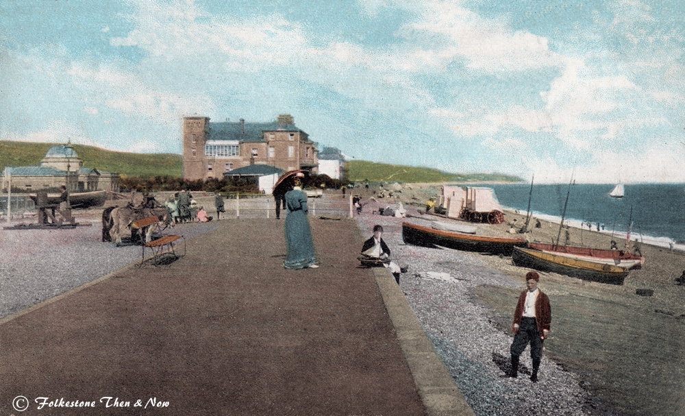
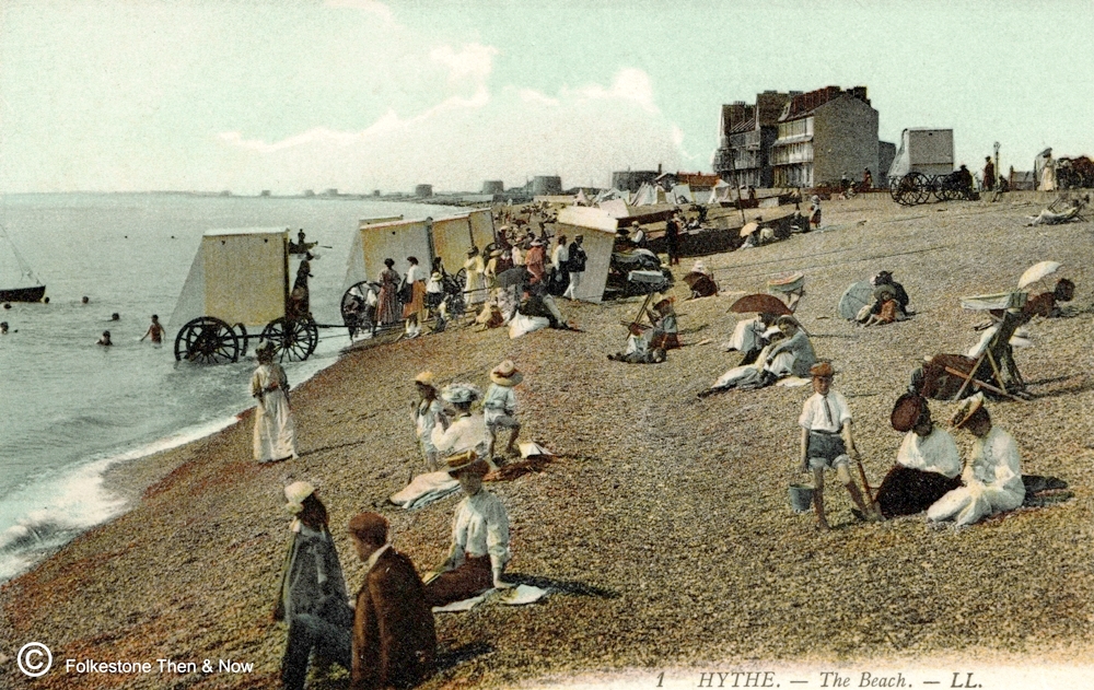
This one shows the seafront, with changing tents. Very sensible inventions in my opinion! Sure beats having to wear your swimsuit underneath your clothes. Or even worse - having to do a Mr. Bean when you get there, and try to change without anyone seeing anything!
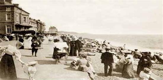
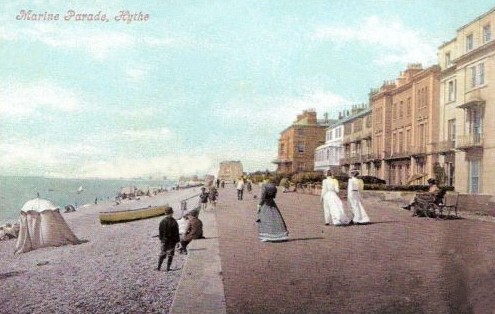
Marine Parade in Hythe. Look at that woman sitting on the beach - she looks more suitably attired for a funeral than sun bathing!
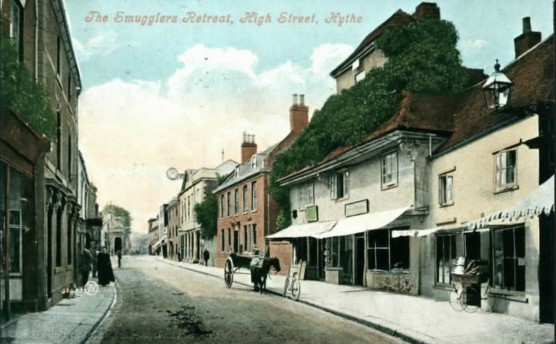
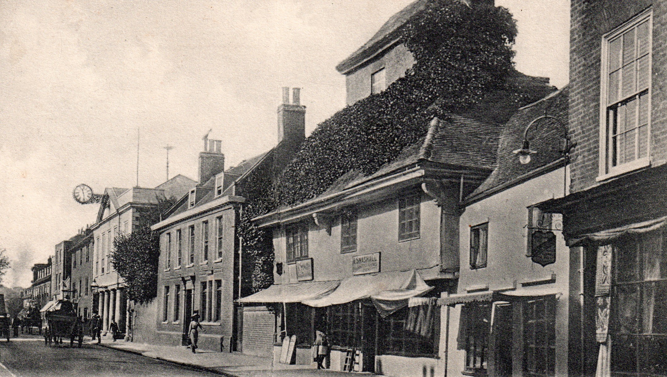
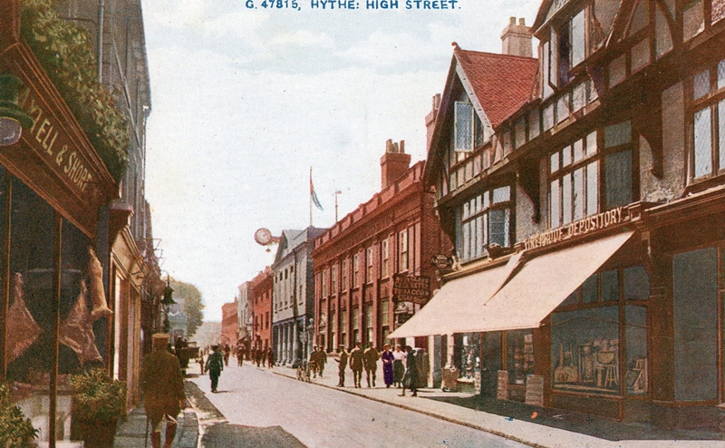
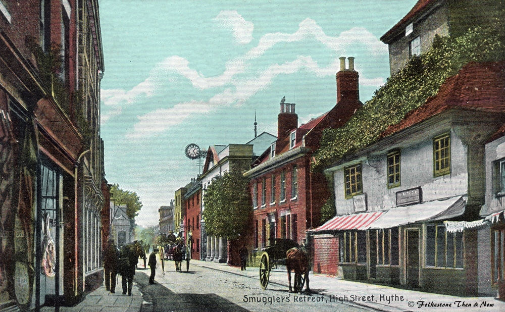
Here we have Hythe High Street in 1904, the building with the ivy all over the roof is the Smuggler's Retreat public house. However, it looks here as if it is two businesses. The sign over the one on the right looks like L. Snashall or something, but that is all I can make out. On the left, it looks like menu boards outside, so maybe that side was still a pub.
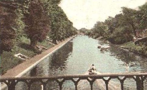
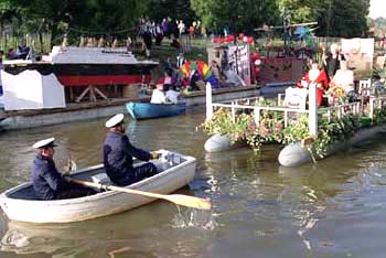
Now this is where I used to go fishing. The Hythe Canal. I remember watching the lovely Hythe Venetian Fete here too. Like a parade on water! They still have it too, every two years!
Princes Parade, Hythe. Not a terribly old picture, judging by the length of that woman's dress. Of course, to me the 50's is not terribly old! :-)
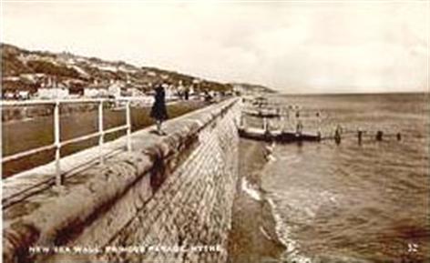
It's hard to believe that sometimes the sea is so rough that it comes up and over that wall, leaving shingle all over the road! However, I understand it has now been made higher. I saw this card for sale on the internet, and it was described as 'Sea Wall & ?Jumper!" I do hope she didn't, with the tide that far out, all she would have achieved is a broken leg!!
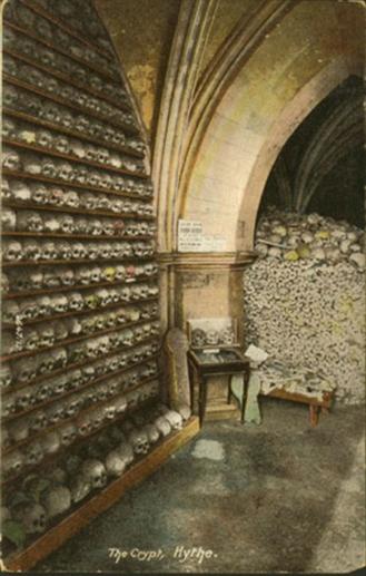
I visited St. Leonard's Church in Hythe where this macabre sight is still open to the public. This picture doesn't show all of the skulls by any means, there are three more displays just like it. The pile of bones at the back stretches almost the length of the crypt, although they have been rearranged since this picture was taken by scientists who did lots of tests to try to discover the origin of these people.
There have been many theories over the years. It was once thought there might have been a plague which caused so many deaths, but it was ruled out, because there are too many bones for the size of Hythe at that time.
It was then considered that they might have been the result of a battle. But as the collection includes many women and children, that idea was ruled out.
They then came to the conclusion that it is nothing more sinister than the fact that the graveyard ran out of room, so they removed the larger bones to allow further burials. The pile has only the bones from legs and arms, with a few skulls visible in this photo for effect.
It is a very interesting place to go, if you are up to the steep uphill climb to get there!
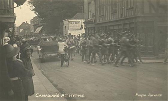
The Canadians at Hythe. During the first world war, I would guess from the mode of dress.
(Lots of Canadians were stationed at Shorncliffe Camp nearby during both world wars.)
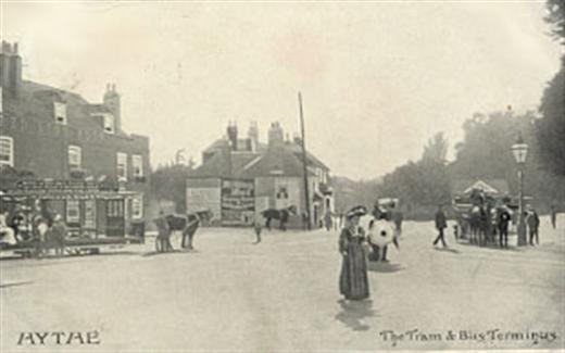
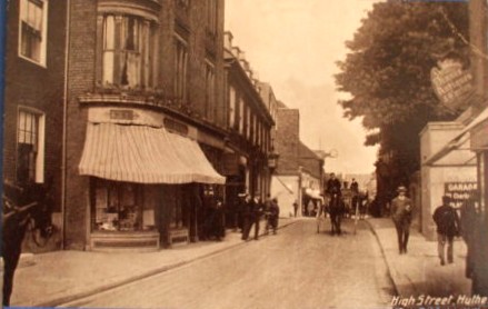
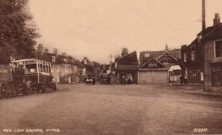
This card says 'The Tram & Bus Terminus' Wasn't there a lot of road space in those days? All the roads in Hythe seem so narrow now. However, I think the roads are the same size, it's just the traffic that is different.
Same place, different era. Now it is known as Red Lion Square after the pub on the left that is in both photos. We can see exactly why the road looks so much more narrow these days, that's because it is! Not just because of the pavements, but because of all the road markings and keep left islands Even the Sandgate toastrack would have trouble getting through these days!
This is what Alan Taylor told me about this pub:
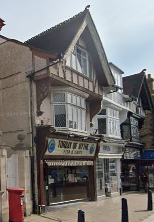
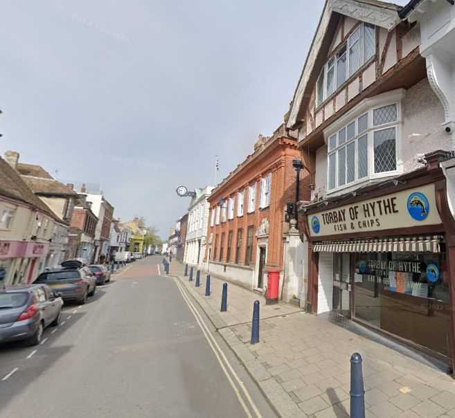
"The tower on the roof of the Smuggler's Retreat was reputedly used to house a lantern to signal to smugglers at sea; Hythe was heavily involved in the smuggling trade in the 18th century. The building was demolished in 1908 and three mock Tudor shops were built on the site, and remain in situ.
Here they are on the right, still looking very nice in 2001, housing Torbay of Hythe Fish & Chips, Ideas Greeting Cards & Confectionery and A. Simmonds, Jewellers

Not much has changed in this section of the High Street has it?
Here is Hythe High Street once again, but this time the timeframe is 1955 I thought they had moved on from sepia cards by then, but obviously not.
Same part of the High Street in the 1900's. The building with the clock has remained exactly the same. It is the Town Hall, formerly the Guildhall, which was built on the site of the covered market place in Hythe High Street in 1794.
Previous meetings had been held in the parvise of the Church of St Leonard's. Meetings of Mayors and Town Councillors (called Jurats) may have been held in the ancient 'Wealden House' almost opposite the Town Hall.
These buildings look so derelict, it's amazing that they stayed up as long as they did. Now is that a pram emerging from the shop next to the Smuggler's Retreat? Looking at the rims on those wheels, and the shallow body, I wouldn't be surprised if the poor baby wasn't bumped right out onto the pavement at regular intervals!
A lot of soldiers in Hythe High Street in this one. It was dated 1912. They were possibly from the School of Musketry or Shorncliffe Camp. The Smugglers Retreat had already been pulled down.

I stand to be corrected on this, but if the School of Musketry was where I think it was, the houses on the right have been built on that site in Military Road.
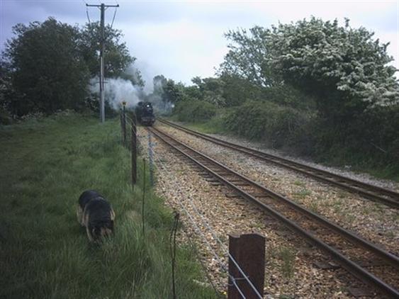
Here comes the little train! I have gathered quite a few cards of the engines of the Romney Hythe & Dymchurch Light Railway, and have decided to give them a page of their own. However, I will leave this one here.
Here is an aerial shot of Hythe, sent to me by Dave. The white building you can see is what used to be the School of Musketry. It then became the Small Arms School, but has now been demolished, as have the barracks on the hill.
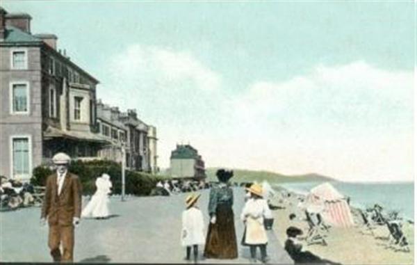
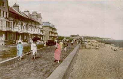
This is the beach and promenade at Hythe. Two clues that this one is a little later than the two above. First of all nobody is wearing black, and secondly you can actually see a little bit of leg on those ladies! :-)
A very busy Hythe Beach in 1910. I thought at first that the child in the foreground was being hauled back with a pair of reins - something you don't see these days, but on second glance, I think mother is hanging onto the little girl's dress. Notice that the child's hat is bigger than her mother's!
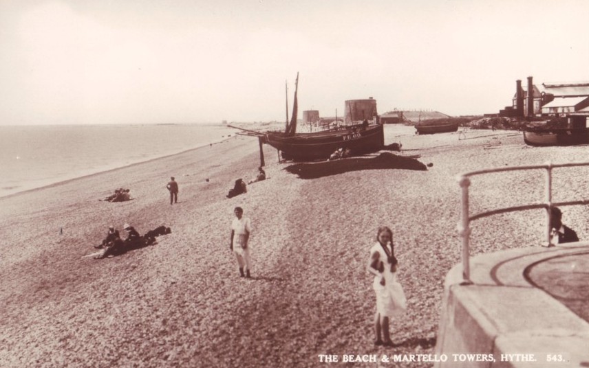
A more modern photo of the beach at Hythe, and look - you can see two Martello Towers.

I love this one, it dates from 1910, and shows the bathing machines which allowed the ladies to step into the sea without being ogled too much by the men, although the man in the foreground looks as if his eyes are firmly fixed on them to catch a glimpse of a sexy ankle or two! Shame on him, with his wife sitting right there and all! :-)
I wonder how they wheeled them down the beach? Did they use horses or manpower? It must have been no easy task because that is shingle, which the tide always leaves in big ridges.
Now when I put this one alongside the one on the left, I noticed there is something very strange about it, posted in 1907, at first I thought it was completely different, but then I started noticing a few things that are exactly the same in each picture, like the two women sitting on the right, the deckchair and a few of the figures and umbrellas behind that. Some of the figures and objects have been put in or taken out, but basically I think it is the same photograph. How amazing, and they didn't even have Photoshop in those days! Maybe they just took it the same day, and that is why things have moved around.
This one is considerably later because that woman has legs! You can see some Martello Towers in this one, but not as many as you can see in the photos directly above.

At first I wasn't sure if this was the Hythe in Kent, as I didn't recognise the shelter in the distance, so didn't add it to the page. However, I have since bought the card directly below, so feel more confident that it is indeed Hythe, Kent. This one is dated 1906.
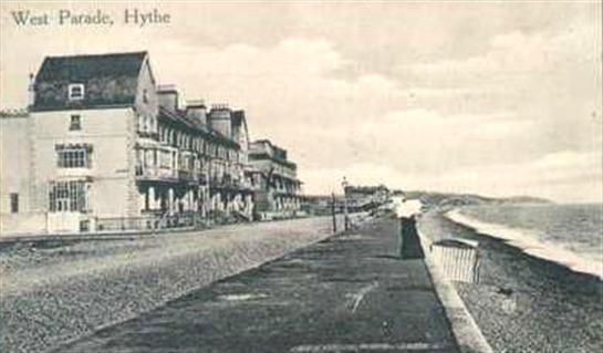
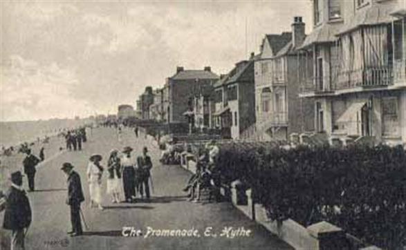
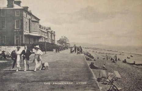
So now we know that the walk above was Marine Parade
Now was The Promenade another name for Marine Parade? Or West Parade? Because I can't find it on the map these days. I would guess the one on the right to be late 20's or early 30's The one on the left could be a little later.

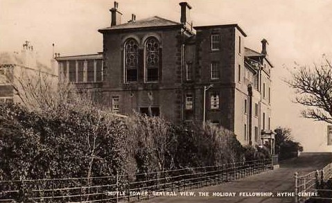
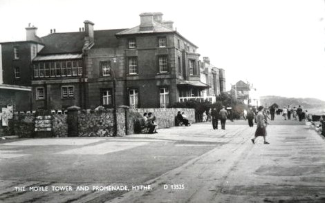
Towards the end of Marine Parade, or The Parade as it was sometimes referred to was a building called Moyle Tower. I admit I knew nothing of the history of this building, but luckily I have friends who do. Alan Taylor told me that it was built in 1877-8 for use as a hotel. However, it was left as an unfinished shell for a number of years. The Holiday Fellowship moved into the premises in 1923. The Fellowship ran about forty such Christian Holiday Centres throughout Britain.
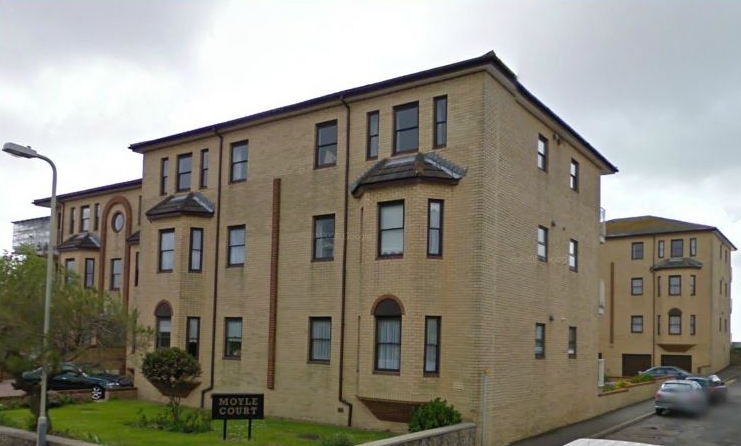
Klaus of Germany knew all about it as a youth centre, because he had been a guest there in 1967/8. The beach in front of it was known as Moyle Tower Beach. On the right is Moyle Court, which is on the site today.
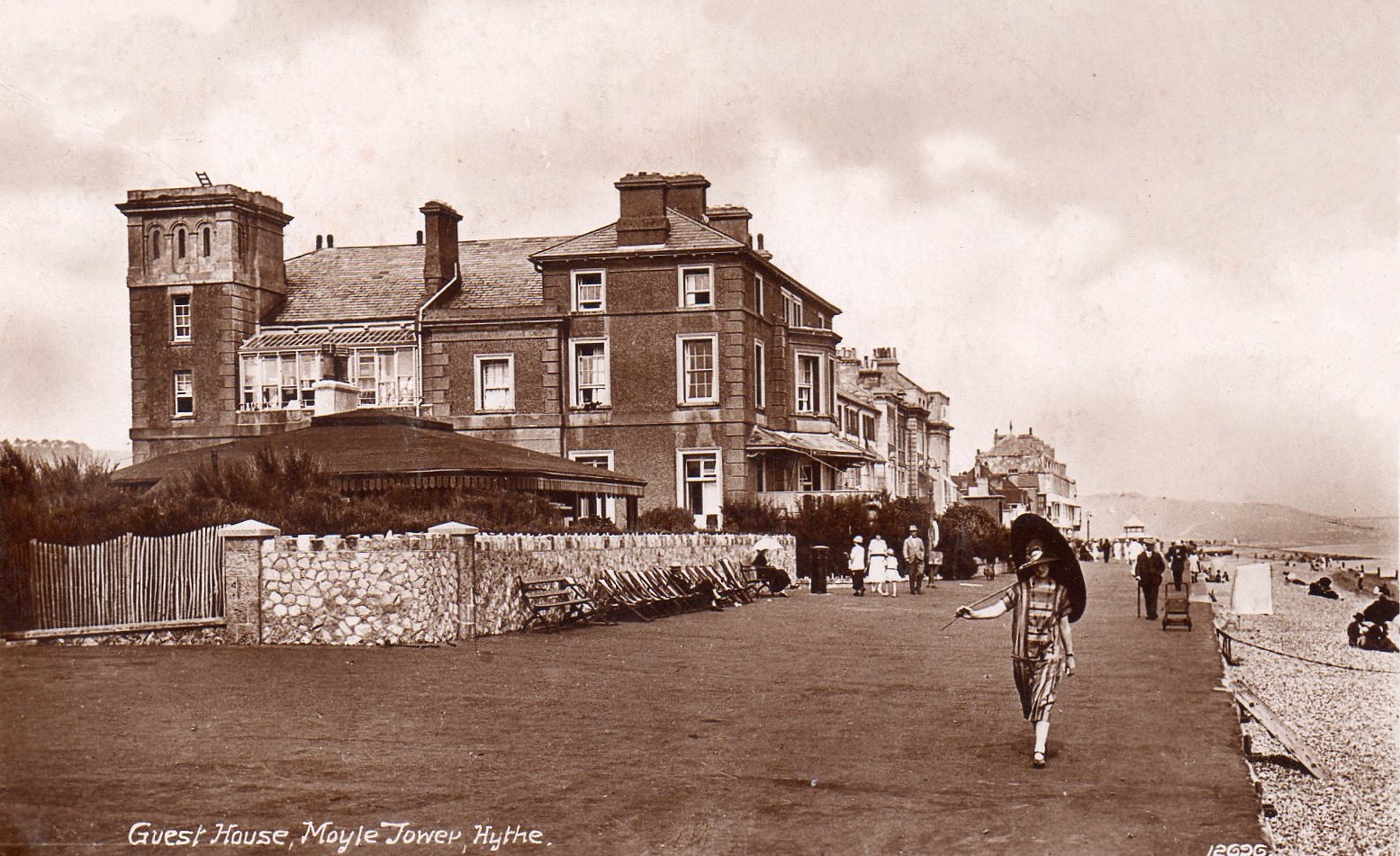
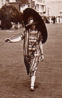
I loved the way this woman was dressed so much in this one that I had to bring her up bigger to show you!
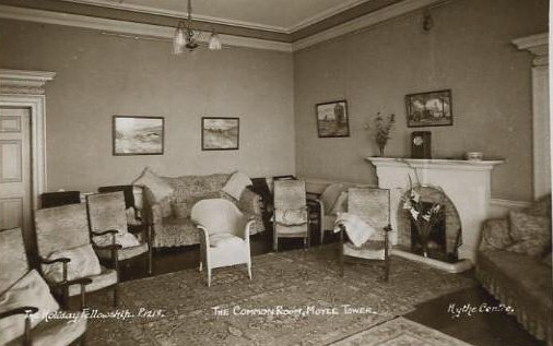
I am not sure of the date of this photo, but some may recognise it as the common room at Moyle Tower.
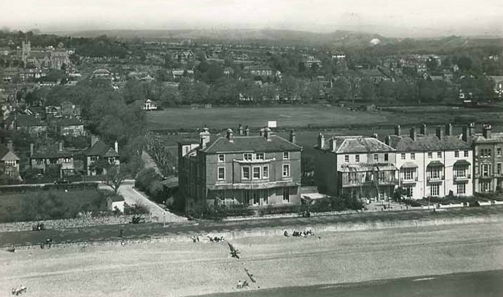
An aerial shot showing you exactly where Moyle Tower was located, what a great place for a holiday, right on the beach. I am sure the people who live in Moyle Court today appreciate their location also.
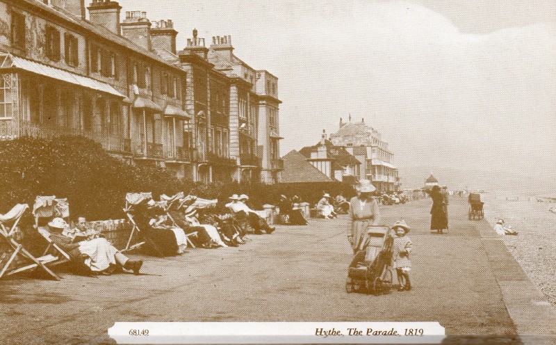
I bought this as a reprint of an old card, and I think somebody goofed. I am pretty sure it would have been 1919 not 1819, they didn't have cameras in 1819.
This is a very modern view taken from approximately the same place as the one on the left. The Martello towers are the only things that remain exactly the same.

Here are some of the holidaymakers from the Holiday Fellowship Centre in 1928.
Fishermans Beach
Fishing boats in 1969
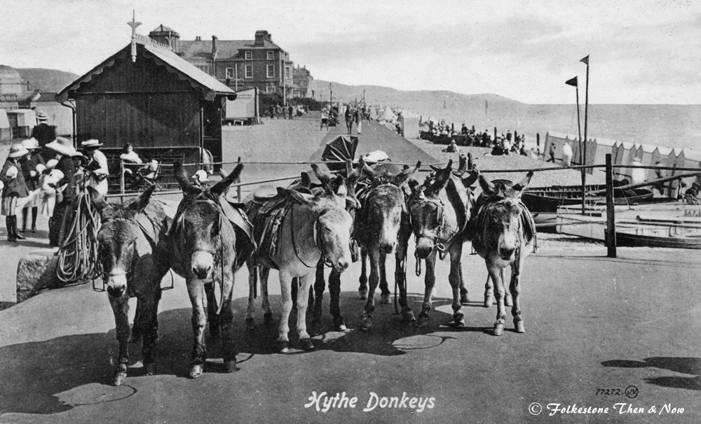
Here is a closer view of those donkeys on the left, this card was dated 1914, and was sent to Dear Old Nance Embling in Mattawa, Ont. Canada.
Back to the Promenade in 1923
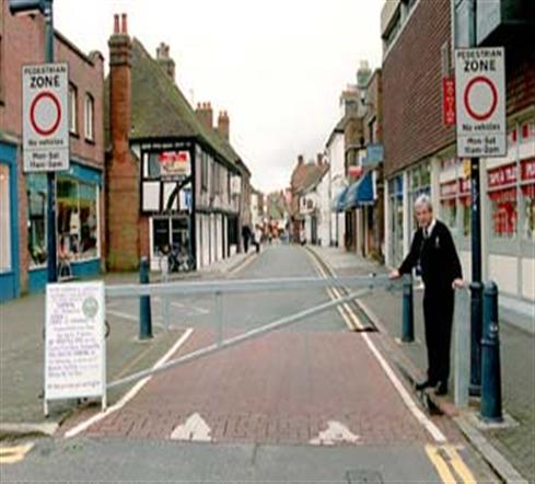
Not the same portion of the street, a more modern picture of the corner of the High Street and Douglas Avenue where the pedestrian area begins.
Good grief! Is that Ken Barlow waiting to cross?
To be noted on this one is an antique shop and garage on the right. So despite the obvious horse and cart, I suspect they had a few motor cars too.

The sign above the shop on the extreme left looks like 'Oceanic', and has a ladies' boot alongside, so possibly it is a shoe shop. Next door, or next door but one, it is called 'Gloria'.

This nice clear one dates from 1926, and the fellow leaning on his bike looks as if he is checking out another shoe shop. Note the chair outside the shop for the tired old pedestrian who can't walk another step. Wouldn't that be nice today?
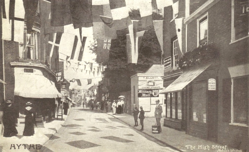
This 1906 card was taken approximately the same place as the one immediately above, and can see in this one that the garage belonged to T. Elliott, but at this point it was also a livery stable. There was also an ad for the Military Mail newspaper. I wonder what they were celebrating with all the bunting out?
Roughly the same area now, with Brandon's Music shop on the left, and T. Elliott's a distant memory on the other side.
This one was taken from the same direction as the two above, but just a little further along. That looks like an interesting shadow on the rooftops of the buildings on the right, but I can't make out what it said.
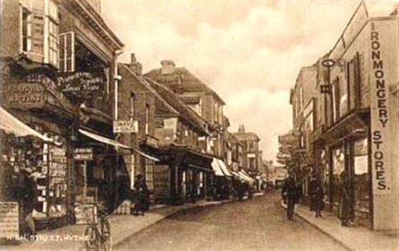
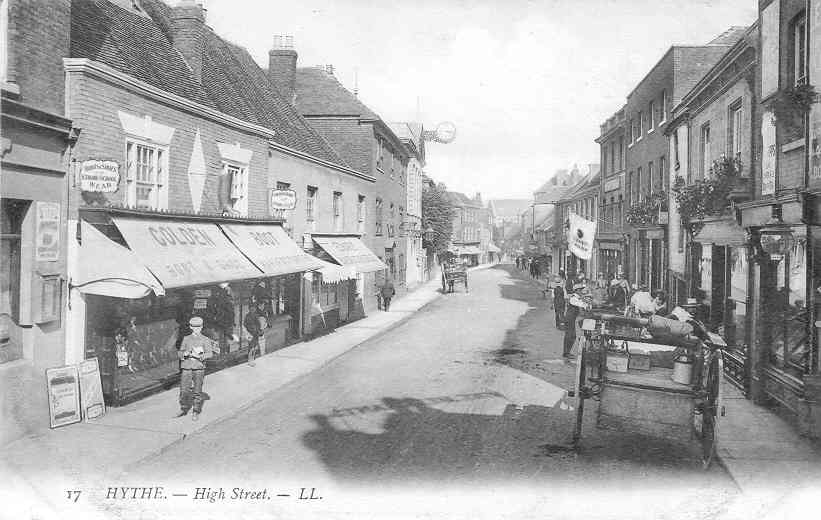
This card dates from a lot further back than my childhood, but I do remember having Ironmongery stores. I loved the smell of them inside, and they always seemed to have wooden floors.
Here is The Red Lion Square in 1925
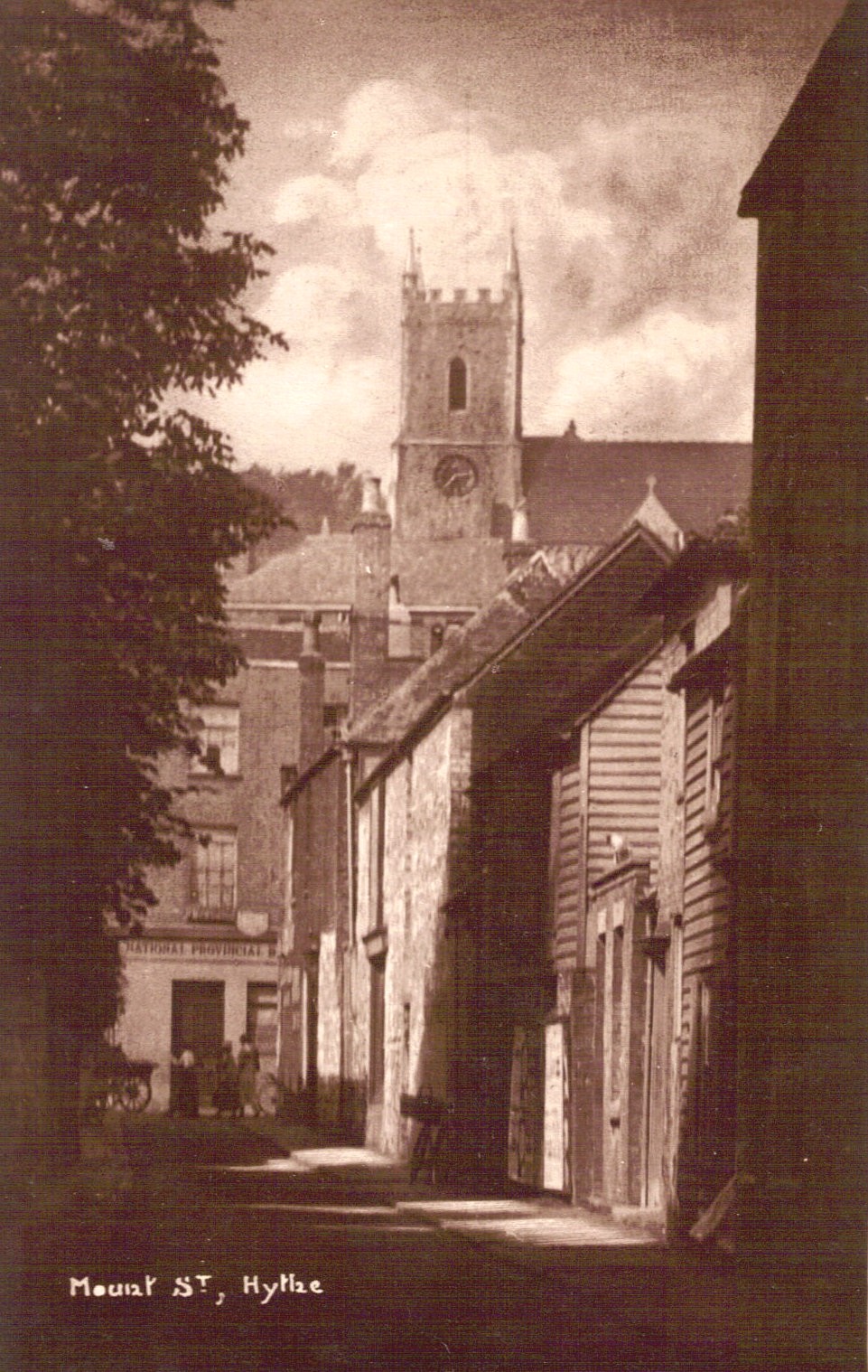
This is Mount Street in 1926, and you can see the National Provincial Bank in the High Street ahead. St. Leonard's Church is behind, it looks closer in this card than it actually is.
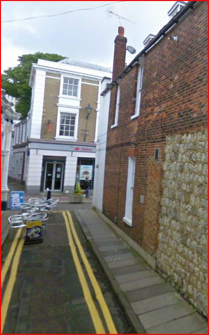
A modern view of Mount Street, and I am not sure if traffic is allowed down there at all any more, despite the double yellow lines indicating no parking. The reason I think so, is because those are table & chairs in the road just ahead. The bank is now The Abbey, and no church towers can be seen above the rooftops!
Hasn't changed much has it? They have just added a safety rail to save people tumbling down the steps.
Here is an interesting comparison. I don't have a date for the one on the right, but the left one dates from 1890. You can see how they have added the spikes to each corner of the tower (I am sure there is a proper name for those, but I don't know what it is!) The round turret in the centre has a bigger roof, and there is also something poking up from the left side of the building that wasn't there before. There also looks to be less graves doesn't there? Hmmmmm, did they possibly add to the bones in the crypt around that time? It does look as if the graveyard has been cleaned up in the photo on the right doesn't it?
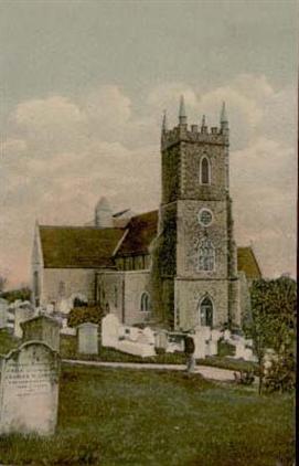
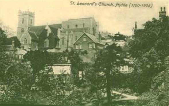
St. Leonard's Church taken from a different angle. The date on it as you can see spanned at the time from 1100 to 1908. However, the card was postmarked 1911, and in fact it is still there today, so was it rebuilt sometime after 1908?
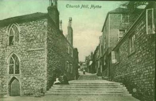
Ah yes, I have climbed up here. It leads up to St. Leonards Church, home of the crypt full of skulls. It is very pretty at the top, and the view is magnificent, but very tiring if it comes at the end of a long day of sight seeing like I had had that day. This photo dates from 1910.
Hythe canal in 1956. Showing the Town Bridge. A fellow by the name of Tony Reeve tells me that this photo was taken shortly after the bridge was erected. Before that, following the war, for many years there was a bailey bridge, borrowed from the army, spanning the gap, as the original bridge was partially destroyed by a bomb during the war.
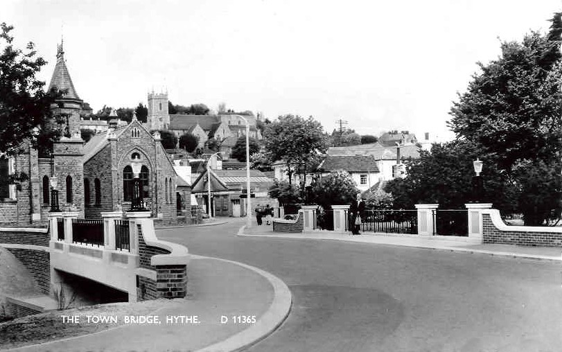
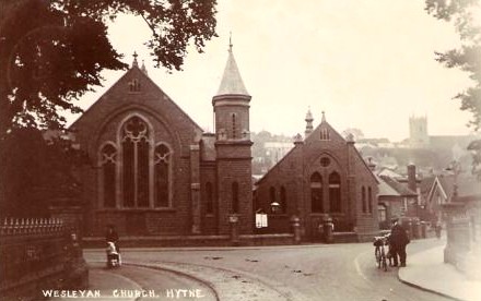
And an up to date one of the same bridge, however, it shows more of the Hythe Methodist Church than the bridge.
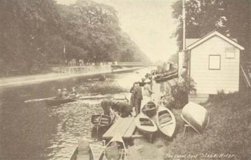
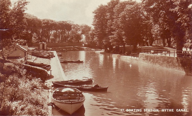
This one was entitled 'The Boat Stage' on Hythe Canal. Which could possibly have been the same place as the boating station. The building looks similar.
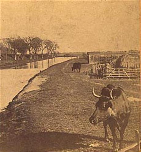
Oh my goodness! I wish I had a date for this one. Again it is Hythe Canal, and doesn't it look old? I don't think you see cattle in Kent with horns like that any more do you?
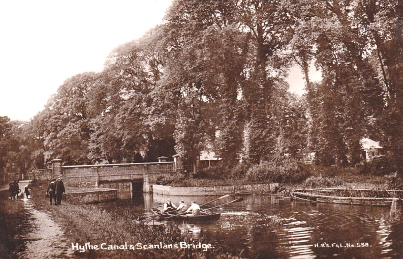
I was curious about this one, because I admit I didn't know where Scanlans Bridge was. I was very surprised to discover that it is the one just past the Romney Hythe & District Light Railway Station, except it is actually called Scanlons Bridge. Not only that, but the road that runs between Dymchurch Road and Military Road is also called Scanlons Road. All the years I lived in Hythe, I only ever thought it was the A259. More modern photo below.
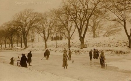
This one looks more like Winnipeg than Hythe, but it's not the Red River, it's the Hythe Canal in 1912, frozen solid enough to walk on, with the help of a chair by the looks of the lady in front.
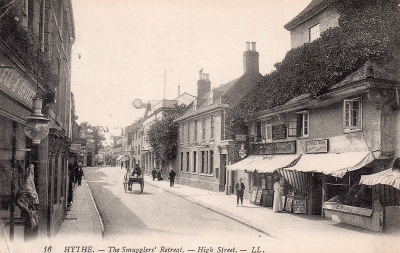
Four years later, and I blew this one up extra large to try to read the signs on the Smugglers Retreat. On the left, all I could make out was the words Smugglers Retreat, but the boards outside look like the type you see outside newsagents. The business on the right has changed hands, by this time it looked like a George Wire had taken over, and can't be certain, but the I think I can make out the word Poulterer in the top sign, and below the window, it looks like 'Dried Fish Merchant'. Oh really?
Is this the location of the International Stores? It is 43 High Street so I think so, but it looks as if they have done away with the fancy scroll work on the columns on either side, and covered the brickwork.

I think this is the same stretch of canal as the one above, but taken much earlier.
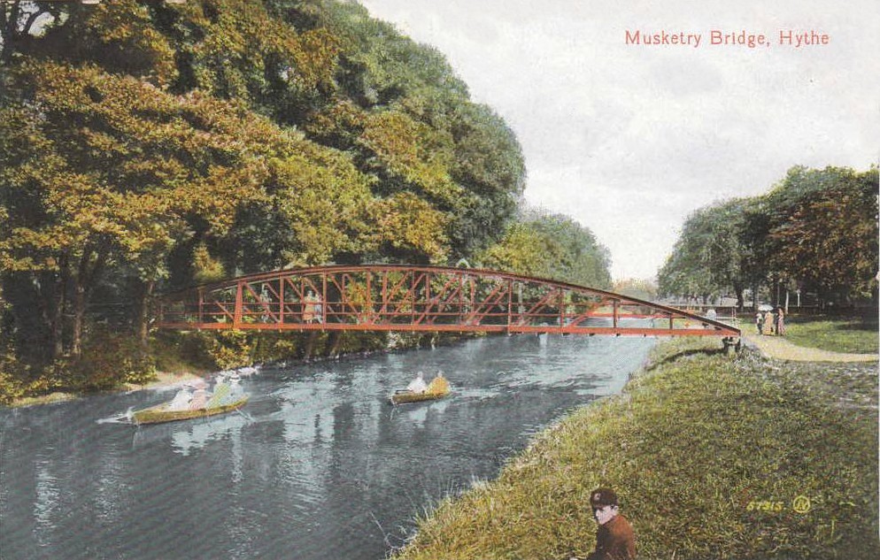
I don't know for sure which bridge is the Musketry Bridge, however, I am guessing it would be located near what used to be the School of Musketry. The one in the modern photo below runs across the canal between Military Road and Dymchurch Road, so would guess that this might be it.

1913


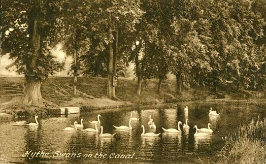

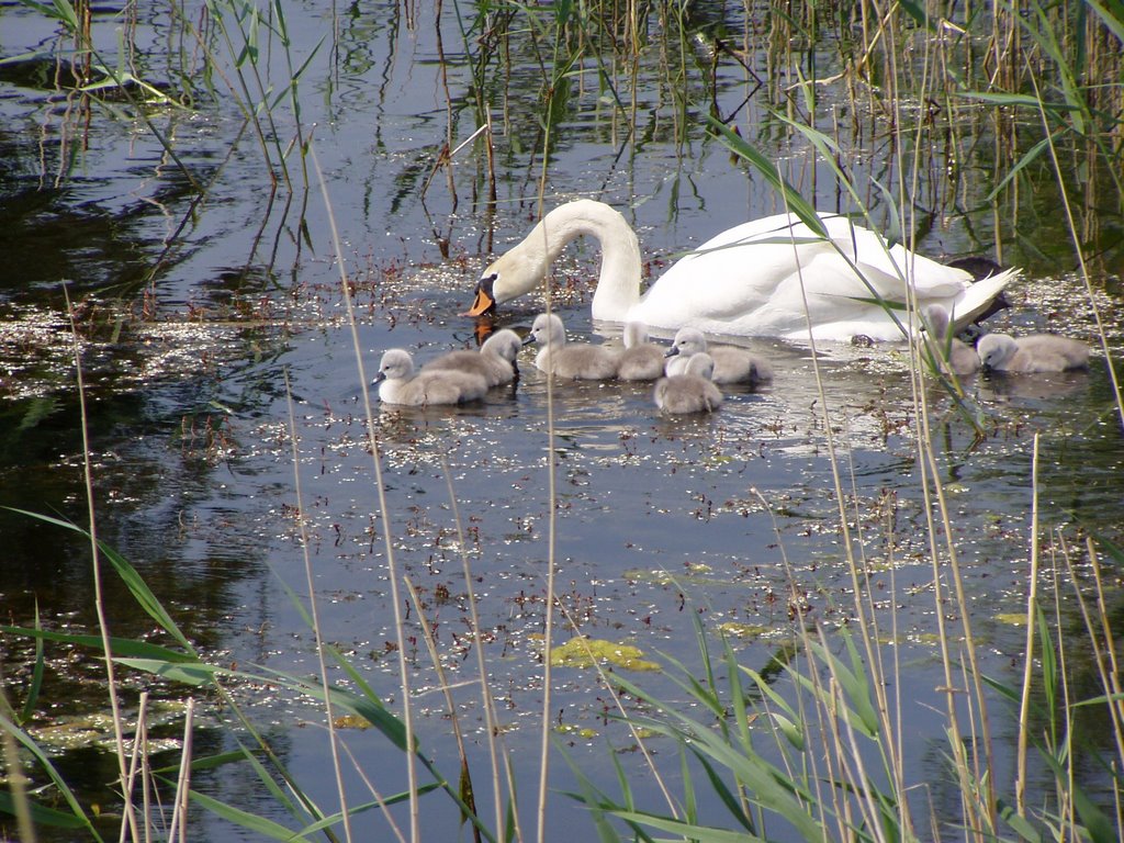
This is a lovely 1927 photograph of the swans on the canal
And you can still find them on there now, this modern one is courtesy Pat Duke
.jpg)
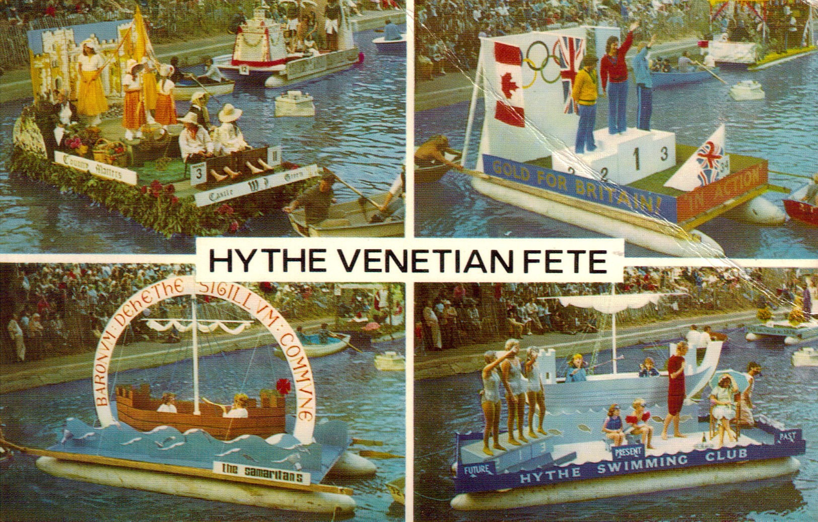
If you are interested in learning more about this fete which has been going since 1860, I urge you to check out this site: http://www.venetian-fete.com/mainPage.htm


The Hythe Venetian Fete. I used to love watching this. Tony also had something to say about this. "I remember one Venetian Fete in particular, the guest of honour was Peter Twiss, who was the pilot of the first UK airplane to reach the incredible speed of 1,132mph - before that, the official speed record was lttle more than 350mph!
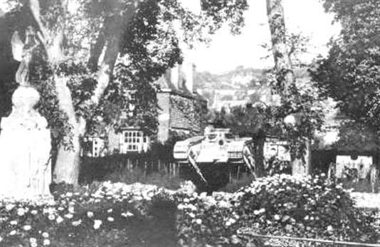
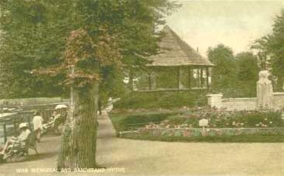
I don't have a date for this one which shows a tank field gun and war memorial, and wasn't sure where it was located. Alan Taylor told me that they were in the 'Grove' (gardens which are just off Prospect Road, or A259). The tank has been removed, the war memorial is still there as is a bandstand. However, the latter is no longer beside the Memorial, it is on the other side of the canal.
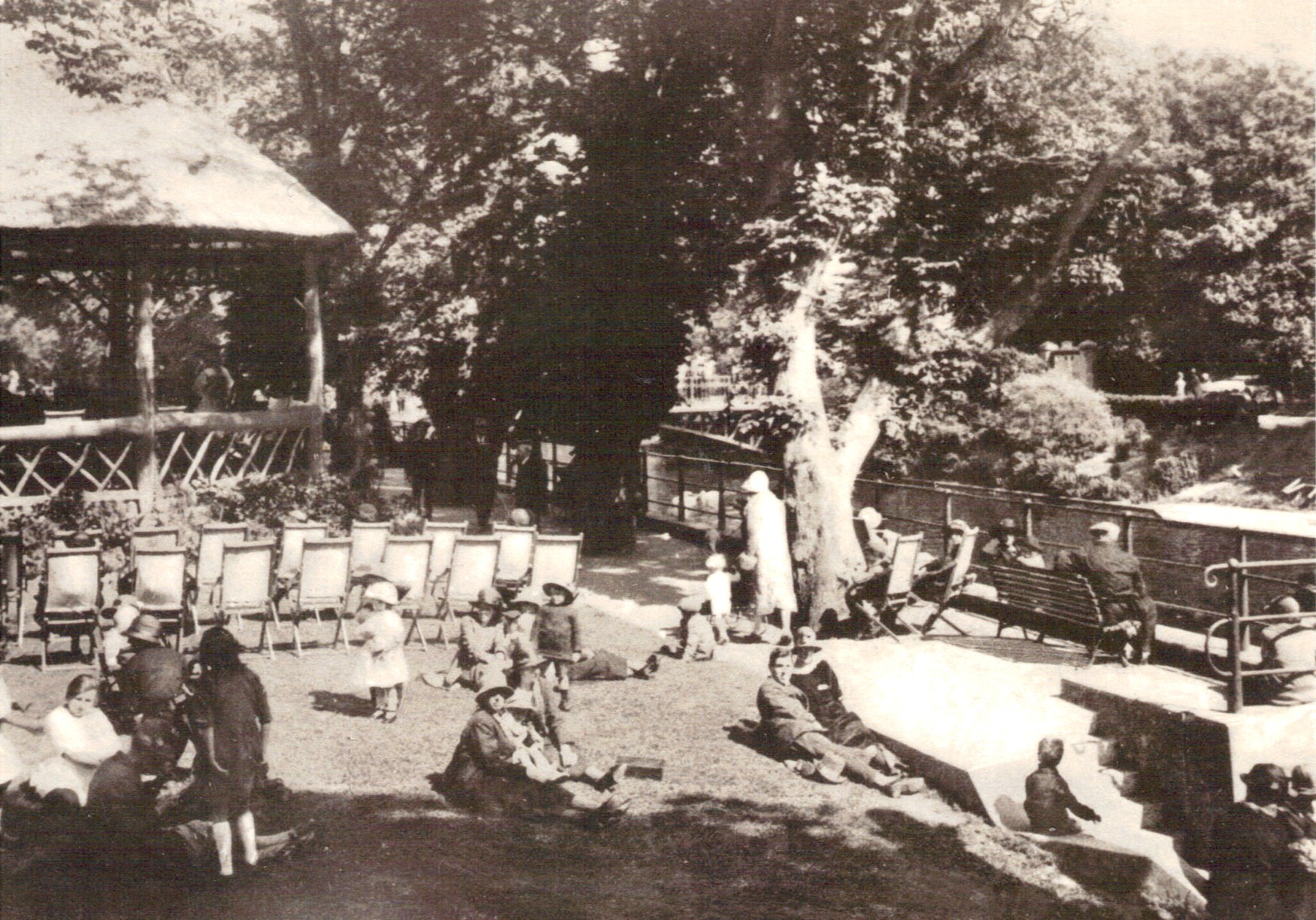
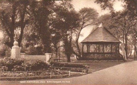
Here is another nice one of the bandstand, also in the 20's with people relaxing in the sunshine.
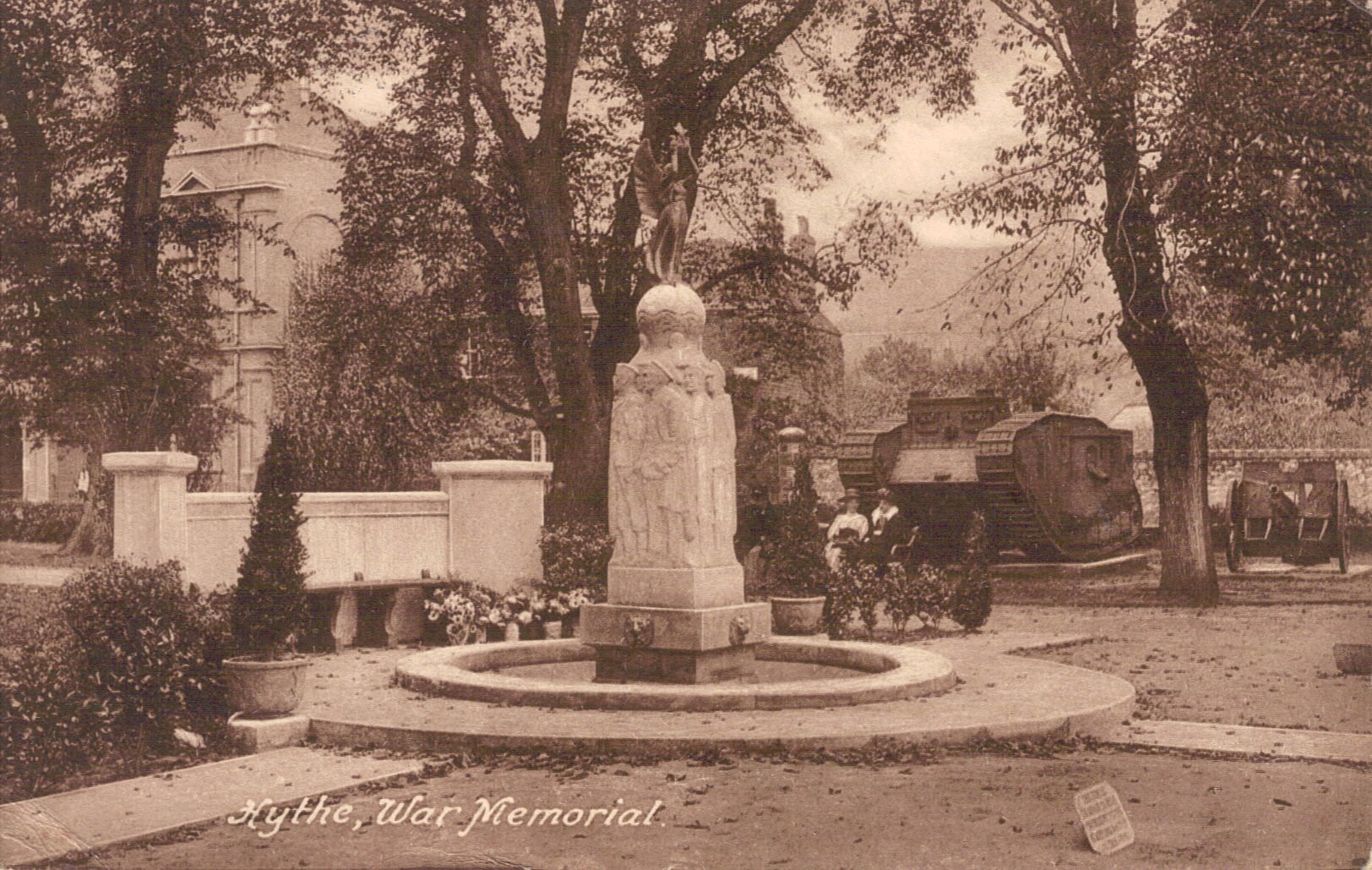
Here is another nice one of the war memorial, showing a couple of ladies taking a rest on a bench in front of the tank. I don't believe those large houses you see in the background are there any more.
This one looks to be quite a bit earlier than 1956, but unfortunately we can't see the bailey bridge or the original one that would have been there at that time. It does look like tram tracks in the road though doesn't it?
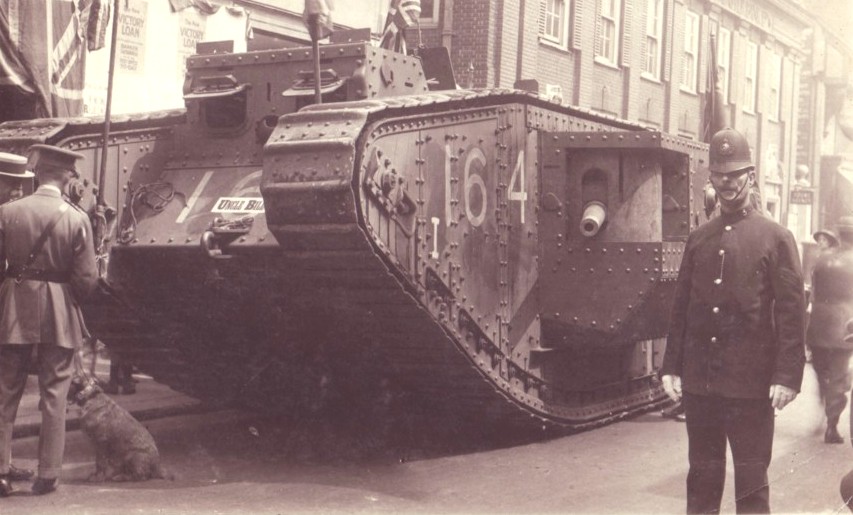
This must be when the tank first arrived in town. I hate myself for this, but someone must have sent this photo to me, and I can't find any notes with it. I called the photo "WW1 Tank Uncle Bill Policeman Victory Loan" which tells me that it must be one sent by the niece or nephew of the policeman in the photograph. If it was you, please drop me a line so I can credit the photograph properly.
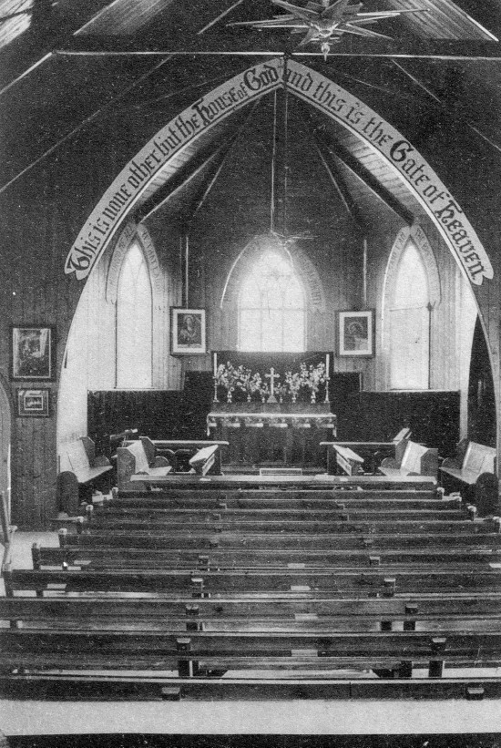
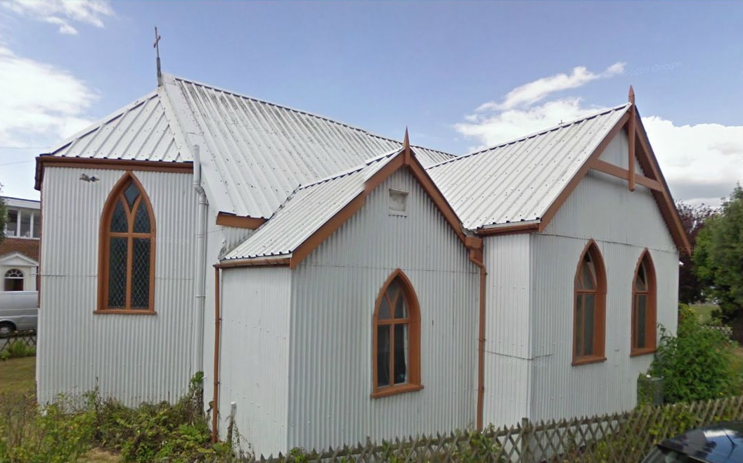
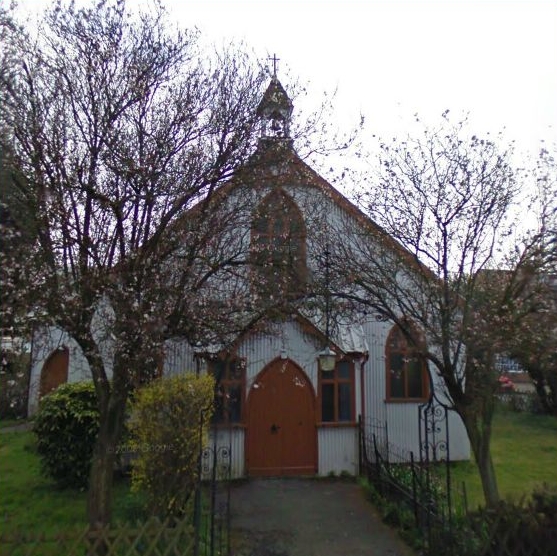
'This is none other but the house of God, and this is the Gate of Heaven' This is what it reads over the archway in this 1905 photograph of the inside of St. Michaels & All Angels Mission Church which is still located at the junction of Stade Street and Portland Road. I couldn't get a modern photo of the inside, but here are a couple of the outside.
St Michael's Church is situated in the most convenient and accessible spot. Erected on a triangular site at the junction of Stade Street and Portland Road and adjacent to the Town Bridge, it cannot escape the notice of the passer-by. Lovingly referred to as the 'tin tabernacle' (or 'Tin Tab') because of its timber frame and corrugated iron construction, it is one of the few survivors of 'temporary' or prefabricated buildings erected at the end of the Victorian era.
At this time Hythe was developing fast; many hundreds of houses were built on the sea side of the Royal Military Canal Victoria Road, Albert Road, Ormonde Road, Park Road to which working class families were attracted to move because of their modest cost (most of them were let on weekly tenancies rather than purchases). The Church saw a need to provide services for this influx and, for a time, 'mission type' services were held in the school. The vicar cherished his idea of building a place of worship for those who were unable to attend St Leonard's, and this was made possible by two generous gifts: an offer to pay for the building by a former vicar, the Reverend F.T. Scott, and the provision of a site liberally presented by the Watts family.
In 1893 matters moved swiftly. An appeal for funds to furnish the church met with generous response. The 'iron' church, as it was referred to in those days, was ordered and erected within months. Described as a 'pretty building', it was intended to seat about 280 people. A Mr Andrews promised an altar to be made from oak grown on his own land, and this is still in use. However, the original wooden pews have been replaced by more comfortable chairs, the gas lighting has been replaced by electricity; gone also are the coke stove and the nice two-manual organ (now in St Peter's Church, Canterbury). They also now have a carpeted floor!
The opening of the church took place on Tuesday 19 September 1893 when the Archdeacon of Maidstone dedicated it to St Michael and All Angels. Since then it has been lovingly used and was restored for its centenary, celebrated in 1993 with special services, a flower festival, tea parties, etc. Throughout its 106-year history, regular Sunday and weekday services, as well as Sunday School classes for children, have provided opportunity for thousands of worshippers who would not find it possible to get to St Leonard's. St Michael's is also in regular use as a venue for secular events such as talks and meetings; indeed it is almost a second 'church hall' within the parish. The building, though not pretentious, always surprises visitors by its homely yet dignified interior. It stands witness to the generosity of many people, the faith of those who use it, and, to those who pass by, that the Church is alive and relevant to the community of Hythe.
Tin tabernacles were a cheap alternative to churches, built by the Victorians to cope with swelling congregations at home and abroad. The churches were ordered as flat-packs; companies all over the country were able to provide the kit. (See www.tintabernacles.co.uk for more information.)
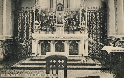
I do have an old photo of the High Altar though, and it looks very similar to the modern one on the right, with subtle changes.
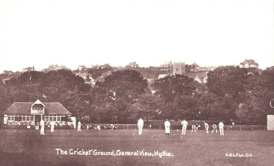
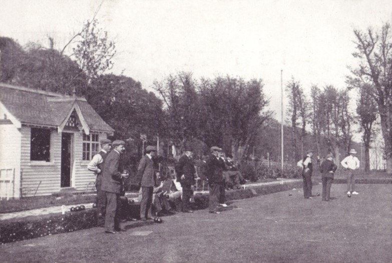
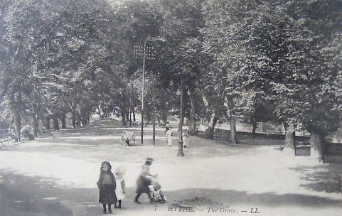
I could be wrong, but I think The Grove is where you can find a lot of these sports, I am pretty sure they have a tennis club plus a cricket & squash club there anyway. I don't know if they did back in 1911 when this photo was taken.
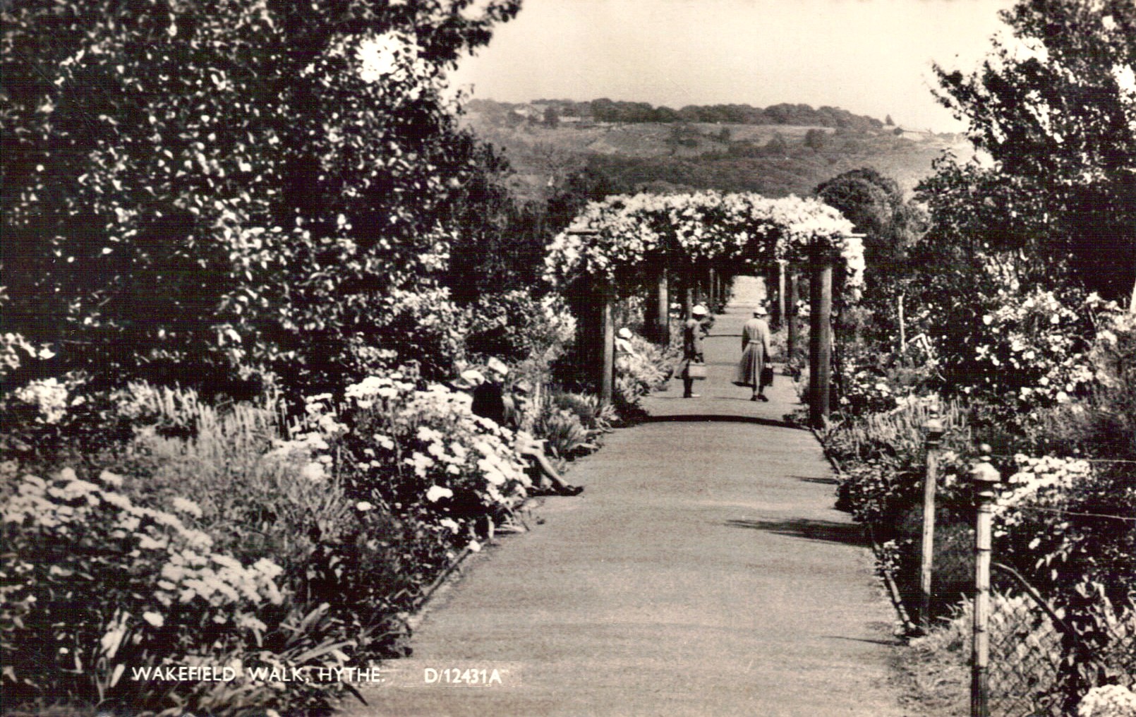
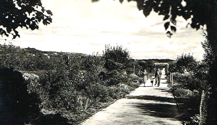
Another little mystery. Both of these photos date from the 50's, one is called Wakefield Walk and the other Wakefield Gardens, that I suspect were part of each other. I have searched online, and in the books I have, but cannot find any reference to these gardens. All I can find on a current map is Wakefield Way, which has some newer looking houses. Were these built on these gardens? If not, what happened to them? Answered - see right!
.jpg)
This 2000 pic of the Hythe boundary stone was supplied by Detmold
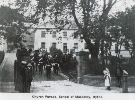
I hadn't seen this one before George Hills sent it to me. This time the soldiers are coming out the gates of the School of Musketry to go on Church Parade. Don't those little girls watching look adorable?
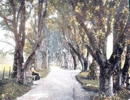
What a shame this one isn't coloured. Detmold donated this lovely photograph of Ladies Walk, which runs from the town down to the seafront.
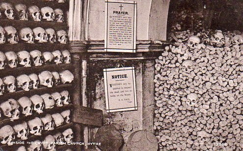
Another view of the Crypt at St. Leonard's Church. If you are curious as to what the notice is about, it reads as follows:
'Visitors are requested to respect the dead, and not write on the bones.'
Was that really so big a problem that they had to put up a notice about it? Vandals have been around for ever it seems.
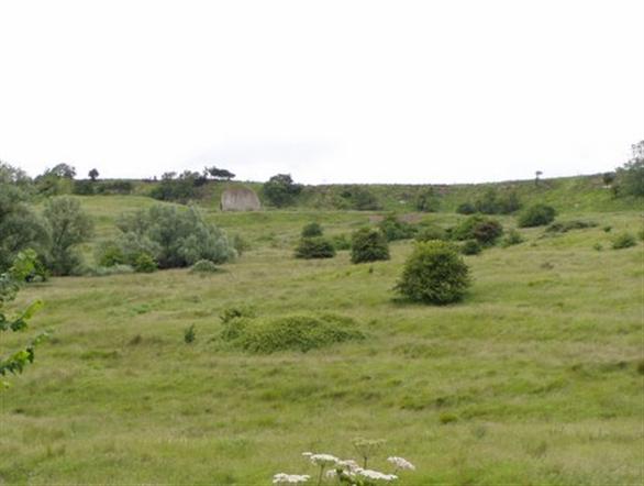
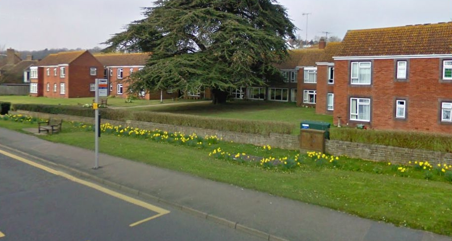
George Hills has just e-mailed me to let me know that it is indeed the site of the School of Musketry, and is now Halliday Court, a residence for the elderly. He also tells me that the tree you see in the centre has now been cut down because a branch fell on a resident, and severely injured her. The tree was over 200 years old!
My question on the left about Wakefield Walk and gardens has been answered by Tam Hogben who wrote to say Wakefield Walk is definitely still there. It runs between Twiss Road and Ladies Walk.
Thank you Tam
My question about The Esplanade has been answered by Chris Melchers, and this is his explanation: "The names Parade, Marine Parade, Promenade and Esplanade are used almost indiscriminately but the correct usage now is: Marine Parade from The Imperial to Stade Court Hotel and West Parade from there to Fishermans Beach." That's cleared that up, thanks very much Chris.
Chris Melcher of the Hythe Civic Society Newsletter also came up with some information on Moyle Tower. This is what he says: "Moyle Tower was, (as told to the society by an elderly resident, recorded in the 1970s) owned originally by a wealthy family named Porter and the grounds included land as far inland as Tower gardens which was tended by 3 gardeners and was used by the Excelsior Town Band for concerts. The North side of the building included a ballroom with stained glass windows where young children of the town were given Christmas Parties. The Porters were regarded as great benefactors to the town but we havent yet traced any descendants."
Thank you Chris, you can see the stained glass windows in the image below.
Chris Melcher confirmed this. He also told me that Lord Wakefield was the founder of the Castrol oil company which became a major part of B.P. and he was also a big benefactor of the town. I didn't know that, thank you Chris!
Chris Melcher also told me he believes this photo is also Wakefield Walk, not Ladies' Walk.
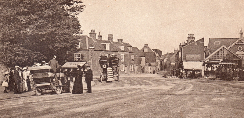
I came across this fabulous photo below left on Facebook, and received permission from the owner, Joe Bleach to add it to this site. I was excited to see it, because I had no idea that the Tram Terminus was still standing, and discovered by looking on Google (below right) that it was previously hidden by another building, which has now been demolished. As you can see in the photo above left, when it was operational and very busy, the roof has been changed, but you can see the sign. If you click on that photo you can see it enlarged. It looks to me as if it might have had a clock inside that curved piece above the sign at one time. Thank you Joe, it's a fabulous addition to the page.
I would guess these two photos of the High Street were taken around the same time, as the same butchers shop is on the left. Anybody know what it was called? I can make out ??ell & Short. There are several military men in the left picture who could have come from either the School of Musketry or Shorncliffe Camp. The right card was dated 1926.
I have a LOT more pictures of old Hythe, so why not take a look at
Kevin Farrell of Warrington, Cheshire wrote to say his Great-Grandfather Thomas Elliott owned the livery stable, plus the Swan Hotel nearby. His Grandfather, Thomas Robert Elliott was born in the hotel in 1884. The livery stable became a garage. Thank you Kevin!
Look at that! You could even get away with parking your vehicle on the pavement in those days! Every time I see meat hanging outside a butcher's shop, I cringe thinking about all the fly eggs being laid inside it. But with no refrigeration, I guess it was the coolest place to display it. They were a hardy lot back then!
Nowadays it's a one way street with parking on one side only and even then in designated places. I wonder if they gave parking tickets to horses?

This one is later because the Smuggler's Retreat has gone, but the butcher is still there. Can't quite make out the name. Something & Short. Note the soldiers on the other side of the street.
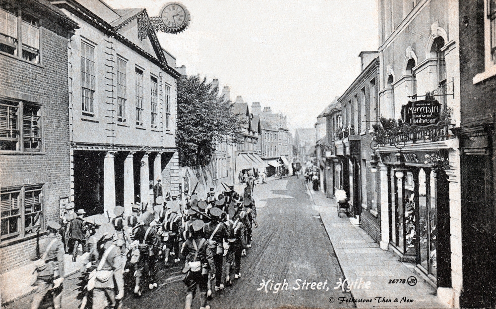
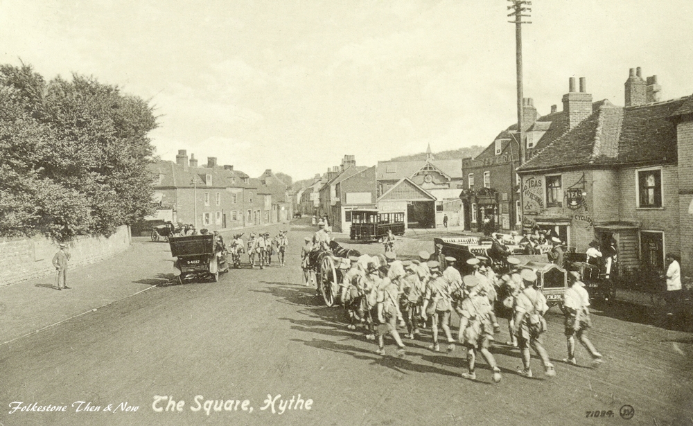
Looking from the opposite direction in 1923 we see soldiers marching through the High Street. Let's look next at one of the places they used to come from.
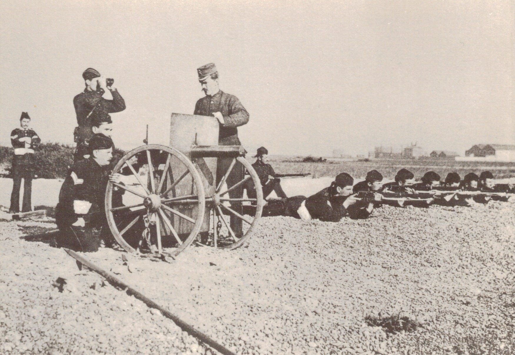
Above you will see the Ranges I mentioned further up the page. This photo was taken in 1890.
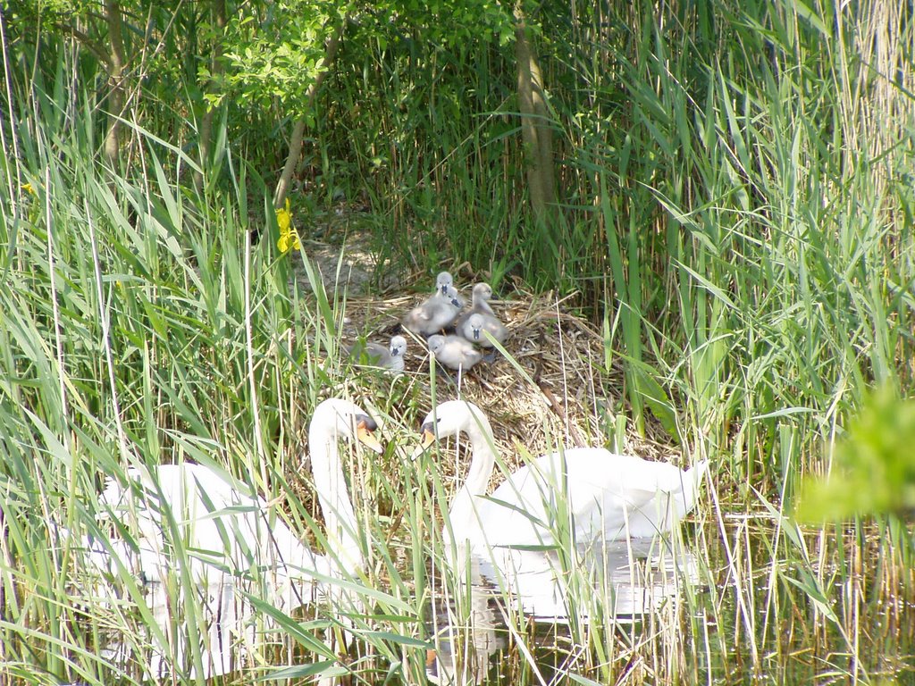
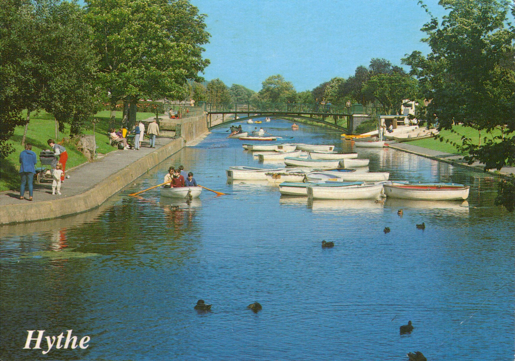
If you are wondering how the swans are doing these days on the Hythe Canal. I can assure you they are doing very nicely thank you, and George Hills sent me these beautiful photos of Mr & Mrs Swan with their little cygnets that he took near his home in West Hythe. Aren't they adorable?
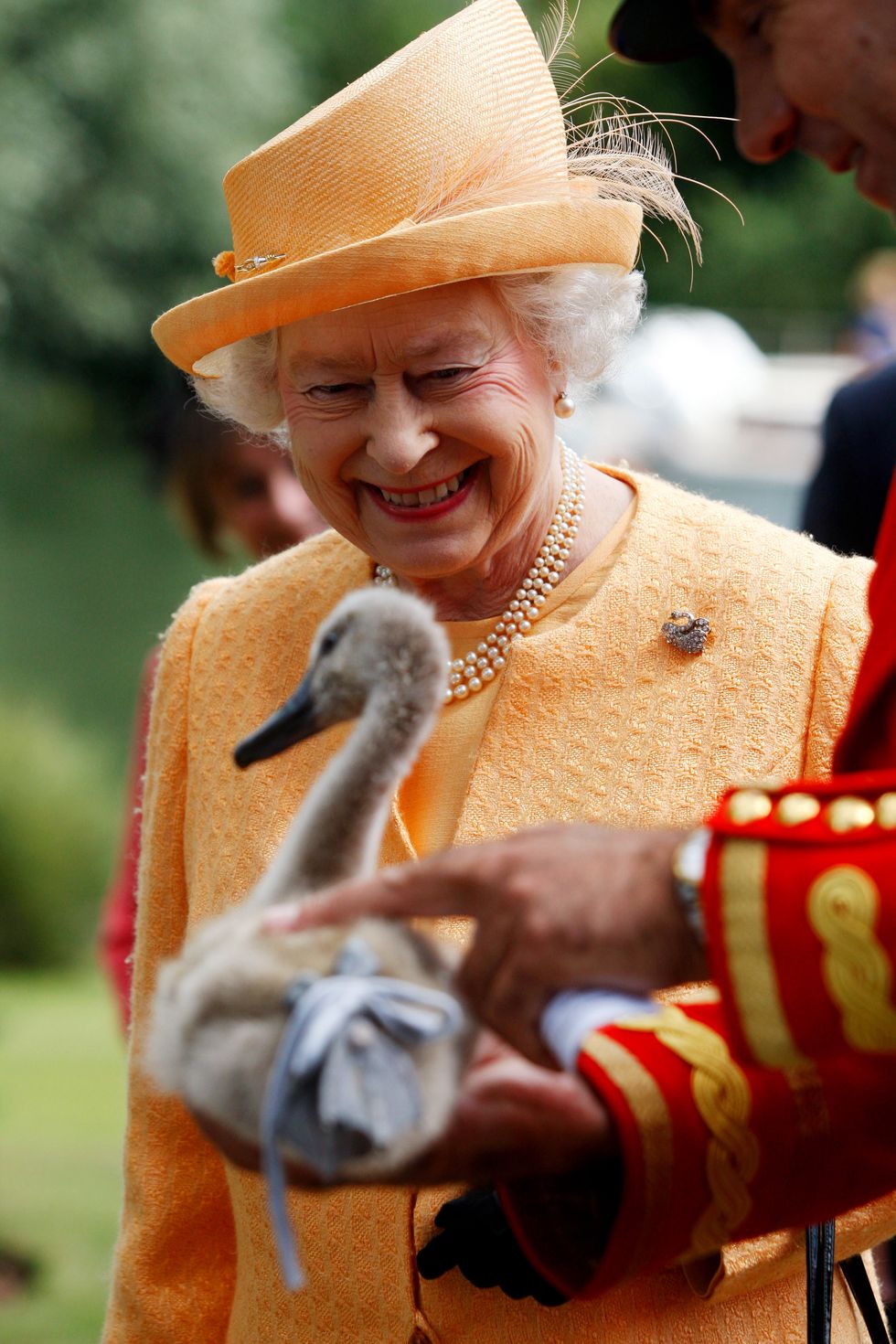
I have heard many times over the years that the Queen owns all the swans in the country. This is what I gleaned from the Town & Country Magazine website, article written by Caroline Halemann, along with the photograph which holds the copyright of wpa pool/Getty Images:
Being the British monarch comes with more than a few perks. In addition to a vault of jewels, and getting to celebrate your birthday twice a year, Queen Elizabeth is the technical owner of all "unmarked mute swans swimming in open waters" in the U.K.
The royal family's website notes that the British crown has "held the right to claim ownership" of these birds since the 12th century, and traditionally, "valuable rights of ownership" were subsequently granted by the monarch to many people and organisations as swans were a prized food, served at banquets and feasts."
Given that swans are no longer a delicacy in Britain, things have changed a bit over the past 800 years, but the birds (well, at least the ones on a specific portion of the River Thames) are still counted every year by a group headed by the Queens official Swan Marker in an event known as "Swan Upping." But the process now centers around conservation and education.
I am so glad we don't eat them today, they are so beautiful and graceful. The photo on the left dates from 1927, and on the right is a modern one taken by Pat Duke.
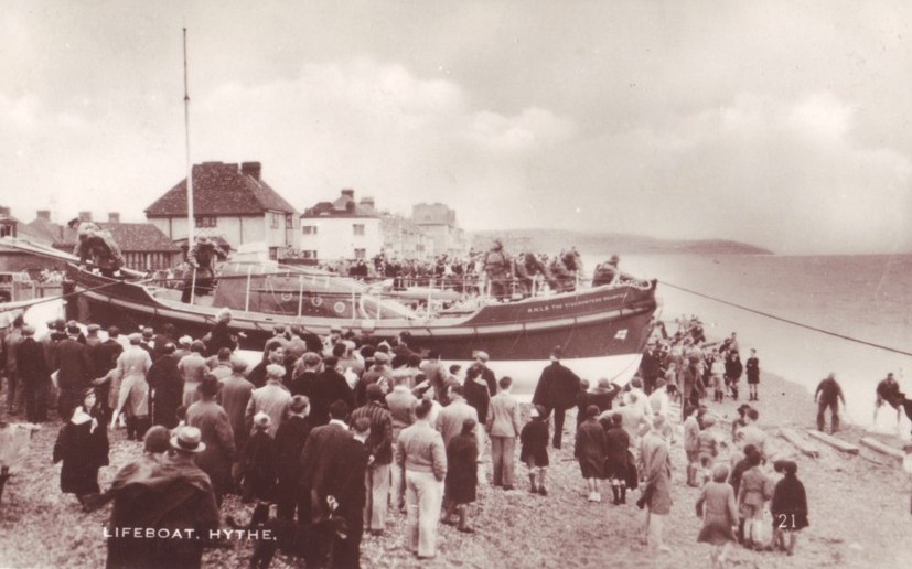
The Lifeboat always drew a crowd when it was launched
The Parade. Looked like a womens' day out didn't it?
You have everything in this one, boats, bathing machines, donkeys and Moyle Tower in the distance (more about that later).
A modern photo of the Catholic Church, Our Lady of Good Counsel on Blackhouse Hill. I haven't come across an old photo of it, but this one doesn't look very old does it?

This one is a little later, and shows you a closeup of the bridge. On the other side, on Rampart Road, you can see the Weslyan Church, now known as the Hythe Methodist Church.
Before we move away from the canal, I must show you a few pictures of a very tranditional event that has been held intermittently since 1860
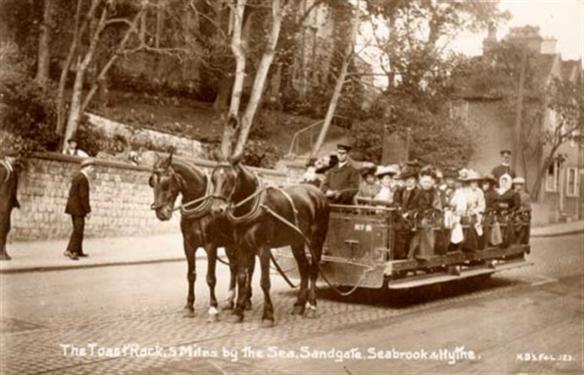
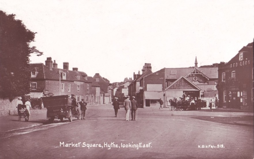
The toastrack's final destination was the Red Lion Square, or Market Square as it was once called. It was also the point for picking up and dropping for the charabancs of the day.
Above right you can see an army unit heading back to Shorncliffe Camp after rifle practice on the Hythe ranges.
You can't see the toastrack depot very well in these photos, but.....
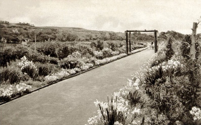
Now, as it's not far away, let's wander over to The Grove.

Isn't this pretty? This one really is Ladies Walk. Still there, running from the centre of the town to the seafront. It was laid out in 1810 to commemorate the Golden Jubilee of King George 111. Due to dutch elm disease, the walk is now less wooded. I do believe gentlemen are more than welcome to walk it too!

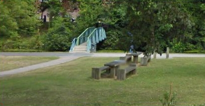
We have to leave the Memorial with a 'Now' image, and thanks to Nigel Parsons we have a beautiful 2022 photograph to show you. What a lovely place to spend a few relaxing hours on a summer's day. Thank you so much Nigel.
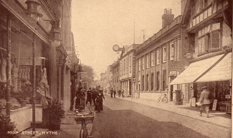
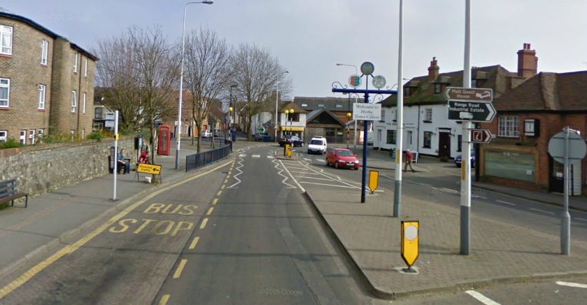
We briefly visited the main shopping area in the High Street when we looked at the Smuggler's Retreat, but there are a lot more businesses than that in the street, and always has been, so let's see the shops of days gone by.

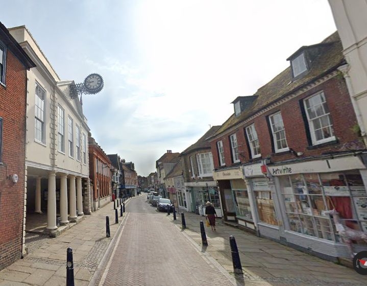
A more modern view of the section of the High Street on the left. Hasn't changed a lot has it? A few chimneys less, the inevitable no parking yellow lines, and bollards to prevent you from driving on the pavement. No bikes, horses (or chair), but apart from that, it's business as usual.

There are photos of the Moyle Tower interior on Page 2, link at the bottom of this page.

1933
Here is that same angle of the square about 86 years later.
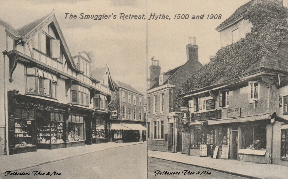
Before we move on to Page 2, I just wanted to show you the latest card I bought. L. E. Straughan, who owned the Stationers and Library in the left photo in 1908 had the idea of Then & Now before I did! However, I don't think his photo of the Smuggler's Retreat dated from 1500, but I guess he was talking about the businesses in that location.