


On the left, we have a Library on the corner of the High Street & Theatre Street, which also has all daily newspapers, with the Congregational Church far left. I think the first building on the opposite corner to the library might have been a pub at one time, as I can make out the words 'Free House' on the chimney in the wall, but appears to be closed, on the left side of the door is a sign reading T. Bear, Tonsorial Artist. On another site, I found reference to Thomas Bear, who was in those premises from 1907-1923. A tonsorial artist gave shaves and haircuts. He also had a beer off licence next door at 5 Theatre Street from 1911-1932, so was that the said 'Free House'? On the site of the library in 2021 we find Demelza Hospice Care for Children on the corner, The Butt of Sherry public house on the opposite corner, followed by shops and residences. The High Street looks unpaved in this doesn't it?


Another old photo of the High Street, on the right you can see the Rose & Crown public House. No Rose & Crown in the modern photo on the right, but I think that is roughly where it used to be.
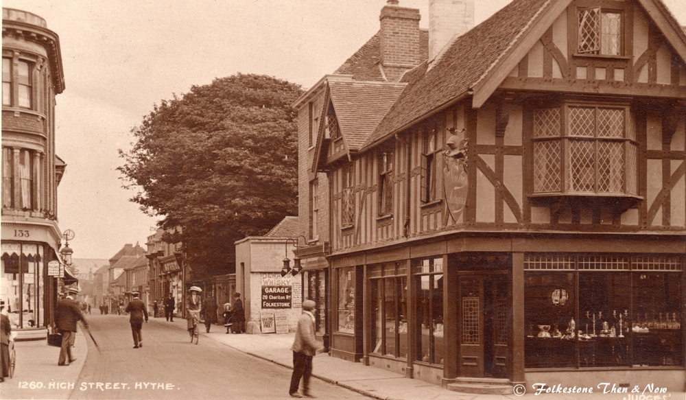

The High Street at Bank Street. I don't have a date for it, but can you imagine the dates on the items in that antique shop on the corner? How I would love to time travel and browse through there! Enlarging it, I can read the ads on the wall behind. We have Dewar's Whiskey, Garage at 20 Cheriton Road, Folkestone and the Olympia Skating Rink (right at the entrance to the Victoria Pier) where they were offering free roller skating lessons.
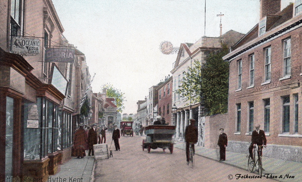
Same spot many years later, in fact we are now up to 1960 and a big sale is going on at Newman's furniture shop, who are now in the premises on the corner of Bank Street. Where the ads were in the previous photo, we now have a couple of cars plus a kiosk of some kind. The Hythe Summer Theatre is in full swing, playing every night with a matinee on Wednesdays.
Two modern photos of the same spot, what was an antique shop, Newmans and Furniture World, is now Castons Furniture. Here's hoping they stay for quite a while as the furniture looks lovely. Looks like they have a sale on too, so hurry up!

These next four pictures all have the Guildhall clock in them, so are from various angles either side of it. This one is early 1900's, not sure what that vehicle is, it has wheels but looks to be missing the horses and driver.
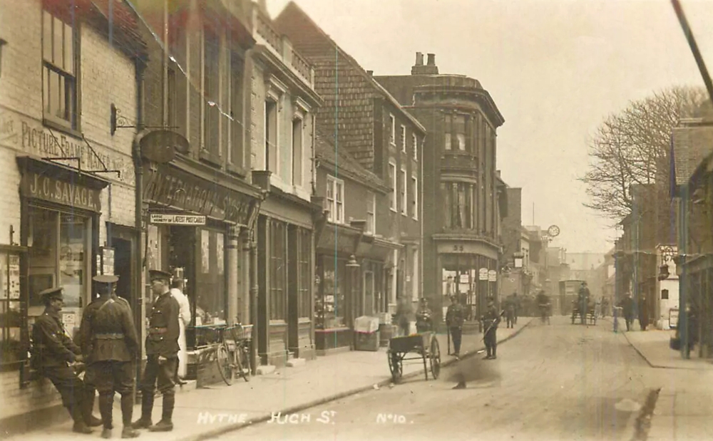
This shows soldiers shooting the breeze outside a picture framing shop, next door is the International Stores. I remember the International Stores very well, and was wondering what happened to them. This is their history according to Wikipedia:
International Tea Co. Stores was a leading chain of grocers based in London. It was an original constituent of the FT 30 index of leading companies listed on the London Stock Exchange.
The business was founded in 1878 by Hudson Kearley (later Viscount Devonport) and Gilbert Augustus Tonge as the International Tea Co., with the objective of selling tea direct to consumers rather than through wholesalers. International's main blenders were Ridgways, which became part of the group with the acquisition of Star Supply Stores in 1929.
Soon, most towns in Southern England had their own International Tea Co. store. International Tea Co. Stores fell out of the FT 30 index in 1947 to reflect market developments since the index was originally compiled in 1935.
The company was subsequently re-branded International Stores and was acquired by BAT Industries in 1972. In 1973, the Price Rite chain was purchased, adding stores to the International brand. This was further increased by the purchase of Wallis Supermarkets in 1977, which added a further 100 stores. After acquiring the large footprint Mac Food Centres from Unilever's closure of Mac Fisheries, in 1979, the chain created a new brand, Mainstop, to develop the new superstore division in 1980. However, BAT decided to sell any business that failed to progress and so the company was sold off in chunks. Former Price Rite stores in the south of England were sold off in 1980 to Fine Fare, with the remaining 67 branches sold to Argyll Foods in 1982.
In 1984, International Stores was sold to the Dee Corporation. The company became the Gateway Corporation in 1988, and then Somerfield plc in 1994.
Whew! Wish I hadn't wondered now.
1939


Still in the High Street we find Hythe's oldest hostelry, the White Hart, still going strong today, as in the photo on the right.
Tim Croft sent me the two pictures on the left just as he was in the process of taking over 108 High Street about three years ago. He was hoping to find even older photos of previous tenants, but unfortunately I had none. However, I took a look at what he had done with the place on Street View recently, and I think he has done a great job. I really like the paint colour, very classy. I hope the residents of Hythe are keeping him busy and that he is there a very long time!


I don't think the card on the left is very old, but Kipps Tea Room is no longer located at 152 High Street, Hythe. The restaurant was obviously named thus because of H. G. Wells living in the vicinity at one time. Now Henry's Chocoate Cafe and Wine Bar are in both 152 & 154 High Street.


I know I put up quite a few of the Smuggler's Retreat on the previous page, but I can't resist when a nice one comes up for sale. I chuckled when I read the back of this one, poor little brother, I wonder why she didn't address it to herself if he couldn't keep it? As you can see by the stamp, it was posted in 1905.
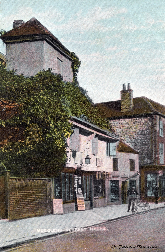

Under a magnifying glass, I can make out the name of the proprietor in 1906, it was A. Snashall, bit of a strange name, hope I read it right.


The Wilberforce Temperance Hotel at 113 High Street was demolished in the 1920's, but the photo on the right shows roughly where it used to be. Originally a large house, a man by the name of Frank White converted it into the hotel as one of his failed projects. If you would like to read more about Frank White, there is a very interesting account of his life here: https://hythehistoryblog.wordpress.com/tag/wilberforce-temperance-hotel/ If you want to know more about the Temperance movement, just Google it, it was popular with a lot of people in the late 1800's/early 1900's.

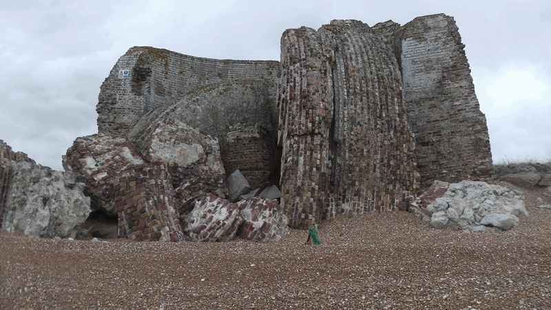
This is a really interesting photograph dated around 1860 of Fort Sutherland in Hythe.
You can see the Martello towers stretching way into the distance right along the coast. The fort had 8 cannons and housed a hundred men. There were two other forts in Hythe. Fort Twiss and Fort Moncrieff.


I received this message in the Guestbook from Courtney on Dec 8, 2014:
"I believe the crumbling Martello tower you have on the Hythe Page may in fact be Martello number 17, as the more recent tower you have displayed beside is in fact martello tower 19, which is seen in the photo I have posted still standing. I'm not sure when the photo was taken though however :)"
Courtney followed up this message with another on on January 14th 2015:
"Just an update after doing some more research:
A report from the Times Newspaper in 1899 reads that "the tower near the redoubt at Dymchurch been split into 2 by the action of the sea sucking away the shingle from the base". Remains of tower 17 and adjacent tower 16 were visible into the 1970's event though they started to collapse in 1899 and the Autumn of 1938. Between towers 18 and 19 used to also stand a 6 gun battery fort known as Fort Moncrief, however this was claimed by the sea in 1873. I have also managed to find an aerial view of Martello tower 19 dating back to 1947, found on this website: [www.britainfromabove.org.uk] "
Thanks very much for the information Courtney, it is very helpful. By the way, did you see the photo of Fort Sutherland further up this page? It was there at the same time as Fort Moncrief, and housed 8 guns. Here is the photo mentioned above that Courtney posted.
I would guess that this one has been cleared away by now. Hythe is listed as still having Martello Tower Nos. 9, 13, 14, 15 and 19. So would hazard a guess that this one might have been numbered either 10, 11, 12, 16, 17, 18, 20 or 21, as these are all the numbers missing between Sandgate and Dymchurch.
I don't know the date of this one showing a Martello Tower right on the beach, but would guess late 40's early 50's
I had a very interesting e-mail from Tony Reeve about this photograph. The white building in the photo used to be a Martello tower, and here is what Tony says:
"The Martello tower was inhabited in the 1940's and 50's - later Ronnie Ward, who was the architect of the new lighthouse at Dungeness, built a glass cube on the roof, where, even in the strongest storm, you could sit and enjoy the view of the sea. On the floor of this room was linoleum, laid out as a map of the Channel; it was possible to stand on the martello tower marked on this floor at night, and line the lighthouses and lightships on the floor map with the real ones at sea.
The photo on the right shows this converted Martello Tower today.
Just received the photo above, taken June 2014 by Lewis of Hythe, who tells me it is the same tower as the one on the left. So it is still hanging in there, but looks like a pretty dangerous place to venture these days. They certainly were well built though weren't they? Thank you very much Lewis.
I did see an aerial view showing the Pavilion on the Britain From Above website here: https://www.britainfromabove.org.uk/en/image/EPW026128 and could be wrong, but I think the rough location would have been near the Hythe & Saltwood Sailing Club.
The Martello Towers were built for defense against the French at the same time they built the Royal Military Canal for the same reason. I put quite a lot of photos of the canal on the previous page, but here are a few more old ones. If you would like to know more about the canal and why it was build, I have copied a potted history as stated on information boards on the banks onto a separate page: ROYAL MILITARY CANAL
1912
I couldn't find a Beaconsfield Terrace in Hythe when I looked on the map. But Chris Melcher, Editor of the Hythe Civic Society Newsletter pointed me in the right direction. It is located in Twiss Road, just along from the Imperial Hotel, and there it is on the far right. It hasn't really changed that much has it? A couple of them have had penthouse rooms added, but the whole building has been splendidly maintained. The detached house next to it in the photo below. Unfortunately I could only get a shot of it from the back, but you can see it is the same one, and another building has been added between the two.
Looks like a sentry box on the left. I wonder what was inside? Life belts etc. maybe?

1959


Before we leave West Parade, we have to mention a couple of famous faces that used to live in one of the houses.
Another interesting snippet told to me by Tony Reeve, who gave me the information about the Martello Tower house:
"My grandmother lived in a house called Lilybet, at the end of the West Parade, just before the 'dump', on the corner of West Parade and Albert Road. The house had that name as my grandmother was Lisa Sheridan, who was a professional photographer - the business that she and her husband ran was called Studio Lisa. She held the Royal warrant for informal photographs of the Royal family, and Lilybet was the family name of Princess Elizabeth.
My grandmother changed the house's name to Limpet in 1953, following the coronation of Queen Elizabeth 11. For the first 21 years of my life I spent all school holidays in Hythe, and knew the fishermen well - Mr. Lee, old man Whitey, the Griggs boys and others - and can tell stories of their smuggling and their superstitions. Thanks for your input Tony, loved your memories!


Did you know that Lisa and James originally had the surname of Ginsburg? After their daughter Dinah, who was using the stage name of Sheridan, became famous, her parents changed their name to hers.
Dinah Sheridan who died in 2012 at age 92
Modern photo of 'Lilybet'/'Limpet' once belonging to Royal photographer Lisa Sheridan with thanks to Stephen Burgess, who took this photo, and told me that he knew the house well as a child, and in fact his cat Bartle left home and decided to move in with Lisa Sheridan! He and Nigel Griggs used to play on the waste ground known as the dump.

I was very thrilled to find this 1925 card because before that, I had no idea this beautiful building ever existed, and cannot fathom for the life of me why it doesn't still exist today. I tried to find out some history in the Hythe Library, but although they tried very hard, they too came up with nothing. Anyway, it was called The Pavilion, and was located right on the seafront. The only photo I could find of it in situ was in a 1951/52 Ward Lock Guide which said it was on The Esplanade. 1951/52? That is not even before the war, so it had to have been demolished deliberately.

I don't usually take pictures from books, but hope I can be forgiven in this case.
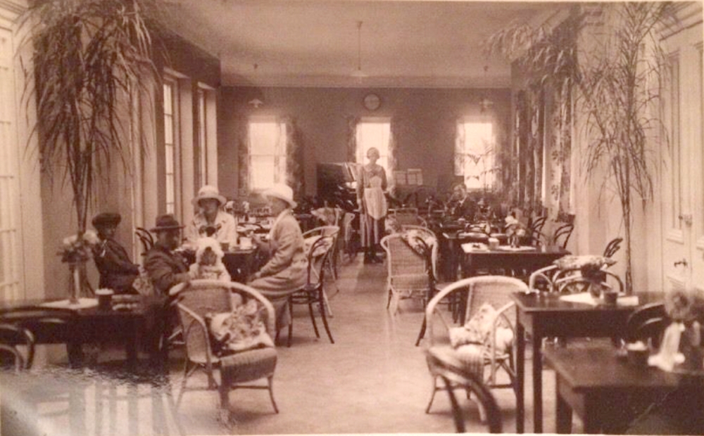
After finding the above, I also found the photo below of the interior. It was obviously a pleasant place to go to get out of the sun, and have a nice cup of tea. It was such a large building, I am sure it was used for functions too, so I am hoping to hear from someone who could fill us in with some details.


The Four Winds Restaurant on the corner of Victoria Road and West Parade was probably doing good business when this photo was taken. However, like so many other businesses, it has now gone, and the Four Winds Apartments have been erected on the site. When they were first built, they were advertising 3 spacious 3 or 4 bedroom townhouses and two 2 bedroom flats. When the photo on the right was taken, there was a 4 bedroom one for sale, and with a direct view like this, I bet it didn't last long.


1912
1935


Both photos below were listed as Hythe Parade, but it seems to me, the areas were called Parade, Esplanade or Promenade depending upon who was printing the postcard. The one on the left seems to have been produced by Pear's Soap, as you can see their name advertised both on the Parade and on the beach.

1914


Everyone looked so nicely dressed for a day at the seaside in those days, but it must have been sweltering hot to be wearing all those clothes in summer, plus all the waistcoats & jackets for the men and corsets and petticoats for the women etc. Probaby OK though, because in those days the women especially didn't sweat - they glowed. LOL.
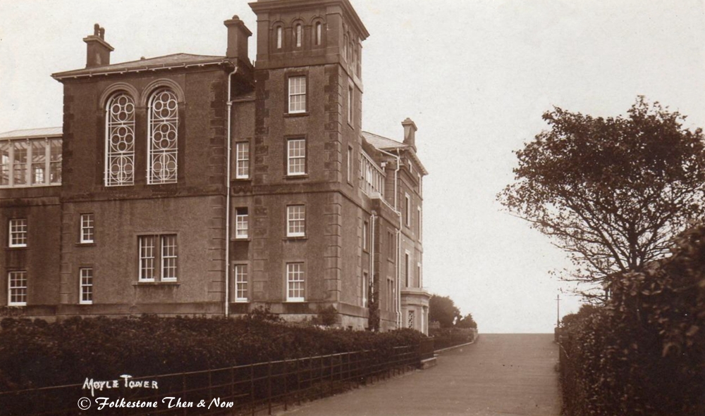

I mentioned on the previous page I had a couple more of of the Moyle Tower Guesthouse, and here they are. In the first, from the back, you can see those lovely stained glass windows, and in the second, you can see what they looked like from the inside in the Dining room. I bet they cast an interesting shadow when the sun shone through.
Lifeboat crew at Hythe with their self righting pulling lifeboat shortly after returning from a service in 1891 to a Glasgow ship which was driven ashore. The lifebboat was named The 'Mayer de Rothschild' in accordance with the RNLI's regular practice of giving lifeboats the name of the donor. Researching the name, I think the donor was probably banker Amschel Mayer de Rothschild, or donated in his memory, as he died in 1874.

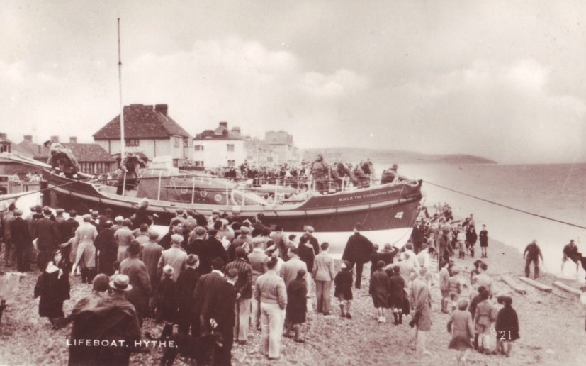
Launching the lifeboat always draws a crowd. This was a lot later, and the boat had been replaced.


Not sure how long ago The Mount Restaurant was on the corner of Mount Street and Prospect Road, but it is now a hairdressers, A Cut Above.


I can't read the date on this card, but it has King George V1 stamps, so must be between 1936 - 1952. It was sent by Sr. M. Brenders, so maybe someone can date it more accurately. I admit I don't know a lot about this building, but I believe it used to have a primary school attached, but think it was closed. However, I think the Convent itself is still in use on Seabrook Road, Hythe.
This is a 1904 picture of Ursuline College, Hythe. I can't find anything on a college of this name now, but there is one at Westgate-on-Sea, I can't seem to find out if the convent Is still operational at this location, or indeed if the building still stands. Can anyone out there help?


Update: Received an e-mail from Nigel Dowe, Landlord of The Bell Inn, who said this: "This mill never had sails, its a water mill and the mill race is to the left hand side of the mill as you face it .
The culvert for the mill runs under what was always known as Mill Lane (now for some unknown reason as Bell Inn Lane)and runs underneath the Bell Inn Below the fireplace in the lower bar. The mill was and still is owned by the Marston family who owned the Imperial and Stade Court Hotels"
Nigel also kindly sent me a newspaper clipping which explains about this culvert, and what it was used for in the smuggling days, and about a dastardly double murder which took place there, the bodies were bricked up in the chimney of the pub. Read all about it on the Pubs page.
Thank you very much Nigel!
On the left, this didn't look too much like a mill even in the older photograph, but expect at one time, the building in the distance had sails. I think I am right in saying that the photograph on the right is the way it looks now, which is beautiful I think you will agree. Someone is obviously giving it some tender loving care.

Ah, then it definitely wasn't this windmill that could be seen behind the Hope Inn. I was confused about this one, because the Hope Inn is on Stade Street today, and it didn't look quite right, however, when I went down Albert Lane beside it, I think I am right in saying that what is now the side of the pub used to be the front. I believe this windmill was the Stade Mill.


I bought this one as a photograph of a card, so no information on it. I believe it was on Dymchurch Road, but have no address, so can't look to see if the building is still standing, or what is there now.

The Stade Cottages in 1935, long gone now.

I think this is where they used to be, on the corner of Arthur Road.

St. Saviour's Hospital, Seabrook Road, where my Mum spent her final days back in 1980. I thought it was located in Seabrook, but see it is listed under Hythe, so added it here.
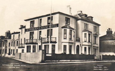

The Sutherland House Hotel on the opposite corner of Arthur Road and Stade Street to the Stade Cottages above. In the more modern view on the right, the hotel sign has gone, and looks as if it might be flats these days.


A couple more of that same intersection, as we can see the cottages gone, so as these don't look much older than 1935, I would say they photographed them just in time.

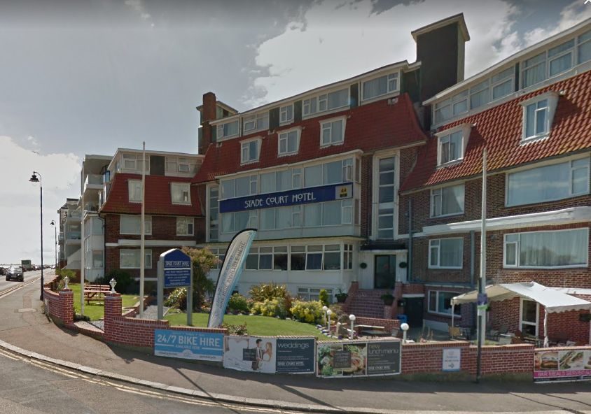
Walking down Stade Street to the seafront we come across Stade Court Hotel. Sorry about the blurred version on the left, I think that dates from around the 1970's. It hasn't changed a lot on the outside has it?

When I had Grove House, Prospect Road on my site before, I had linked it to another website that had some interesting history about it, unfortunately that website has now gone so can't do that this time. This was many years ago, and I am afraid the only thing I remember reading (what can I say, I am old and my memory is not good!) is that the Hythe Institute used to be next door. The only thing I could find out online was from a real estate company, who figure it is the most expensive Grade 11 listed property in that post code, and if it came up for sale, it would be worth at least £1,584.000, possibly more.


George Hills of Palmarsh sent me this photo of the Hythe Institute
Built in 1892 by Alfred Bull for the working classes to meet. It used to be located to the left of Grove house as you stand in front looking at it. What a magnificent looking building.
Kenny Bignall kindly sent me the above photograph of the original foundation stone that is still there. The plaque reads: 'The Original Foundation Stone of the Hythe Institute. Demolished for road widening in 1968.'
So this lovely building was there when I lived in Hythe. Why is it that when you are young, and busy working and raising your family you pay little attention to your surroundings? I don't remember seeing it.

When I bought this card I had never heard of Saltwood Gardens. It looked more like the seafront with that wall rather than a garden. It was written on the back but not posted. It says "billeted end house". So I assume it dates from one of the wars, and was being put to military use.

Then I came across this card that confirms it was definitely the seafront, but I don't think they call that section Saltwood Gardens these days because it doesn't come up on a map.

Do you think this 2019 one could be Waverley House? It is no longer on the end, but you can see it might have been once. The top has altered, it now has two dormer windows, but you can see by the others it probably originally had one. It has also lost it's canopy.
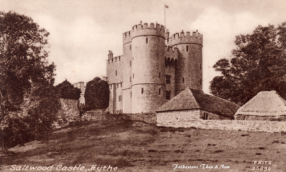
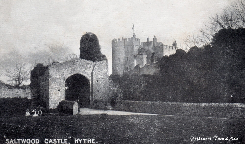
While talking about Saltwood - well kind of, we have to show what is probably the village of Saltwood's oldest building, Saltwood Castle. The castle is in Saltwood village which derives its name from the castle 1 mile (2km) North of Hythe, Kent. Known as the site where the plot was hatched to assassinate Thomas Becket (11181170). More recently, it became the home of the art historian Lord Clark of Saltwood (1903-1983), then his son Alan Clark (1928-1999), a minister in Margaret Thatchers government.
The castle is maintained by Mrs. Jane Clark daughter of Colonel Leslie Brindley Bream Beuttler OBE, (The Duke of Wellingtons Regiment) and Pamela Rosemary Blake. Widow of military historian and diarist, The Rt. Hon. Alan Kenneth Mackenzie Clark, with the help of her team of locally sourced staff.
The grounds of Saltwood Castle are not normally open to the public but a few times a year there is a rare chance to see this romantic, medieval castle. There is a moat, battlements, a secret garden, peacocks, and on occasions you can view the Rt. Hon Alan Clarks classic car collection.
Saltwood Castle has been a popular location for many TV and films
Play School (1976 TV BBC documentary, episode Saltwood Castle, Kent)
The Tripods (TV series)
The Chateau Ricordeau (TV series 1, episodes 5-8)
The Castle of Adventure (1990 TV)
Dear Bill: A Tribute to Lord Deedes (1994 TV BBC documentary, refrencing Saltwood, his childhood home)
The Real Alan Clark (2000 TV documentary)
The Alan Clark Diaries (2004 TV series)
My Week with Marilyn (2011 British drama film directed by Simon Curtis and written by Adrian Hodges)
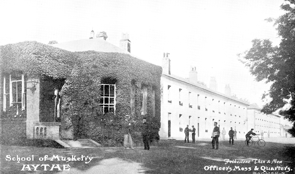
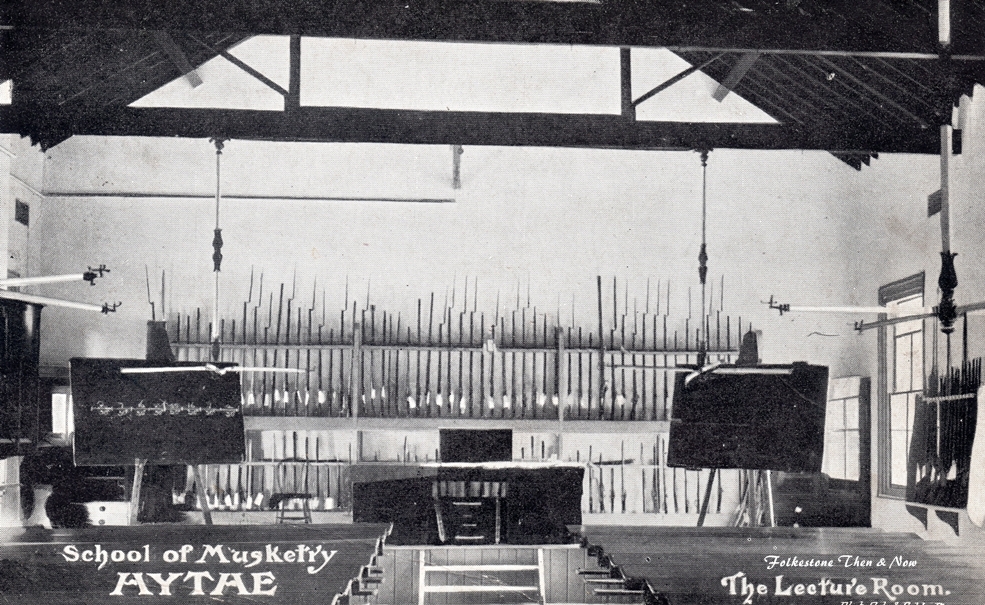
This military fortification brings us naturally to a few more pictures of the School of Musketry.


1904


This beautiful building on Tanners Hill is now the Saltwood Care Home, but it used to be called the Philbeach Convalescent Home, and was officially opened by Charles Wakefield, a former Lord Mayor of London, on April 20, 1925. It was bought in 1924 for £7,650, the building was converted to house female London transport employees and their young children. At its height, the home could accommodate 56 women and 40-50 young children.
Since its time as a convalescent home, the building has been much improved and extended to provide 66 bedrooms and three lounges, two of which overlook the gardens and enjoy views out to sea. Saltwood Care Centre offers personalised nursing, residential, dementia and respite care.
For more information visit https://www.hythecare.com/saltwood-care-centre/
1983
This is the way the television room looked in 1965, hopefully that has been updated somewhat!


The playroom for the children of the female employees of London Transport. Don't you love the little armchairs?

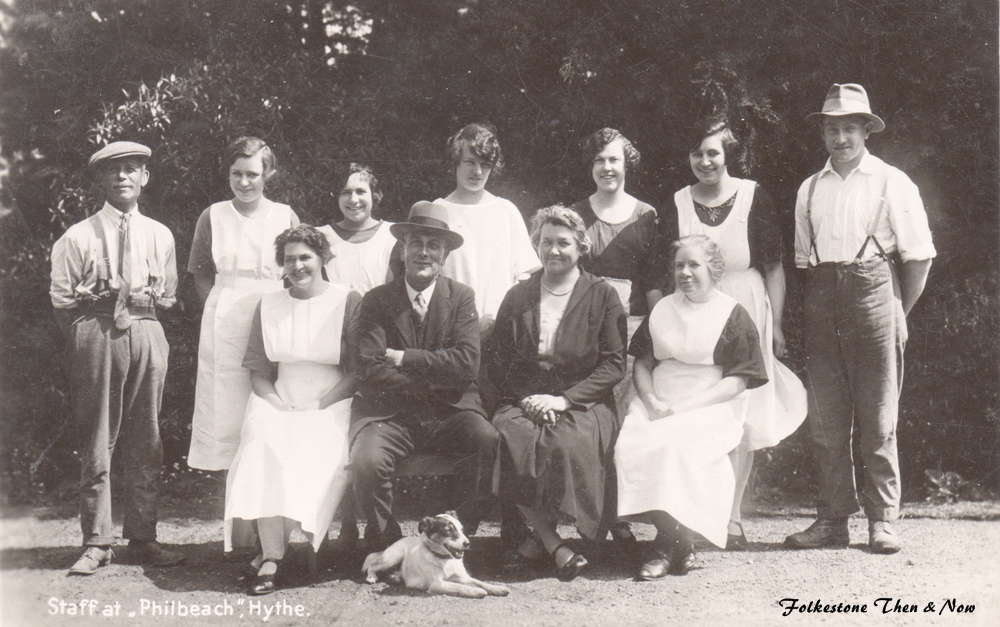
I don't have a date for this photo of the Philbeach staff I would guess maybe late 50's early 60's? Anyone recognise their relative?
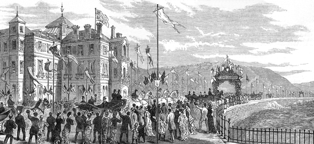
This is an engraving from the Illustrated London News showing the Prince of Wales, later King Edward V11 opening the Marine Parade and embankment between Hythe and Sandgate in 1881. The sign over the arch read 'Welcome to Seabrook'. It probably wasn't hard to get him to do the opening because he spent a lot of time in Folkestone, staying at the Grand Hotel, sometimes with his wife, but more often with his Mistress Alice Keppel, great-grandmother of Camilla Parker-Bowles, now Duchess of Cornwall and married to the great-great grandson of Edward V11, Prince Charles, heir to the throne. I bet Queen Victoria is turning in her grave!
On the left in the engraving above is the Imperial Hotel, still standing and open for business today.
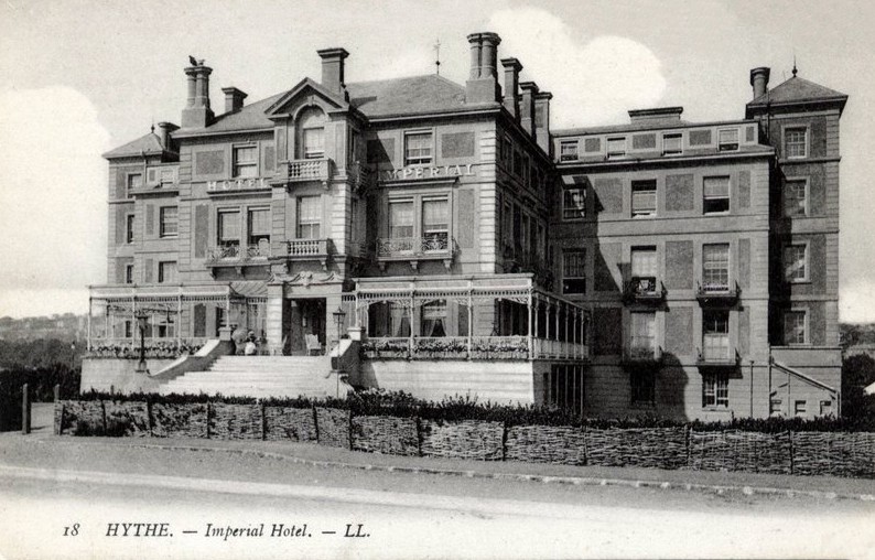
This old photo of the Imperial was sent to me by Ian, who goes under the nickname of Detmold

As you can see, it has undergone a lot of expansion, and lost all the chimneys!
2021
I was checking in my Ward Lock guide from 1905-06 to see if the Imperial advertised their rates. They didn't, they only mentioned that they had 120 rooms available. However, most of the other hotels in the area at the time were ranging from 1/6d (7 1/2P) to 3/6d (17 1/2P) per night. So prices have increased somewhat since then!
This was taken from their website:
We have 92 individually decorated bedrooms with no 2 suites looking the same, but all offering contemporary luxury.
During your stay, enjoy some relaxation time in our Spa and Leisure facilities which are a complementary offer to our residents. But, if thats not for you, why not indulge in a round of golf?
We have 2 restaurants on-site, our award-winning AA Rosette Coast Restaurant on the ground floor and a 3rd party owned Indian fusion restaurant, The Holy Pundit, on the lower ground floor.
You are also welcome to partake in traditional Afternoon Tea in our Windsor Parlour or on our beautifully manicured lawns.
Our Martello Bar offers an extensive drinks and food menu, open daily and we also have our seafront located Buzz Bar and Kents only Moet and Chandon Champagne Bar.
All that, and they boast of having the tallest chandelier in the whole of Europe!
Sure sounds good to me!

OK, let's go for a walk:
and as luck would have it, we are there in 1904, and the Excelsior Military Band are playing today.

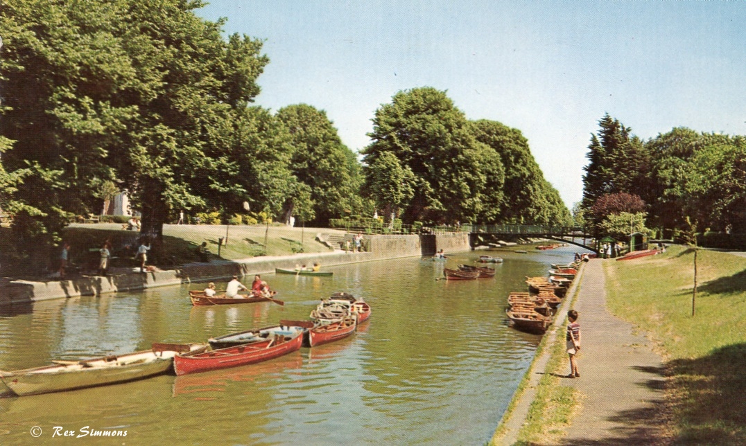
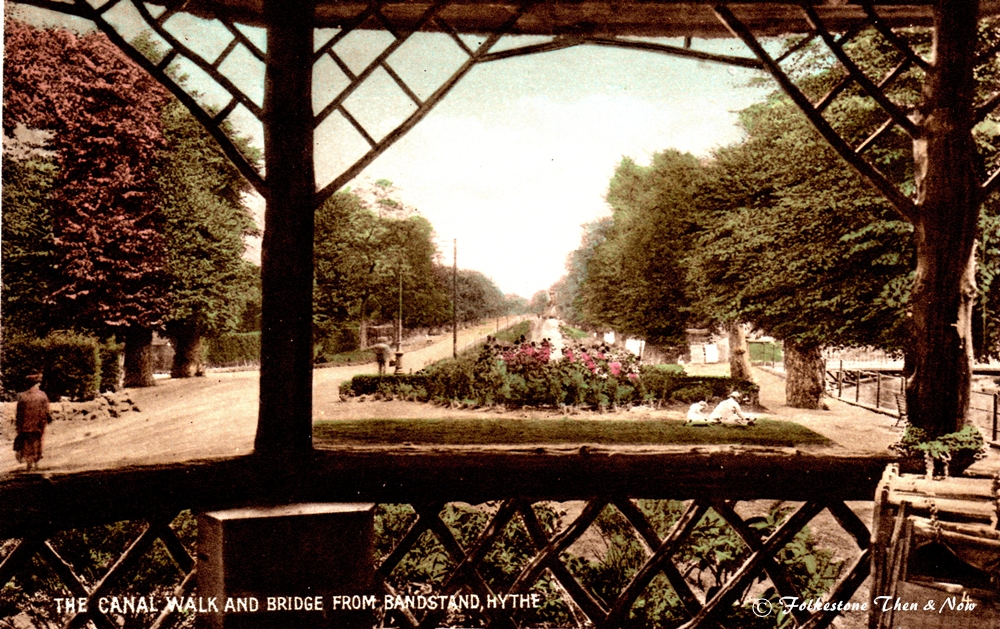
Just going by the bandstand along the canal walk.

Going along Mayor's Avenue, and wondering if we are on the same walk, different name.

This was Seabrook Lodge School, now closed. Not sure why Mr. Savage chose to take a photo of it from so far away, probably because it was set too far back from Seabrook Road where it was located.

On investigating Foxwood School, I found this on a planning application from a developer wanting to build residential housing on the site. The site is currently a special educational needs school, forming part of the federation of Foxwood and Highview School. The school is to be relocated into a purpose built SEN school on Park Farm Road, Folkestone, in Summer 2016, leaving the site vacant. The site is located within a residential area, which
predominantly has detached dwellings in large plots. Located close to the sea, the site benefits from sea views, as well as having mature foliage
and trees. Did this happen? I don't know.

In the background you can see the tank that used to be there. You can see a closeup of it on the previous page.
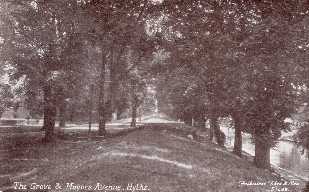

Whatever they call it, it's a very pretty walk.

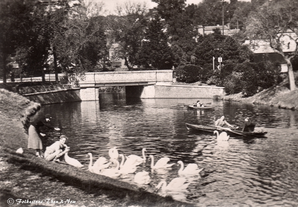
We have nipped across a bridge and are now walking back on the other side of the canal, the year is also 1954, and we spot the Methodist Church on the other side, so let's go back across the Town Bridge to look at it.

Oops! Crossing that bridge, we fell back close to fifty years, and the bridge was called the Nelson's Bridge, and the church was Wesleyan.
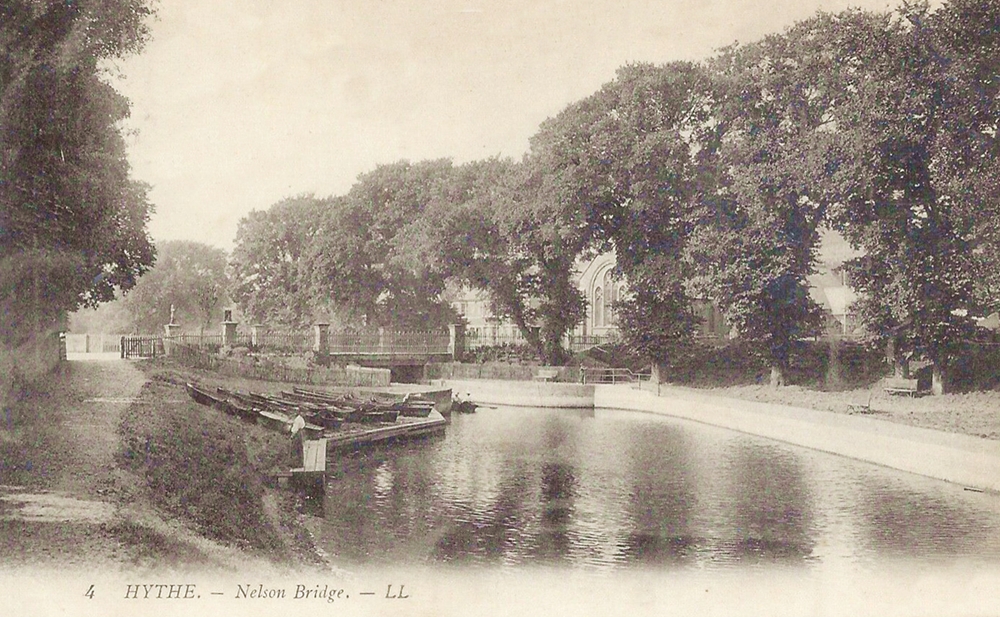
Further proof of the name of the Bridge, this was dated 1911. I think I prefer this name to the Town Bridge.


Walking in a different direction this time, we have Ladies Walk. The one on the right dates from the 50's, early days of producing coloured photographs I guess. They had a long way to go!
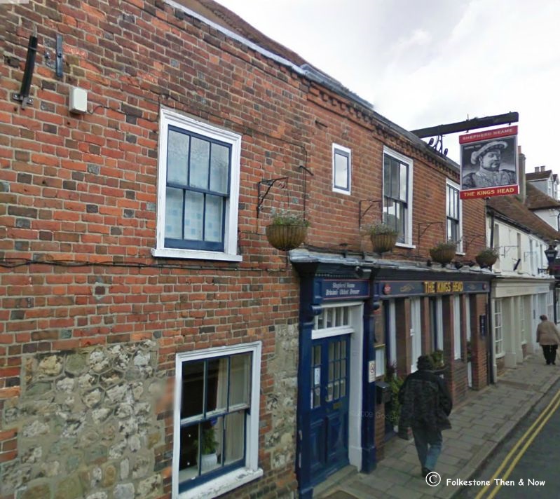
A photo I took in 2009 of the oldest pub in Hythe, it has stood there in the High Street since 1583. Its sign has changed Kings from time to time, and has been spruced up many times, let's face it, in 1583 it didn't even have electricity! But it must have been popular then as it is today, or it wouldn't have stood the test of time

Military Road. Over on the right is the Ordnance Arms pub, and the charabancs parked on the street are possibly waiting for some men on a pub crawl. At least they have designated drivers.
This Google image was approximately the location of the Ordnance Arms, long demolished now. I have seen on another site that it was opened in 1847, and the last landlord in the list took over in 1967, so it was there a long time.
This one was also sent by George Hills, who said he found them in his mother's belongings. This one is entitled 'Motor Coach leaving Hythe for Folkestone', it was dated 1911, I am not sure where it was taken. There is a good chance it was at the Red Lion Square, as I have seen photos before of coaches parked there, facing in the direction of Folkestone. If anyone can identify it, I would love to know. Do you think the soldier in this one was being a nice guy and cranking the engine into life for the driver?


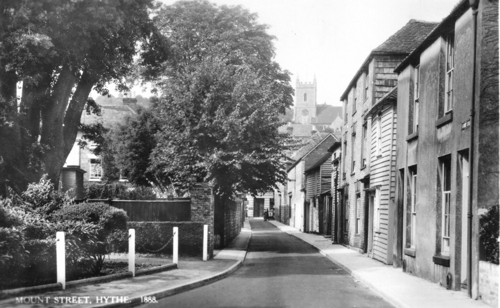
A couple more of Mount Street. The image on the left was not dated, but obviously older than the one on the right, which dates from 1953

I bought this one mainly because I couldn't believe what I was looking at! All I know about it is that it was Hythe, but it wasn't dated, nor was there any explanation for the bizare clothing some were wearing. So if anyone can shed any light on it, I am sure we would all like to hear from you!


These are the Church Hill steps, accessed from Bartholomew Street. I have climbed them and it is a very long way up, especially if it comes at the end of a long day of sight seeing like I had that day. They lead up the St. Leonard's Church, the home of the crypt full of skulls and bones. When the photo on the left was taken, the building at the bottom were Alms Houses for the poor. I don't know what is inside now. The view from the top of those steps is magnificent.

St Leonard's Church is up very high, but this 1913 photograph was taken from even higher.

I don't usually buy multiview postcards as the images are too small, but made an exception with this one, as it included a photo of Rev. H. D. Dale, the vicar of the day. But as the card wasn't dated, I don't know when that was.
Aha! I found him. You really should read this blog, it covers lots of Hythe history, and is very interesting. https://hythehistoryblog.wordpress.com/tag/st-leonards-church/page/2/ I have linked it specifically to the history of Rev. Herbert Dixon Dale and his sisters during their time at St. Leonard's Church. He was there from 1899 to 1926 when he retired to Saltwood and in 1931 had a book published called 'The Ancient Town of Hythe and St. Leonard's Church, Kent', which was reprinted several times, and can still be found in shops like Abe Books.

Oak Walk and the steps of St. Leonard's Church then and now.


One last look at the infamous crypt. This photograph dates from 1908 and was hand tinted.

Here is a very old photo of a house in West Hythe. I doubt if it is still standing, but if it is, and you recognise it, please send me a modern scan of it.
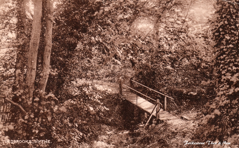

A couple of photos taken in the same place in Redbrooks Wood, which is beside the A261. The photo on the left was taken in the early 1900's, and the one on the right a little later. Looking on Street View, there are a lot of houses along that road these days, so not sure how much wood is left. Anyone know if the stream and bridge is still there?


The Sandy Bay Caravan site in West Hythe. First photo dates from 1965, don't you love how they are all parked in a circle like a wagon train? I was delighted to discover it is still there, and about twice the size. You can access it off the Dymchurch Road.


History of Botolphs Bridge
Taken from the Botolph's Bridge Inn website
The Legend of Botolphs Bridge
(As related by Duncan Forbes in his book Hythe Haven pub 1981)
The English monk St Botolph lived in the seventh century, and many popular tales have been told about him, since there is very little known historical fact. His monastery is thought to have been in Boston, Lincolnshire, which has derived its name from Botolphs Town. But our legend about the saint concerns his dead body and Botolphs Bridge.
Go to the bridge across the canal cut at West Hythe, which is not the same as the original bridge before that canal was constructed, and look at the Inn sign there, which illustrates the story. There is a boat, with a coffin, like an ark, being carried on to it by two tonsured monks. Two more monks are following them from the bank, and a shaft of light is seen shining down on them all out of a dark sky.
The legend is that the body of St Botolph was being borne to some place where it would be kept safe from desecration by the heathen Danes. There was water to cross, and the night was pitching black. Then suddenly a shaft of light, which was not the moon, shone down from heaven to guide the escort as they went abroad. But where the body now lies, no one knows.
The bridge by the Inn spans a stretch of water that is now a branch of the Royal Military canal, draining into the sea through the sluice beside the Grand Redoubt built during the Napoleonic wars. But in the past it carried travellers to the shore across one of the many creeks of the marsh. It was called Boters, Butters or Butlers Bridge on the old maps, whether Butler is derived from Botolph, or whether there really is a man in charge of the drinks there, as there is today, or whether, as is more likely, the name comes from that of a well-known local family, I do not know .
What I do know is that, with the sheep meadows around you, the placid water nearby, the Roman ruins, looking like old, decayed teeth sprouting out the hillside, and the more modern castle with its Second World War reinforced concrete watchtower on the skyline, there is no more pleasant place to stop and take a glass.

The inn, which looks as if it has been demolished and rebuilt between these two photographs, is located at Botolph's Bridge Rd and Lower Wall Rd, West Hythe.

If you are wondering why there are so few photos of the Romney, Hythe & Dymchurch Railway, it's because they now have their own page! Click the photo of Black Prince to the right to go there!
This page updated Aug 4,2023

If you have your own memories of Hythe, be sure to share them with us in the Guestbook below

If you live in England, I urge you to watch the TV program 'Saving Lives at Sea', if you are not in awe of the work of the RNLI before, you will be after watching a couple of episodes of that wonderful documentary. At the time of writing you can catch it on the BBC2 player.

Update, it's 2023 and I believe it has been demolished to make way for a new housing development.

An older photograph of Grove House, although it was known as Hythe Club in those days. I am afraid I have no date for it, as I bought it as a photograph of a postcard.

A poor quality photo of the Hythe Lifeboat being launched.

